 |
|
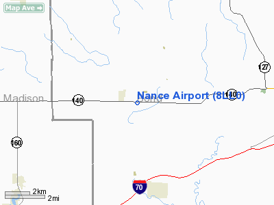
Location
& QuickFacts
|
FAA
Information Effective: |
2007-12-20 |
|
Airport
Identifier: |
8LL0 |
|
Airport
Status: |
Operational |
|
Longitude/Latitude: |
089-33-26.3090W/38-53-15.1680N
-89.557308/38.887547 (Estimated) |
|
Elevation: |
570 ft / 173.74 m (Estimated) |
|
Land: |
0 acres |
|
From nearest
city: |
1 nautical miles SE of Old Ripley, IL |
|
Location: |
Bond County, IL |
|
Magnetic
Variation: |
01E (1985) |
Owner & Manager
|
Ownership: |
Privately
owned |
|
Owner: |
Thomas L. Nance |
|
Address: |
443 Il Rt 140
Pocahontas, IL 62275 |
|
Phone
number: |
618-664-2688 |
|
Manager: |
Thomas L. Nance |
|
Address: |
443 Il Rt 140
Pocahontas, IL 62275 |
|
Phone
number: |
618-664-2688 |
Airport
Operations and Facilities
|
Airport
Use: |
Private |
|
Wind indicator: |
Yes |
|
Segmented
Circle: |
No |
|
Control
Tower: |
No |
|
Landing
fee charge: |
No |
|
Sectional
chart: |
St Louis |
|
Region: |
AGL - Great Lakes |
|
Boundary
ARTCC: |
ZKC - Kansas City |
|
Tie-in
FSS: |
COU - Columbia |
|
FSS on
Airport: |
No |
|
FSS Toll
Free: |
1-800-WX-BRIEF |
|
Runway Information
Runway 09/27
|
Dimension: |
2100 x 70 ft
/ 640.1 x 21.3 m |
|
Surface: |
TURF, |
|
|
Runway 09 |
Runway 27 |
|
Traffic
Pattern: |
Left |
Left |
|
Radio Navigation
Aids
|
ID |
Type |
Name |
Ch |
Freq |
Var |
Dist |
|
LTD |
NDB |
Litchfield |
|
371.00 |
01E |
17.6 nm |
|
CVM |
NDB |
Civic Memorial |
|
263.00 |
02E |
23.3 nm |
|
BL |
NDB |
Belleville |
|
362.00 |
02E |
27.1 nm |
|
SLO |
NDB |
Salem |
|
400.00 |
01W |
31.3 nm |
|
TAZ |
NDB |
Taylorville |
|
395.00 |
00E |
40.5 nm |
|
LM |
NDB |
Oblio |
|
338.00 |
00E |
43.3 nm |
|
SAR |
NDB |
Sparta |
|
239.00 |
01E |
45.1 nm |
|
SYZ |
NDB |
Shelbyville |
|
365.00 |
01E |
45.6 nm |
|
SKE |
TACAN |
Scott |
059X |
|
02E |
24.8 nm |
|
CSX |
VOR/DME |
Cardinal |
111Y |
116.45 |
00E |
38.5 nm |
|
VNN |
VOR/DME |
Mount Vernon |
085X |
113.80 |
02E |
47.3 nm |
|
TOY |
VORTAC |
Troy |
107X |
116.00 |
04E |
19.1 nm |
|
VLA |
VORTAC |
Vandalia |
090X |
114.30 |
04E |
22.2 nm |
|
ENL |
VORTAC |
Centralia |
097X |
115.00 |
04E |
33.8 nm |
|
STL |
VORTAC |
St Louis |
121X |
117.40 |
01E |
43.3 nm |
|
STL |
VOT |
St Louis Lambert |
|
111.00 |
|
38.6 nm |
Based Aircraft
|
Aircraft
based on field: |
1 |
|
Single Engine
Airplanes: |
1 |
Nance Airport
Address:
Bond County, IL
Tel: 618-664-2688
Images and information placed
above are from
http://www.airport-data.com/airport/8LL0/
We
thank them for the data!
| General
Info |
| Country |
United
States |
| State |
ILLINOIS
|
| FAA ID |
8LL0 |
| Latitude |
38-53-15.168N
|
| Longitude |
089-33-26.309W
|
| Elevation |
570 feet
|
| Near City |
OLD RIPLEY
|
We don't guarantee the information is fresh and accurate. The data may
be wrong or outdated.
For more up-to-date information please refer to other sources.
|
|


