 |
|
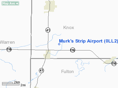
Location
& QuickFacts
|
FAA
Information Effective: |
2007-12-20 |
|
Airport
Identifier: |
0LL2 |
|
Airport
Status: |
Operational |
|
Longitude/Latitude: |
090-22-50.4590W/40-44-20.1410N
-90.380683/40.738928 (Estimated) |
|
Elevation: |
700 ft / 213.36 m (Estimated) |
|
Land: |
0 acres |
|
From nearest
city: |
3 nautical miles NE of St Augustine, IL |
|
Location: |
Knox County, IL |
|
Magnetic
Variation: |
02E (1985) |
Owner
& Manager
|
Ownership: |
Privately
owned |
|
Owner: |
Beryle Murk |
|
Address: |
190 Knox Road 300 East
St Augustine, IL 61474 |
|
Phone
number: |
309-462-3407 |
|
Manager: |
Beryle Murk |
|
Address: |
190 Knox Road 300 East
St Augustine, IL 61474 |
|
Phone
number: |
309-462-3407 |
Airport Operations
and Facilities
|
Airport
Use: |
Private |
|
Wind indicator: |
Yes |
|
Segmented
Circle: |
No |
|
Control
Tower: |
No |
|
Sectional
chart: |
Chicago |
|
Region: |
AGL - Great Lakes |
|
Boundary
ARTCC: |
ZAU - Chicago |
|
Tie-in
FSS: |
IKK - Kankakee |
|
FSS on
Airport: |
No |
|
FSS Toll
Free: |
1-800-WX-BRIEF |
|
Runway Information
Runway E/W
|
Dimension: |
2600 x 75 ft
/ 792.5 x 22.9 m |
|
Surface: |
TURF, |
|
|
Runway E |
Runway W |
|
Traffic
Pattern: |
Left |
Left |
|
Obstruction: |
4 ft fence |
4 ft fence |
|
Radio Navigation
Aids
|
ID |
Type |
Name |
Ch |
Freq |
Var |
Dist |
|
JZY |
NDB |
Macomb |
|
251.00 |
01E |
15.6 nm |
|
CTK |
NDB |
Canton |
|
236.00 |
02E |
17.3 nm |
|
EZI |
NDB |
Kewanee |
|
245.00 |
01E |
33.7 nm |
|
PI |
NDB |
Tungg |
|
356.00 |
01E |
36.8 nm |
|
GBG |
VOR/DME |
Galesburg |
035X |
109.80 |
03E |
12.2 nm |
|
BRL |
VORTAC |
Burlington |
051X |
111.40 |
05E |
24.9 nm |
|
PIA |
VORTAC |
Peoria |
099X |
115.20 |
04E |
27.0 nm |
|
MZV |
VORTAC |
Moline |
091X |
114.40 |
05E |
36.9 nm |
|
BDF |
VORTAC |
Bradford |
094X |
114.70 |
00E |
44.0 nm |
Murk's Strip Airport
Address:
Knox County, IL
Tel:
309-462-3407
Images
and information placed above are from
http://www.airport-data.com/airport/0LL2/
We
thank them for the data!
| General
Info |
| Country |
United
States |
| State |
ILLINOIS
|
| FAA ID |
0LL2 |
| Latitude |
40-44-20.141N
|
| Longitude |
090-22-50.459W
|
| Elevation |
700 feet
|
| Near City |
ST AUGUSTINE
|
We don't guarantee the information is fresh and accurate. The data may
be wrong or outdated.
For more up-to-date information please refer to other sources.
|
|


