 |
|
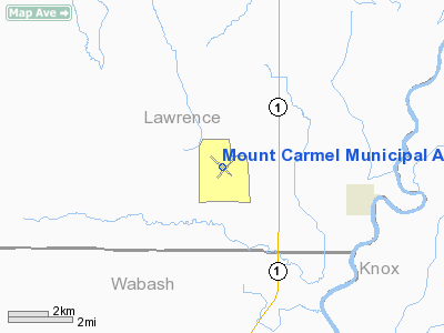
Mount Carmel Municipal Airport |
|
|
Location
& QuickFacts
|
FAA
Information Effective: |
2007-12-20 |
|
Airport
Identifier: |
AJG |
|
Airport
Status: |
Operational |
|
Longitude/Latitude: |
087-43-36.0990W/38-36-23.5700N
-87.726694/38.606547 (Estimated) |
|
Elevation: |
429 ft / 130.76 m (Estimated) |
|
Land: |
603 acres |
|
From nearest
city: |
12 nautical miles N of Mount Carmel, IL |
|
Location: |
Lawrence County, IL |
|
Magnetic
Variation: |
02W (2000) |
Owner
& Manager
|
Ownership: |
Publicly
owned |
|
Owner: |
City Of Mt Carmel |
|
Address: |
City Hall 235 Market St
Mt Carmel, IL 62863 |
|
Phone
number: |
618-262-4822 |
|
Manager: |
Kenneth Wood |
|
Address: |
Route 1 Box 54
St Francisville, IL 62460 |
|
Phone
number: |
618-948-2413 |
Airport Operations
and Facilities
|
Airport
Use: |
Open
to public |
|
Wind indicator: |
Yes |
|
Segmented
Circle: |
Yes |
|
Control
Tower: |
No |
|
Lighting
Schedule: |
DUSK-DAWN
MIRL RY 04/22 PRESET ON LOW INTST; TO INCR INTST & ACTVT
MIRL RY 13/31; REIL RYS 04, 22 & 31; PVASI RYS 04, 22
& 31 - CTAF. |
|
Beacon
Color: |
Clear-Green (lighted land airport)
OTS INDEFLY. |
|
Landing
fee charge: |
No |
|
Sectional
chart: |
St Louis |
|
Region: |
AGL - Great Lakes |
|
Boundary
ARTCC: |
ZID - Indianapolis |
|
Tie-in
FSS: |
STL - Saint Louis |
|
FSS on
Airport: |
No |
|
FSS Toll
Free: |
1-800-WX-BRIEF |
|
NOTAMs
Facility: |
AJG (NOTAM-d service avaliable) |
|
Federal
Agreements: |
NGPY |
Airport Communications
|
CTAF: |
122.700 |
|
Unicom: |
122.700
|
Airport
Services
|
Fuel
available: |
100LL |
|
Airframe
Repair: |
MINOR |
|
Power
Plant Repair: |
MINOR |
|
Bottled
Oxygen: |
NONE |
|
Bulk Oxygen: |
NONE |
|
Runway Information
Runway 04/22
|
Dimension: |
4000 x 100 ft
/ 1219.2 x 30.5 m |
|
Surface: |
ASPH, Fair Condition |
|
Weight Limit: |
Single wheel: 11000 lbs. |
|
Edge Lights: |
Medium |
|
|
Runway 04 |
Runway 22 |
|
Longitude: |
087-43-47.6420W |
087-43-14.7440W |
|
Latitude: |
38-36-07.3130N |
38-36-37.2680N |
|
Elevation: |
428.00 ft |
428.00 ft |
|
Alignment: |
41 |
127 |
|
Traffic
Pattern: |
Left |
Left |
|
Markings: |
Non-precision instrument, Fair Condition |
Non-precision instrument, Fair Condition |
|
Crossing
Height: |
25.00 ft |
25.00 ft |
|
VASI: |
pulsating/steady burning on left side
PSIL UNUSBL BYD 8 DEG LEFT OF COURSE. |
pulsating/steady burning on left side |
|
Visual Glide
Angle: |
3.00° |
3.00° |
|
Runway End
Identifier: |
Yes |
Yes |
|
Centerline
Lights: |
No |
No |
|
Touchdown
Lights: |
No |
No |
|
Obstruction: |
101 ft tree, 3191.0 ft from runway, 438 ft
left of centerline, 29:1 slope to clear |
15 ft road, 543.0 ft from runway, 282 ft right
of centerline, 22:1 slope to clear |
|
Runway 13/31
|
Dimension: |
4500 x 75 ft
/ 1371.6 x 22.9 m |
|
Surface: |
ASPH, Good Condition |
|
Edge Lights: |
Medium |
|
|
Runway 13 |
Runway 31 |
|
Longitude: |
087-44-02.0010W |
087-43-19.0600W |
|
Latitude: |
38-36-39.2000N |
38-36-10.1660N |
|
Elevation: |
427.00 ft |
429.00 ft |
|
Alignment: |
127 |
127 |
|
Traffic
Pattern: |
Left |
Left |
|
Markings: |
Basic, Poor Condition
POOR DUE TO PAINT DELAMINATING FROM SURFACE. |
Basic, Poor Condition
POOR DUE TO PAINT DELAMINATING FROM SURFACE. |
|
Crossing
Height: |
0.00 ft |
25.00 ft |
|
VASI: |
|
pulsating/steady burning on left side |
|
Visual Glide
Angle: |
0.00° |
3.00° |
|
Runway End
Identifier: |
|
Yes |
|
Obstruction: |
90 ft tree, 2946.0 ft from runway, 321 ft right
of centerline, 30:1 slope to clear |
, 50:1 slope to clear |
|
Radio Navigation
Aids
|
ID |
Type |
Name |
Ch |
Freq |
Var |
Dist |
|
AJG |
NDB |
Mount Carmel |
|
524.00 |
02W |
0.3 nm |
|
OEA |
NDB |
Vincennes |
|
251.00 |
00E |
9.5 nm |
|
OLY |
NDB |
Olney |
|
272.00 |
00W |
22.0 nm |
|
PLX |
NDB |
Palestine |
|
391.00 |
00W |
24.8 nm |
|
DCY |
NDB |
Washington |
|
212.00 |
03W |
28.4 nm |
|
SIV |
NDB |
Sullivan |
|
326.00 |
02W |
33.2 nm |
|
FOA |
NDB |
Elm River |
|
353.00 |
00E |
34.3 nm |
|
FWC |
NDB |
Wayne County |
|
257.00 |
01E |
34.9 nm |
|
PDW |
NDB |
Evansville |
|
284.00 |
00E |
35.3 nm |
|
CUL |
NDB |
Carmi |
|
332.00 |
01W |
36.0 nm |
|
CZB |
NDB |
Casey |
|
359.00 |
00E |
43.9 nm |
|
FNZ |
NDB |
Ferdinand |
|
239.00 |
00E |
47.1 nm |
|
GVA |
NDB |
Geneva |
|
224.00 |
01W |
48.3 nm |
|
HU |
NDB |
Yinno |
|
245.00 |
02W |
49.4 nm |
|
LWV |
VOR/DME |
Lawrenceville |
025X |
108.80 |
01W |
11.4 nm |
|
SAM |
VOR/DME |
Samsville |
113X |
116.60 |
03E |
18.4 nm |
|
RSV |
VOR/DME |
Robinson |
021X |
108.40 |
02E |
25.0 nm |
|
HNB |
VOR/DME |
Huntingburg |
029X |
109.20 |
00E |
42.1 nm |
|
BIB |
VORTAC |
Bible Grove |
027X |
109.00 |
03E |
40.1 nm |
|
PXV |
VORTAC |
Pocket City |
080X |
113.30 |
03E |
40.8 nm |
Remarks
- AGRICULTURE
OPNS INVOF ARPT.
- EXISTED
PRIOR TO 1959.
Based Aircraft
|
Aircraft
based on field: |
21 |
|
Single Engine
Airplanes: |
19 |
|
Multi Engine Airplanes: |
2 |
Operational Statistics
Time
Period: 2006-08-01 - 2007-07-31
|
Aircraft
Operations: |
212/Week |
|
Air Taxi: |
6.8% |
|
General Aviation
Local: |
59.1% |
|
General Aviation
Itinerant: |
31.8% |
|
Military: |
2.3% |
Mount Carmel Municipal Airport
Address:
Lawrence County, IL
Tel:
618-262-4822,
618-948-2413
Images
and information placed above are from
http://www.airport-data.com/airport/AJG/
We
thank them for the data!
| General
Info |
| Country |
United
States |
| State |
ILLINOIS
|
| FAA ID |
AJG |
| Latitude |
38-36-23.570N
|
| Longitude |
087-43-36.099W
|
| Elevation |
429 feet
|
| Near City |
MOUNT
CARMEL |
We don't guarantee the information is fresh and accurate. The data may
be wrong or outdated.
For more up-to-date information please refer to other sources.
|
|


