 |
|
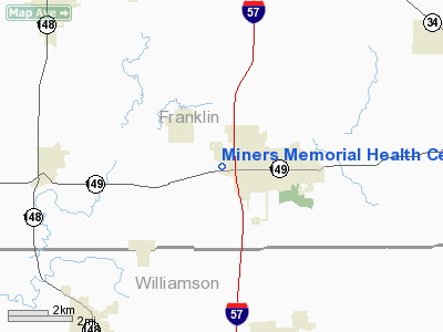
Miners Memorial Health Center Heliport |
Location
& QuickFacts
|
FAA
Information Effective: |
2007-12-20 |
|
Airport
Identifier: |
8LL8 |
|
Airport
Status: |
Operational |
|
Longitude/Latitude: |
088-57-14.0000W/37-53-58.0000N
-88.953889/37.899444 (Estimated) |
|
Elevation: |
402 ft / 122.53 m (Estimated) |
|
Land: |
0 acres |
|
From nearest
city: |
1 nautical miles W of West Frankfort, IL |
|
Location: |
Franklin County, IL |
|
Magnetic
Variation: |
01W (2000) |
Owner
& Manager
|
Ownership: |
Privately
owned |
|
Owner: |
Franklin Community Care Services |
|
Address: |
Box 3988
Carbondale, IL |
|
Manager: |
Christina Border |
|
Address: |
Miners Memorial Health Center, 2553 Ken Gray
Blvd
West Frankfort, IL 62896 |
|
Phone
number: |
618-932-2155
EXT 345 |
Airport Operations
and Facilities
|
Airport
Use: |
Private |
|
Segmented
Circle: |
No |
|
Control
Tower: |
No |
|
Lighting
Schedule: |
PHONE REQ
FOR PERIMETER LGTS CALL 618-932-2155. |
|
Sectional
chart: |
St Louis |
|
Region: |
AGL - Great Lakes |
|
Boundary
ARTCC: |
ZKC - Kansas City |
|
Tie-in
FSS: |
COU - Columbia |
|
FSS Toll
Free: |
1-800-WX-BRIEF |
|
Runway Information
Helipad H1
|
Dimension: |
40 x 40 ft /
12.2 x 12.2 m |
|
Surface: |
CONC, |
|
|
Runway H1 |
Runway |
|
Traffic
Pattern: |
Left |
Left |
|
Radio Navigation
Aids
|
ID |
Type |
Name |
Ch |
Freq |
Var |
Dist |
|
PJY |
NDB |
Pinckneyville |
|
215.00 |
00E |
19.9 nm |
|
HSB |
NDB |
Harrisburg-raleigh |
|
230.00 |
00E |
20.1 nm |
|
SAR |
NDB |
Sparta |
|
239.00 |
01E |
38.4 nm |
|
FWC |
NDB |
Wayne County |
|
257.00 |
01E |
38.7 nm |
|
CUL |
NDB |
Carmi |
|
332.00 |
01W |
41.2 nm |
|
SLO |
NDB |
Salem |
|
400.00 |
01W |
44.8 nm |
|
BDD |
NDB |
Bellgrade |
|
254.00 |
00E |
47.3 nm |
|
MWA |
VOR/DME |
Marion |
041X |
110.40 |
04E |
9.1 nm |
|
VNN |
VOR/DME |
Mount Vernon |
085X |
113.80 |
02E |
28.7 nm |
|
CGI |
VOR/DME |
Cape Girardeau |
076X |
112.90 |
01E |
50.0 nm |
|
ENL |
VORTAC |
Centralia |
097X |
115.00 |
04E |
32.8 nm |
Remarks
- PRVDD
APCH/DEP FM 175-185 & 295-305; AREA MKD; WIND INDICATOR MAINTAINED;
COMPLY WITH PART 91.126(B)(2).
Miners Memorial Health Center Heliport
Address:
Franklin County, IL
Tel:
618-932-2155
Images
and information placed above are from
http://www.airport-data.com/airport/8LL8/
We
thank them for the data!
| General
Info |
| Country |
United
States |
| State |
ILLINOIS
|
| FAA ID |
8LL8 |
| Latitude |
37-53-58.000N
|
| Longitude |
088-57-14.000W
|
| Elevation |
402 feet
|
| Near City |
WEST FRANKFORT
|
We don't guarantee the information is fresh and accurate. The data may
be wrong or outdated.
For more up-to-date information please refer to other sources.
|
|


