 |
|
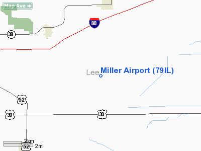
Location
& QuickFacts
|
FAA Information Effective: |
2007-12-20 |
|
Airport
Identifier: |
79IL |
|
Airport
Status: |
Operational |
|
Longitude/Latitude: |
089-13-49.0000W/41-47-48.0000N
-89.230278/41.796667 (Estimated) |
|
Elevation: |
820 ft / 249.94 m (Estimated) |
|
Land: |
0 acres |
|
From
nearest city: |
5 nautical miles SE of Ashton, IL |
|
Location: |
Lee County, IL |
|
Magnetic
Variation: |
() |
Owner & Manager
|
Ownership: |
Privately
owned |
|
Owner: |
Neil Miller |
|
Address: |
1470 Baldyville Rd
Ashton,
IL 61006 |
|
Phone
number: |
815-453-2336 |
|
Manager: |
Neil Miller |
|
Address: |
1470 Baldyville Rd
Ashton,
IL 61006 |
|
Phone
number: |
815-453-2336 |
Airport
Operations and Facilities
|
Airport Use: |
Private |
|
Wind
indicator: |
Yes |
|
Control
Tower: |
No |
|
Sectional
chart: |
Chicago |
|
Region: |
AGL - Great Lakes |
|
Boundary
ARTCC: |
ZAU - Chicago |
|
Tie-in
FSS: |
IKK - Kankakee |
|
FSS
Toll Free: |
1-800-WX-BRIEF |
|
Runway Information
Runway 18/36
|
Dimension: |
1600 x 70 ft / 487.7 x 21.3 m |
|
Surface: |
TURF, Good Condition |
|
|
Runway 18 |
Runway 36 |
|
Traffic
Pattern: |
Left |
Left |
|
Obstruction: |
25 ft pline, 1000.0 ft from runway |
130 ft pline, 3560.0 ft from runway |
|
Radio Navigation
Aids
|
ID |
Type |
Name |
Ch |
Freq |
Var |
Dist |
|
DKB |
NDB |
Dekalb |
|
209.00 |
02W |
24.8 nm |
|
BOZ |
NDB |
Whiteside |
|
254.00 |
01E |
25.4 nm |
|
VYS |
NDB |
Valley |
|
230.00 |
00W |
26.8 nm |
|
OIX |
NDB |
Ottawa |
|
266.00 |
01E |
31.1 nm |
|
FEP |
NDB |
Freeport |
|
335.00 |
00E |
31.3 nm |
|
EZI |
NDB |
Kewanee |
|
245.00 |
01E |
48.6 nm |
|
CWI |
NDB |
Clinton |
|
377.00 |
01E |
49.2 nm |
|
JVL |
NDB |
Janesville |
|
375.00 |
03E |
49.9 nm |
|
PLL |
VOR/DME |
Polo |
049X |
111.20 |
03E |
16.6 nm |
|
RFD |
VOR/DME |
Rockford |
045X |
110.80 |
01E |
25.8 nm |
|
DPA |
VOR/DME |
Dupage |
021X |
108.40 |
02E |
39.8 nm |
|
JVL |
VOR/DME |
Janesville |
090X |
114.30 |
03E |
46.1 nm |
|
BDF |
VORTAC |
Bradford |
094X |
114.70 |
00E |
41.5 nm |
|
JOT |
VORTAC |
Joliet |
070X |
112.30 |
02E |
43.6 nm |
Remarks
- 70
FT BLDG 150 FT E OF RY.
Based Aircraft
|
Aircraft
based on field: |
1 |
|
Single
Engine Airplanes: |
1 |
Miller
Lee Airport
Address:
Lee County, IL
Tel:
815-453-2336
Images
and information placed above are from
http://www.airport-data.com/airport/79IL/
We
thank them for the data!
| General
Info |
| Country |
United
States |
| State |
ILLINOIS
|
| FAA ID |
79IL
|
| Latitude |
40-38-09.130N
|
| Longitude |
087-42-04.103W
|
| Elevation |
659 feet
|
| Near City |
MILFORD
|
We don't guarantee the information is fresh and accurate. The data may
be wrong or outdated.
For more up-to-date information please refer to other sources.
|
|


