 |
|
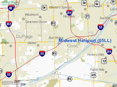
Location
& QuickFacts
|
FAA
Information Effective: |
2007-12-20 |
|
Airport
Identifier: |
05LL |
|
Airport
Status: |
Operational |
|
Longitude/Latitude: |
087-56-06.2120W/41-44-56.1120N
-87.935059/41.748920 (Estimated) |
|
Elevation: |
710 ft / 216.41 m (Estimated) |
|
Land: |
0 acres |
|
From nearest
city: |
1 nautical miles N of Willowbrook, IL |
|
Location: |
Du Page County, IL |
|
Magnetic
Variation: |
01W (1985) |
Owner & Manager
|
Ownership: |
Privately
owned |
|
Owner: |
Midwest Hel Airways, Inc |
|
Address: |
525 Executive Dr
Hinsdale,
IL 60521 |
|
Phone
number: |
630-325-7860 |
|
Manager: |
Richard J. Smith |
|
Address: |
525 Executive Dr
Hinsdale,
IL 60521 |
|
Phone
number: |
630-325-7860 |
Airport
Operations and Facilities
|
Airport
Use: |
Private |
|
Wind indicator: |
Yes |
|
Segmented
Circle: |
Yes |
|
Control
Tower: |
No |
|
Landing
fee charge: |
No |
|
Sectional
chart: |
Chicago |
|
Region: |
AGL - Great Lakes |
|
Boundary
ARTCC: |
ZAU - Chicago |
|
Tie-in
FSS: |
IKK - Kankakee |
|
FSS on
Airport: |
No |
|
FSS Toll
Free: |
1-800-WX-BRIEF |
|
Runway Information
Helipad H1
|
Dimension: |
120 x 120 ft
/ 36.6 x 36.6 m
HELIPAD IS CIRCULAR. |
|
Surface: |
ASPH, |
|
|
Runway H1 |
Runway |
|
Traffic
Pattern: |
Left |
Left |
|
Radio Navigation
Aids
|
ID |
Type |
Name |
Ch |
Freq |
Var |
Dist |
|
HK |
NDB |
Ermin |
|
332.00 |
01W |
4.8 nm |
|
MX |
NDB |
Kedzi |
|
248.00 |
01W |
11.0 nm |
|
ME |
NDB |
Deana |
|
350.00 |
00E |
13.8 nm |
|
DKB |
NDB |
Dekalb |
|
209.00 |
02W |
36.3 nm |
|
OIX |
NDB |
Ottawa |
|
266.00 |
01E |
47.4 nm |
|
ORD |
VOR/DME |
Chicago O'hare |
086X |
113.90 |
02E |
14.4 nm |
|
DPA |
VOR/DME |
Dupage |
021X |
108.40 |
02E |
20.4 nm |
|
OBK |
VOR/DME |
Northbrook |
077X |
113.00 |
02W |
28.4 nm |
|
IKK |
VOR/DME |
Kankakee |
053X |
111.60 |
00E |
40.7 nm |
|
JOT |
VORTAC |
Joliet |
070X |
112.30 |
02E |
21.1 nm |
|
CGT |
VORTAC |
Chicago Heights |
089X |
114.20 |
02E |
21.7 nm |
|
EON |
VORTAC |
Peotone |
079X |
113.20 |
02E |
29.5 nm |
|
MDW |
VOT |
Chicago Midway |
|
111.00 |
|
8.5 nm |
|
ORD |
VOT |
Chicago O'hare Intl |
|
112.00 |
|
14.1 nm |
Remarks
- PROVIDED
INGRESS/EGRESS OPNS ARE CONDUCTED ONLY IN AREA FROM 180DEG CLKWS TO
360DEG FROM HELIPAD (USING HELIPAD AS CNTR OF COMPASS ROSE).
Based Aircraft
|
Aircraft
based on field: |
4 |
|
Helicopters: |
4 |
Midwest Heliport
Address:
Du Page County, IL
Tel:
630-325-7860
Images
and information placed above are from
http://www.airport-data.com/airport/05LL/
We
thank them for the data!
| General
Info |
| Country |
United
States |
| State |
ILLINOIS
|
| FAA ID |
05LL |
| Latitude |
41-44-56.112N
|
| Longitude |
087-56-06.212W
|
| Elevation |
710 feet
|
| Near City |
WILLOWBROOK
|
We don't guarantee the information is fresh and accurate. The data may
be wrong or outdated.
For more up-to-date information please refer to other sources.
|
|


