 |
|
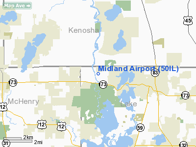
Location
& QuickFacts
|
FAA
Information Effective: |
2007-12-20 |
|
Airport
Identifier: |
50IL |
|
Airport
Status: |
Operational |
|
Longitude/Latitude: |
088-10-27.3100W/42-29-20.0600N
-88.174253/42.488906 (Estimated) |
|
Elevation: |
750 ft / 228.60 m (Estimated) |
|
Land: |
0 acres |
|
From nearest
city: |
4 nautical miles E of Antioch, IL |
|
Location: |
Lake County, IL |
|
Magnetic
Variation: |
02W (1995) |
Owner & Manager
|
Ownership: |
Privately
owned |
|
Owner: |
John Petschelt |
|
Address: |
27801 Wilmot Road
Antioch,
IL 60002 |
|
Phone
number: |
847-395-9294 |
|
Manager: |
John Petschelt |
|
Address: |
27801 Wilmot Road
Antioch,
IL 60002 |
|
Phone
number: |
847-395-9294 |
Airport
Operations and Facilities
|
Airport
Use: |
Private |
|
Segmented
Circle: |
No |
|
Control
Tower: |
No |
|
Sectional
chart: |
Chicago |
|
Region: |
AGL - Great Lakes |
|
Boundary
ARTCC: |
ZAU - Chicago |
|
Tie-in
FSS: |
IKK - Kankakee |
|
FSS on
Airport: |
No |
|
FSS Toll
Free: |
1-800-WX-BRIEF |
|
Runway Information
Runway 09/27
|
Dimension: |
1100 x 70 ft
/ 335.3 x 21.3 m |
|
Surface: |
TURF, Fair Condition |
|
|
Runway 09 |
Runway 27 |
|
Traffic
Pattern: |
Left |
Left |
|
Obstruction: |
|
90 ft trees, 675.0 ft from runway |
|
Radio Navigation
Aids
|
ID |
Type |
Name |
Ch |
Freq |
Var |
Dist |
|
RA |
NDB |
Paser |
|
206.00 |
00E |
16.8 nm |
|
LVV |
NDB |
Lake Lawn |
|
404.00 |
00W |
22.4 nm |
|
GM |
NDB |
Teels |
|
242.00 |
02W |
25.9 nm |
|
ME |
NDB |
Deana |
|
350.00 |
00E |
32.0 nm |
|
UES |
NDB |
Waukesha |
|
359.00 |
01W |
33.5 nm |
|
BL |
NDB |
Yanks |
|
260.00 |
02W |
36.8 nm |
|
JVL |
NDB |
Janesville |
|
375.00 |
03E |
39.1 nm |
|
DKB |
NDB |
Dekalb |
|
209.00 |
02W |
40.9 nm |
|
RYV |
NDB |
Rock River |
|
371.00 |
01W |
47.8 nm |
|
HK |
NDB |
Ermin |
|
332.00 |
01W |
48.7 nm |
|
MX |
NDB |
Kedzi |
|
248.00 |
01W |
49.9 nm |
|
ENW |
VOR/DME |
Kenosha |
029X |
109.20 |
02W |
12.6 nm |
|
BUU |
VOR/DME |
Burbun |
092X |
114.50 |
01W |
13.3 nm |
|
OBK |
VOR/DME |
Northbrook |
077X |
113.00 |
02W |
18.9 nm |
|
HRK |
VOR/DME |
Horlick |
124X |
117.70 |
02W |
22.9 nm |
|
ORD |
VOR/DME |
Chicago O'hare |
086X |
113.90 |
02E |
32.4 nm |
|
DPA |
VOR/DME |
Dupage |
021X |
108.40 |
02E |
36.8 nm |
|
LJT |
VOR/DME |
Timmerman |
072X |
112.50 |
02W |
37.8 nm |
|
JVL |
VOR/DME |
Janesville |
090X |
114.30 |
03E |
41.5 nm |
|
RFD |
VOR/DME |
Rockford |
045X |
110.80 |
01E |
48.2 nm |
|
BAE |
VORTAC |
Badger |
111X |
116.40 |
02E |
38.1 nm |
|
MKE |
VOT |
Milwaukee |
|
109.00 |
|
30.2 nm |
|
ORD |
VOT |
Chicago O'hare Intl |
|
112.00 |
|
32.7 nm |
|
MDW |
VOT |
Chicago Midway |
|
111.00 |
|
46.2 nm |
Remarks
- OBSTN
REMOVED/LOWER TO ACHIEVE 20:1 APCH CLNC; 125 FT EITHER SIDE OF RY &
200 FT OFF RY ENDS CLEAR OF OBSTN; 60 FT EITHER RY SIDE & 240 FT
OFF RY ENDS CLEAR & GRADED.
Based Aircraft
|
Aircraft
based on field: |
1 |
|
Single Engine
Airplanes: |
1 |
Midland Airport
Address:
Lake County, IL
Tel:
847-395-9294
Images
and information placed above are from
http://www.airport-data.com/airport/50IL/
We
thank them for the data!
| General
Info |
| Country |
United
States |
| State |
ILLINOIS
|
| FAA ID |
50IL |
| Latitude |
42-29-20.060N
|
| Longitude |
088-10-27.310W
|
| Elevation |
750 feet
|
| Near City |
ANTIOCH
|
We don't guarantee the information is fresh and accurate. The data may
be wrong or outdated.
For more up-to-date information please refer to other sources.
|
|


