 |
|
Metropolis Municipal Airport |
| Metropolis Municipal Airport |
| IATA: none – ICAO: none – FAA LID: M30 |
| Summary |
| Airport type |
Public |
| Owner |
City of Metropolis |
| Location |
Metropolis, Illinois |
| Elevation AMSL |
384 ft / 117 m |
| Coordinates |
37°11′09″N 088°45′02″W / 37.18583°N 88.75056°W / 37.18583; -88.75056 |
| Runways |
| Direction |
Length |
Surface |
| ft |
m |
| 18/36 |
4,000 |
1,219 |
Asphalt |
Metropolis Municipal Airport (FAA LID: M30) is an airstrip 2 miles northwest of Metropolis, Illinois, United States.
The above content comes from Wikipedia and is published under free licenses – click here to read more.
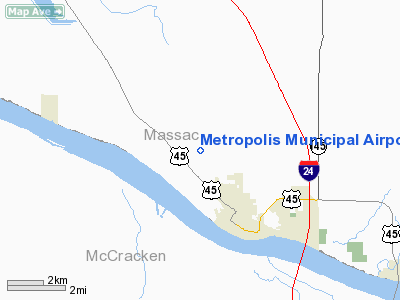
Location
& QuickFacts
|
FAA
Information Effective: |
2007-12-20 |
|
Airport
Identifier: |
M30 |
|
Airport
Status: |
Operational |
|
Longitude/Latitude: |
088-45-02.1960W/37-11-09.1940N
-88.750610/37.185887 (Estimated) |
|
Elevation: |
384 ft / 117.04 m (Estimated) |
|
Land: |
194 acres |
|
From nearest
city: |
2 nautical miles NW of Metropolis, IL |
|
Location: |
Massac County, IL |
|
Magnetic
Variation: |
01E (1985) |
Owner
& Manager
|
Ownership: |
Publicly
owned |
|
Owner: |
City Of Metropolis |
|
Address: |
City Hall, 106 W 5th St
Metropolis, IL 62960 |
|
Phone
number: |
618-524-4016 |
|
Manager: |
Jerry Caudle |
|
Address: |
Rte 1, 751 Airport Rd
Metropolis, IL 62960 |
|
Phone
number: |
618-524-2440 |
Airport Operations
and Facilities
|
Airport
Use: |
Open
to public |
|
Wind indicator: |
Yes |
|
Segmented
Circle: |
No |
|
Control
Tower: |
No |
|
Lighting
Schedule: |
DUSK-DAWN
ACTVT MIRL RY 18/36 - CTAF. |
|
Beacon
Color: |
Clear-Green (lighted land airport) |
|
Landing
fee charge: |
No
OVERNIGHT TIE DOWN FEE. |
|
Sectional
chart: |
St Louis |
|
Region: |
AGL - Great Lakes |
|
Traffic
Pattern Alt: |
800 ft |
|
Boundary
ARTCC: |
ZME - Memphis |
|
Tie-in
FSS: |
STL - Saint Louis |
|
FSS on
Airport: |
No |
|
FSS Toll
Free: |
1-800-WX-BRIEF |
|
NOTAMs
Facility: |
M30 (NOTAM-d service avaliable) |
|
Federal
Agreements: |
NGY |
Airport Communications
|
CTAF: |
122.800 |
|
Unicom: |
122.800
|
Airport
Services
|
Fuel
available: |
100LL
SELF SERV FUEL AVAILABLE 24 HRS |
|
Power
Plant Repair: |
NONE |
|
Runway Information
Runway 18/36
|
Dimension: |
4000 x 75 ft
/ 1219.2 x 22.9 m |
|
Surface: |
ASPH, Good Condition |
|
Weight Limit: |
Single wheel: 12500 lbs. |
|
Edge Lights: |
Medium |
|
|
Runway 18 |
Runway 36 |
|
Longitude: |
088-45-02.1800W |
088-45-02.6300W |
|
Latitude: |
37-11-18.3700N |
37-10-38.8100N |
|
Elevation: |
383.00 ft |
373.00 ft |
|
Traffic
Pattern: |
Left |
Left |
|
Markings: |
Basic, Fair Condition |
Basic, Fair Condition |
|
Runway End
Identifier: |
|
No |
|
Centerline
Lights: |
No |
No |
|
Touchdown
Lights: |
No |
No |
|
Obstruction: |
70 ft tree, 1951.0 ft from runway, 299 ft right
of centerline, 25:1 slope to clear |
94 ft tree, 2513.0 ft from runway, 352 ft left
of centerline, 24:1 slope to clear |
|
Radio Navigation
Aids
|
ID |
Type |
Name |
Ch |
Freq |
Var |
Dist |
|
BDD |
NDB |
Bellgrade |
|
254.00 |
00E |
4.5 nm |
|
CIR |
NDB |
Cairo |
|
397.00 |
00E |
23.9 nm |
|
GGK |
NDB |
Mayfield |
|
401.00 |
00E |
30.7 nm |
|
CHQ |
NDB |
Charleston |
|
208.00 |
01E |
35.6 nm |
|
HSB |
NDB |
Harrisburg-raleigh |
|
230.00 |
00E |
38.9 nm |
|
TWT |
NDB |
Tradewater |
|
276.00 |
00E |
42.0 nm |
|
MWA |
VOR/DME |
Marion |
041X |
110.40 |
04E |
36.4 nm |
|
CGI |
VOR/DME |
Cape Girardeau |
076X |
112.90 |
01E |
39.4 nm |
|
CNG |
VORTAC |
Cunningham |
078X |
113.10 |
03E |
11.4 nm |
Remarks
- AVOID
FACTORY LCTD 4000 FT SW OF RY 18/36.
- EXISTED
PRIOR TO 1959.
Based Aircraft
|
Aircraft
based on field: |
31 |
|
Single Engine
Airplanes: |
29 |
|
Multi Engine Airplanes: |
2 |
Operational Statistics
Time
Period: 2004-10-01 - 2005-09-30
|
Aircraft
Operations: |
250/Week |
|
Air Taxi: |
7.7% |
|
General Aviation
Local: |
69.2% |
|
General Aviation
Itinerant: |
23.1% |
Metropolis Municipal Airport
Address:
Massac County, IL
Tel:
618-524-4016,
618-524-2440
Images
and information placed above are from
http://www.airport-data.com/airport/M30/
We
thank them for the data!
| General
Info |
| Country |
United
States |
| State |
ILLINOIS
|
| FAA ID |
M30 |
| Latitude |
37-11-09.194N
|
| Longitude |
088-45-02.196W
|
| Elevation |
384 feet
|
| Near City |
METROPOLIS
|
We don't guarantee the information is fresh and accurate. The data may
be wrong or outdated.
For more up-to-date information please refer to other sources.
|
|


