 |
|
|
|
Location
& QuickFacts
|
FAA
Information Effective: |
2007-12-20 |
|
Airport
Identifier: |
3IS4 |
|
Airport
Status: |
Operational |
|
Longitude/Latitude: |
090-20-43.4620W/42-17-20.0510N
-90.345406/42.288903 (Estimated) |
|
Elevation: |
970 ft / 295.66 m (Estimated) |
|
Land: |
20 acres |
|
From nearest
city: |
3 nautical miles W of Hanover, IL |
|
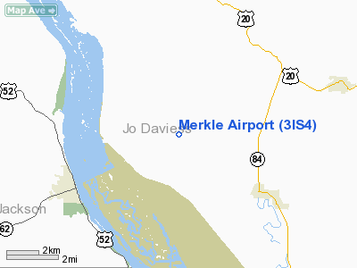
Location: |
Jo Daviess County, IL |
|
Magnetic
Variation: |
01E (1985) |
Owner
& Manager
|
Ownership: |
Privately
owned |
|
Owner: |
Betty Lou Merkle |
|
Address: |
6807 Batey Hollow Road
Hanover,
IL 61041 |
|
Phone
number: |
815-777-1778 |
|
Manager: |
Betty Lou Merkle |
|
Address: |
6807 Batey Hollow Road
Hanover,
IL 61041 |
|
Phone
number: |
815-777-1778 |
Airport Operations
and Facilities
|
Airport
Use: |
Private |
|
Wind indicator: |
Yes |
|
Segmented
Circle: |
No |
|
Control
Tower: |
No |
|
Lighting
Schedule: |
RDO-CTL
ACTVT LIRL RY 18/36; REIL RYS 18 & 36; VASI RY 36 -
123.0. |
|
Sectional
chart: |
Chicago |
|
Region: |
AGL - Great Lakes |
|
Boundary
ARTCC: |
ZAU - Chicago |
|
Tie-in
FSS: |
IKK - Kankakee |
|
FSS on
Airport: |
No |
|
FSS Toll
Free: |
1-800-WX-BRIEF |
Airport
Communications
|
Runway Information
Runway 18/36
|
Dimension: |
2900 x 100 ft
/ 883.9 x 30.5 m |
|
Surface: |
TURF, |
|
Edge Lights: |
Low |
|
|
Runway 18 |
Runway 36 |
|
Traffic
Pattern: |
Left |
Left |
|
Displaced
threshold: |
300.00 ft |
0.00 ft |
|
Obstruction: |
, 300.0 ft from runway |
4 ft fence, 200.0 ft from runway |
|
Radio Navigation
Aids
|
ID |
Type |
Name |
Ch |
Freq |
Var |
Dist |
|
OQW |
NDB |
Maquoketa |
|
386.00 |
02E |
22.7 nm |
|
PVB |
NDB |
Platteville |
|
203.00 |
01E |
24.3 nm |
|
CWI |
NDB |
Clinton |
|
377.00 |
01E |
27.7 nm |
|
FEP |
NDB |
Freeport |
|
335.00 |
00E |
33.9 nm |
|
MXO |
NDB |
Monticello |
|
397.00 |
01E |
35.6 nm |
|
MRJ |
NDB |
Mineral Point |
|
365.00 |
00W |
36.4 nm |
|
BOZ |
NDB |
Whiteside |
|
254.00 |
01E |
42.8 nm |
|
PLL |
VOR/DME |
Polo |
049X |
111.20 |
03E |
41.4 nm |
|
DBQ |
VORTAC |
Dubuque |
105X |
115.80 |
04E |
17.5 nm |
|
CVA |
VORTAC |
Davenport |
085X |
113.80 |
04E |
35.4 nm |
|
DVN |
VOT |
Davenport Municipal |
|
111.80 |
|
42.1 nm |
Based Aircraft
|
Aircraft
based on field: |
1 |
|
Multi Engine Airplanes: |
1 |
Merkle Airport
Address:
Jo Daviess County, IL
Tel:
815-777-1778
Images
and information placed above are from
http://www.airport-data.com/airport/3IS4/
We
thank them for the data!
| General
Info |
| Country |
United
States |
| State |
ILLINOIS
|
| FAA ID |
3IS4 |
| Latitude |
42-17-20.051N
|
| Longitude |
090-20-43.462W
|
| Elevation |
970 feet
|
| Near City |
HANOVER
|
We don't guarantee the information is fresh and accurate. The data may
be wrong or outdated.
For more up-to-date information please refer to other sources.
|
|


