 |
|
|
|
|
|
Location
& QuickFacts
|
FAA
Information Effective: |
2007-12-20 |
|
Airport
Identifier: |
C00 |
|
Airport
Status: |
Operational |
|
Longitude/Latitude: |
090-44-13.5010W/41-14-55.1220N
-90.737084/41.248645 (Estimated) |
|
Elevation: |
740 ft / 225.55 m (Surveyed) |
|
Land: |
15 acres |
|
From nearest
city: |
3 nautical miles NE of Aledo, IL |
|
Location: |
Mercer County, IL |
|
Magnetic
Variation: |
02E (1985) |
Owner & Manager
|
Ownership: |
Publicly
owned |
|
Owner: |
Mercer County |
|
Address: |
County Courthouse
Aledo, IL 61231 |
|
Phone
number: |
309-582-2138 |
|
Manager: |
Garrett Lindell |
|
Address: |
1276 Hwy 94
Aledo, IL 61231 |
|
Phone
number: |
309-582-9020 |
Airport
Operations and Facilities
|
Airport
Use: |
Open
to public |
|
Wind indicator: |
Yes |
|
Segmented
Circle: |
No |
|
Control
Tower: |
No |
|
Lighting
Schedule: |
DUSK-DAWN |
|
Landing
fee charge: |
No |
|
Sectional
chart: |
Chicago |
|
Region: |
AGL - Great Lakes |
|
Traffic
Pattern Alt: |
800 ft |
|
Boundary
ARTCC: |
ZAU - Chicago |
|
Tie-in
FSS: |
IKK - Kankakee |
|
FSS on
Airport: |
No |
|
FSS Toll
Free: |
1-800-WX-BRIEF |
|
NOTAMs
Facility: |
IKK (NOTAM-d service avaliable) |
|
Federal
Agreements: |
N |
Airport Communications
Airport
Services
|
Fuel
available: |
100LL |
|
Bottled
Oxygen: |
NONE |
|
Bulk Oxygen: |
NONE |
|
Runway Information
Runway 17/35
|
Dimension: |
2480 x 45 ft
/ 755.9 x 13.7 m |
|
Surface: |
ASPH, Good Condition |
|
Edge Lights: |
Low |
|
|
Runway 17 |
Runway 35 |
|
Longitude: |
090-44-15.3500W |
090-44-12.5000W |
|
Latitude: |
41-15-07.5400N |
41-14-43.1200N |
|
Elevation: |
742.00 ft |
719.00 ft |
|
Traffic
Pattern: |
Left |
Left |
|
Markings: |
Numbers only, Good Condition |
Numbers only, Good Condition |
|
Runway End
Identifier: |
No |
No |
|
Centerline
Lights: |
No |
No |
|
Touchdown
Lights: |
No |
No |
|
Obstruction: |
36 ft bldg, 1110.0 ft from runway, 168 ft left
of centerline, 25:1 slope to clear
15 FT TREE 90 FT FROM EOR 17 AT 118 FT R. |
10 ft road, 440.0 ft from runway, 24:1 slope
to clear |
|
Radio Navigation
Aids
|
ID |
Type |
Name |
Ch |
Freq |
Var |
Dist |
|
EZI |
NDB |
Kewanee |
|
245.00 |
01E |
35.3 nm |
|
CWI |
NDB |
Clinton |
|
377.00 |
01E |
39.4 nm |
|
MPZ |
NDB |
Mount Pleasant |
|
212.00 |
02E |
39.5 nm |
|
AWG |
NDB |
Washington |
|
219.00 |
02E |
42.3 nm |
|
JZY |
NDB |
Macomb |
|
251.00 |
01E |
44.6 nm |
|
OQW |
NDB |
Maquoketa |
|
386.00 |
02E |
48.3 nm |
|
DDD |
VOR/DME |
Port City |
112X |
116.50 |
01E |
19.9 nm |
|
GBG |
VOR/DME |
Galesburg |
035X |
109.80 |
03E |
23.2 nm |
|
MZV |
VORTAC |
Moline |
091X |
114.40 |
05E |
6.2 nm |
|
CVA |
VORTAC |
Davenport |
085X |
113.80 |
04E |
29.9 nm |
|
BRL |
VORTAC |
Burlington |
051X |
111.40 |
05E |
32.7 nm |
|
IOW |
VORTAC |
Iowa City |
109X |
116.20 |
05E |
42.7 nm |
|
DVN |
VOT |
Davenport Municipal |
|
111.80 |
|
22.8 nm |
Based Aircraft
|
Aircraft
based on field: |
8 |
|
Single Engine
Airplanes: |
8 |
Operational Statistics
Time
Period: 2005-01-01 - 2005-12-31
|
Aircraft
Operations: |
77/Week |
|
General Aviation
Local: |
82.5% |
|
General Aviation
Itinerant: |
17.5% |
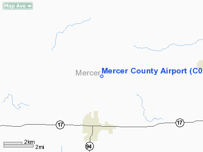
Mercer County Airport
Address:
Mercer County, IL
Tel:
309-582-2138,
309-582-9020
Images
and information placed above are from
http://www.airport-data.com/airport/C00/
We
thank them for the data!
| General
Info |
| Country |
United
States |
| State |
ILLINOIS
|
| FAA ID |
C00 |
| Latitude |
41-14-55.122N
|
| Longitude |
090-44-13.501W
|
| Elevation |
740 feet
|
| Near City |
ALEDO
|
We don't guarantee the information is fresh and accurate. The data may
be wrong or outdated.
For more up-to-date information please refer to other sources.
|
|


