 |
|
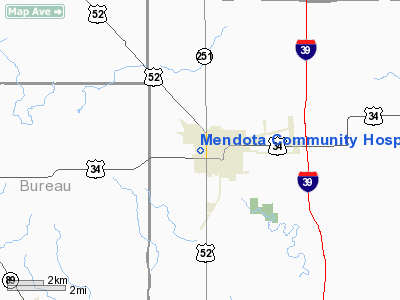
Mendota Community Hospital Heliport |
Location
& QuickFacts
|
FAA
Information Effective: |
2007-12-20 |
|
Airport
Identifier: |
74IL |
|
Airport
Status: |
Operational |
|
Longitude/Latitude: |
089-07-53.3080W/41-33-07.1170N
-89.131474/41.551977 (Estimated) |
|
Elevation: |
770 ft / 234.70 m (Estimated) |
|
Land: |
0 acres |
|
From nearest
city: |
1 nautical miles NW of Mendota, IL |
|
Location: |
La Salle County, IL |
|
Magnetic
Variation: |
00E (1985) |
Owner & Manager
|
Ownership: |
Privately
owned |
|
Address: |
|
|
Manager: |
Gareth D. Weeks, Admstr |
|
Address: |
Memorial Drive
Mendota, IL 61342 |
|
Phone
number: |
815-539-7461 |
Airport
Operations and Facilities
|
Airport
Use: |
Private
MEDICAL USE. |
|
Wind indicator: |
No |
|
Segmented
Circle: |
No |
|
Control
Tower: |
No |
|
Landing
fee charge: |
No |
|
Sectional
chart: |
Chicago |
|
Region: |
AGL - Great Lakes |
|
Boundary
ARTCC: |
ZAU - Chicago |
|
Tie-in
FSS: |
IKK - Kankakee |
|
FSS on
Airport: |
No |
|
FSS Toll
Free: |
1-800-WX-BRIEF |
|
Runway Information
Helipad H1
|
Dimension: |
40 x 40 ft /
12.2 x 12.2 m |
|
Surface: |
CONC, |
|
|
Runway H1 |
Runway |
|
Traffic
Pattern: |
Left |
Left |
|
Radio Navigation
Aids
|
ID |
Type |
Name |
Ch |
Freq |
Var |
Dist |
|
VYS |
NDB |
Valley |
|
230.00 |
00W |
11.9 nm |
|
OIX |
NDB |
Ottawa |
|
266.00 |
01E |
16.9 nm |
|
DKB |
NDB |
Dekalb |
|
209.00 |
02W |
29.8 nm |
|
BOZ |
NDB |
Whiteside |
|
254.00 |
01E |
30.9 nm |
|
EZI |
NDB |
Kewanee |
|
245.00 |
01E |
42.9 nm |
|
FEP |
NDB |
Freeport |
|
335.00 |
00E |
46.4 nm |
|
PLL |
VOR/DME |
Polo |
049X |
111.20 |
03E |
30.5 nm |
|
DPA |
VOR/DME |
Dupage |
021X |
108.40 |
02E |
40.5 nm |
|
RFD |
VOR/DME |
Rockford |
045X |
110.80 |
01E |
40.6 nm |
|
PNT |
VOR/DME |
Pontiac |
033X |
109.60 |
03E |
47.5 nm |
|
BDF |
VORTAC |
Bradford |
094X |
114.70 |
00E |
31.3 nm |
|
JOT |
VORTAC |
Joliet |
070X |
112.30 |
02E |
36.6 nm |
Remarks
- INGRESS/EGRESS
ROUTES LMTD TO N AND S DIRECTION.
Based Aircraft
|
Aircraft
based on field: |
1 |
|
Helicopters: |
1 |
Mendota Community Hospital Heliport
Address:
La Salle County, IL
Tel:
815-539-7461
Images
and information placed above are from
http://www.airport-data.com/airport/74IL/
We
thank them for the data!
| General
Info |
| Country |
United
States |
| State |
ILLINOIS
|
| FAA ID |
74IL |
| Latitude |
41-33-07.117N
|
| Longitude |
089-07-53.308W
|
| Elevation |
770 feet
|
| Near City |
MENDOTA
|
We don't guarantee the information is fresh and accurate. The data may
be wrong or outdated.
For more up-to-date information please refer to other sources.
|
|


