 |
|
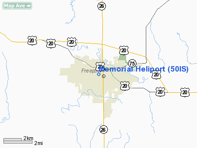
Location
& QuickFacts
|
FAA
Information Effective: |
2007-12-20 |
|
Airport
Identifier: |
50IS |
|
Airport
Status: |
Operational |
|
Longitude/Latitude: |
089-38-16.4180W/42-17-40.0690N
-89.637894/42.294464 (Estimated) |
|
Elevation: |
870 ft / 265.18 m (Estimated) |
|
Land: |
0 acres |
|
From nearest
city: |
0 nautical miles W of Freeport, IL |
|
Location: |
Stephenson County, IL |
|
Magnetic
Variation: |
01E (1985) |
Owner & Manager
|
Ownership: |
Privately
owned |
|
Owner: |
Freeport Memorial Hospital |
|
Address: |
1045 West Stephenson
Freeport, IL 61032 |
|
Phone
number: |
815-235-4131 |
|
Manager: |
Mike Fink |
|
Address: |
1045 West Stephenson
Freeport, IL 61032 |
|
Phone
number: |
815-235-0203 |
Airport
Operations and Facilities
|
Airport
Use: |
Private
MEDICAL USE. |
|
Segmented
Circle: |
No |
|
Control
Tower: |
No |
|
Landing
fee charge: |
No |
|
Sectional
chart: |
Chicago |
|
Region: |
AGL - Great Lakes |
|
Boundary
ARTCC: |
ZAU - Chicago |
|
Tie-in
FSS: |
IKK - Kankakee |
|
FSS Toll
Free: |
1-800-WX-BRIEF
OR LOCAL CALL 965-6758. |
|
Runway Information
Helipad H1
|
Dimension: |
40 x 35 ft /
12.2 x 10.7 m |
|
Surface: |
CONC, |
|
|
Runway H1 |
Runway |
|
Traffic
Pattern: |
Left |
Left |
|
Radio Navigation
Aids
|
ID |
Type |
Name |
Ch |
Freq |
Var |
Dist |
|
FEP |
NDB |
Freeport |
|
335.00 |
00E |
3.7 nm |
|
JVL |
NDB |
Janesville |
|
375.00 |
03E |
32.7 nm |
|
BOZ |
NDB |
Whiteside |
|
254.00 |
01E |
35.7 nm |
|
CWI |
NDB |
Clinton |
|
377.00 |
01E |
41.6 nm |
|
PVB |
NDB |
Platteville |
|
203.00 |
01E |
42.6 nm |
|
MRJ |
NDB |
Mineral Point |
|
365.00 |
00W |
44.2 nm |
|
DKB |
NDB |
Dekalb |
|
209.00 |
02W |
46.8 nm |
|
MS |
NDB |
Monah |
|
400.00 |
00E |
47.9 nm |
|
RFD |
VOR/DME |
Rockford |
045X |
110.80 |
01E |
19.9 nm |
|
PLL |
VOR/DME |
Polo |
049X |
111.20 |
03E |
20.4 nm |
|
JVL |
VOR/DME |
Janesville |
090X |
114.30 |
03E |
28.4 nm |
|
DBQ |
VORTAC |
Dubuque |
105X |
115.80 |
04E |
48.0 nm |
Remarks
- PROVIDED
APP/DEP PATHS ARE FROM 20 TO 80 DEGREES AND FROM 240 TO 250 DEGREES;
AREA IS MARKED; WIND INDICATOR IS MAINTAINED, PERSONS BE RESTRICTED.
Memorial Heliport
Address:
Stephenson County, IL
Tel:
815-235-4131,
815-235-0203
Images
and information placed above are from
http://www.airport-data.com/airport/50IS/
We
thank them for the data!
| General
Info |
| Country |
United
States |
| State |
ILLINOIS
|
| FAA ID |
50IS |
| Latitude |
42-17-40.069N
|
| Longitude |
089-38-16.418W
|
| Elevation |
870 feet
|
| Near City |
FREEPORT
|
We don't guarantee the information is fresh and accurate. The data may
be wrong or outdated.
For more up-to-date information please refer to other sources.
|
|


