 |
|
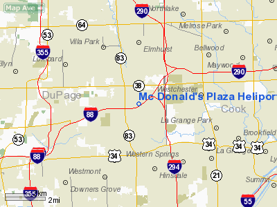
Mc Donald's Plaza Heliport |
Location
& QuickFacts
|
FAA
Information Effective: |
2007-12-20 |
|
Airport
Identifier: |
77IS |
|
Airport
Status: |
Operational |
|
Longitude/Latitude: |
087-56-40.0000W/41-50-53.0000N
-87.944444/41.848056 (Estimated) |
|
Elevation: |
665 ft / 202.69 m (Estimated) |
|
Land: |
0 acres |
|
From nearest
city: |
0 nautical miles N of Oak Brook, IL |
|
Location: |
Du Page County, IL |
|
Magnetic
Variation: |
01W (1985) |
Owner
& Manager
|
Ownership: |
Privately
owned |
|
Owner: |
Mc Donald's Corporation |
|
Address: |
2915 Jorie Rd
Oak
Brook, IL 60521 |
|
Phone
number: |
630-623-8820 |
|
Manager: |
James Lynn |
|
Address: |
One Mc Donalds Plaza
Oak Brook, IL 60521 |
|
Phone
number: |
708-575-3387 |
Airport Operations
and Facilities
|
Airport
Use: |
Private |
|
Wind indicator: |
Yes |
|
Segmented
Circle: |
No |
|
Control
Tower: |
No |
|
Lighting
Schedule: |
PHONE REQ
FOR PERIMETER & FLOOD LGTS CALL 630-623-8820. |
|
Sectional
chart: |
Chicago |
|
Region: |
AGL - Great Lakes |
|
Boundary
ARTCC: |
ZAU - Chicago |
|
Tie-in
FSS: |
IKK - Kankakee |
|
FSS on
Airport: |
No |
|
FSS Toll
Free: |
1-800-WX-BRIEF |
|
Runway Information
Helipad H1
|
Dimension: |
25 x 25 ft /
7.6 x 7.6 m |
|
Surface: |
CONC, |
|
|
Runway H1 |
Runway |
|
Traffic
Pattern: |
Left |
Left |
|
Radio Navigation
Aids
|
ID |
Type |
Name |
Ch |
Freq |
Var |
Dist |
|
ME |
NDB |
Deana |
|
350.00 |
00E |
8.1 nm |
|
HK |
NDB |
Ermin |
|
332.00 |
01W |
9.1 nm |
|
MX |
NDB |
Kedzi |
|
248.00 |
01W |
13.1 nm |
|
DKB |
NDB |
Dekalb |
|
209.00 |
02W |
34.5 nm |
|
ORD |
VOR/DME |
Chicago O'hare |
086X |
113.90 |
02E |
8.6 nm |
|
DPA |
VOR/DME |
Dupage |
021X |
108.40 |
02E |
18.3 nm |
|
OBK |
VOR/DME |
Northbrook |
077X |
113.00 |
02W |
22.4 nm |
|
ENW |
VOR/DME |
Kenosha |
029X |
109.20 |
02W |
45.1 nm |
|
IKK |
VOR/DME |
Kankakee |
053X |
111.60 |
00E |
46.7 nm |
|
JOT |
VORTAC |
Joliet |
070X |
112.30 |
02E |
24.7 nm |
|
CGT |
VORTAC |
Chicago Heights |
089X |
114.20 |
02E |
26.3 nm |
|
EON |
VORTAC |
Peotone |
079X |
113.20 |
02E |
35.4 nm |
|
ORD |
VOT |
Chicago O'hare Intl |
|
112.00 |
|
8.3 nm |
|
MDW |
VOT |
Chicago Midway |
|
111.00 |
|
9.4 nm |
Remarks
- FATO
MEASURES 100 FT BY 100 FT CONC.
- SEE
AIRSPACE CASE 97-AGL-273-NRA..
Based Aircraft
|
Aircraft
based on field: |
1 |
|
Helicopters: |
1 |
Mc Donald's Plaza Heliport
Address:
Du Page County, IL
Tel:
630-623-8820,
708-575-3387
Images
and information placed above are from
http://www.airport-data.com/airport/77IS/
We
thank them for the data!
| General
Info |
| Country |
United
States |
| State |
ILLINOIS
|
| FAA ID |
77IS |
| Latitude |
41-50-15.000N
|
| Longitude |
087-56-36.000W
|
| Elevation |
655 feet
|
| Near City |
OAK BROOK
|
We don't guarantee the information is fresh and accurate. The data may
be wrong or outdated.
For more up-to-date information please refer to other sources.
|
|


