 |
|
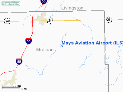
Location
& QuickFacts
|
FAA
Information Effective: |
2007-12-20 |
|
Airport
Identifier: |
IL63 |
|
Airport
Status: |
Operational |
|
Longitude/Latitude: |
088-40-30.2240W/40-42-00.1240N
-88.675062/40.700034 (Estimated) |
|
Elevation: |
720 ft / 219.46 m (Estimated) |
|
Land: |
0 acres |
|
From nearest
city: |
3 nautical miles S of Chenoa, IL |
|
Location: |
Mc Lean County, IL |
|
Magnetic
Variation: |
00E (1985) |
Owner & Manager
|
Ownership: |
Privately
owned |
|
Address: |
|
|
Manager: |
Douglas Mays |
|
Address: |
Rr1 Box 60
Chenoa, IL 61726 |
|
Phone
number: |
815-945-7261 |
Airport Operations
and Facilities
|
Airport Use: |
Private |
|
Wind
indicator: |
No |
|
Segmented
Circle: |
No |
|
Control
Tower: |
No |
|
Landing
fee charge: |
No |
|
Sectional
chart: |
Chicago |
|
Region: |
AGL - Great Lakes |
|
Boundary
ARTCC: |
ZAU - Chicago |
|
Tie-in
FSS: |
IKK - Kankakee |
|
FSS on
Airport: |
No |
|
FSS Toll
Free: |
1-800-WX-BRIEF |
Airport Services
|
Airframe
Repair: |
NONE |
|
Power
Plant Repair: |
NONE |
|
Runway Information
Runway N/S
|
Dimension: |
2640 x 70 ft
/ 804.7 x 21.3 m |
|
Surface: |
TURF, |
|
|
Runway N |
Runway S |
|
Traffic
Pattern: |
Left |
Left |
|
Radio Navigation
Aids
|
ID |
Type |
Name |
Ch |
Freq |
Var |
Dist |
|
OIX |
NDB |
Ottawa |
|
266.00 |
01E |
40.6 nm |
|
PI |
NDB |
Tungg |
|
356.00 |
01E |
42.2 nm |
|
AAA |
NDB |
Abraham |
|
329.00 |
00E |
44.4 nm |
|
VYS |
NDB |
Valley |
|
230.00 |
00W |
44.8 nm |
|
PNT |
VOR/DME |
Pontiac |
033X |
109.60 |
03E |
7.8 nm |
|
BMI |
VOR/DME |
Bloomington |
019X |
108.20 |
03E |
17.6 nm |
|
RBS |
VOR/DME |
Roberts |
115X |
116.80 |
02E |
24.4 nm |
|
IKK |
VOR/DME |
Kankakee |
053X |
111.60 |
00E |
43.7 nm |
|
CMI |
VORTAC |
Champaign |
037X |
110.00 |
03E |
44.0 nm |
|
BDF |
VORTAC |
Bradford |
094X |
114.70 |
00E |
49.8 nm |
Remarks
Based Aircraft
|
Aircraft
based on field: |
2 |
|
Single Engine
Airplanes: |
2 |
Mays Aviation Airport
Address:
Mc Lean County, IL
Tel:
815-945-7261
Images
and information placed above are from
http://www.airport-data.com/airport/IL63/
We
thank them for the data!
| General
Info |
| Country |
United
States |
| State |
ILLINOIS
|
| FAA ID |
IL63 |
| Latitude |
40-42-00.124N
|
| Longitude |
088-40-30.224W
|
| Elevation |
720 feet
|
| Near City |
CHENOA
|
We don't guarantee the information is fresh and accurate. The data may
be wrong or outdated.
For more up-to-date information please refer to other sources.
|
|


