 |
|
|
|
|
|
Location
& QuickFacts
|
FAA
Information Effective: |
2007-12-20 |
|
Airport
Identifier: |
C75 |
|
Airport
Status: |
Operational |
|
Longitude/Latitude: |
089-23-11.1200W/41-01-09.4290N
-89.386422/41.019286 (Estimated) |
|
Elevation: |
568 ft / 173.13 m (Surveyed) |
|
Land: |
230 acres |
|
From nearest
city: |
1 nautical miles E of Lacon, IL |
|
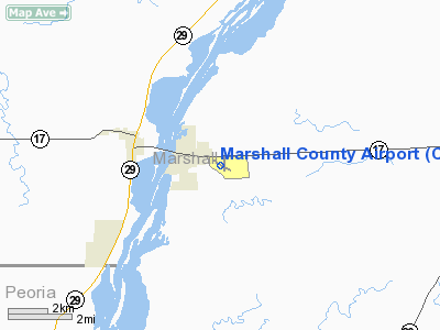
Location: |
Marshall County, IL |
|
Magnetic
Variation: |
01W (2000) |
Owner
& Manager
|
Ownership: |
Publicly
owned |
|
Owner: |
Marshall County |
|
Address: |
County Court House
Lacon, IL 61540 |
|
Phone
number: |
309-246-2870 |
|
Manager: |
Neil Pobanz |
|
Address: |
Po Box 38
Lacon,
IL 61540 |
|
Phone
number: |
309-246-3700 |
Airport
Operations and Facilities
|
Airport
Use: |
Open
to public |
|
Wind indicator: |
Yes |
|
Segmented
Circle: |
Yes |
|
Control
Tower: |
No |
|
Lighting
Schedule: |
DUSK-DAWN
ACTVT MIRL RY 13/31; REIL RY 13 & PAPI RY 31 - CTAF. |
|
Beacon
Color: |
Clear-Green (lighted land airport) |
|
Landing
fee charge: |
No |
|
Sectional
chart: |
Chicago |
|
Region: |
AGL - Great Lakes |
|
Traffic
Pattern Alt: |
1000 ft |
|
Boundary
ARTCC: |
ZAU - Chicago |
|
Tie-in
FSS: |
IKK - Kankakee |
|
FSS on
Airport: |
No |
|
FSS Toll
Free: |
1-800-WX-BRIEF |
|
NOTAMs
Facility: |
C75 (NOTAM-d service avaliable) |
|
Federal
Agreements: |
NGY |
Airport Communications
|
CTAF: |
122.800 |
|
Unicom: |
122.800
|
Airport
Services
|
Fuel
available: |
100LLA |
|
Airframe
Repair: |
MAJOR |
|
Power
Plant Repair: |
MAJOR |
|
Bottled
Oxygen: |
NONE |
|
Bulk Oxygen: |
NONE |
|
Runway Information
Runway 13/31
|
Dimension: |
3200 x 75 ft
/ 975.4 x 22.9 m |
|
Surface: |
ASPH, Good Condition |
|
Edge Lights: |
Medium |
|
|
Runway 13 |
Runway 31 |
|
Longitude: |
089-23-29.7010W |
089-22-56.8770W |
|
Latitude: |
41-01-18.4880N |
41-00-58.9570N |
|
Elevation: |
539.00 ft |
568.00 ft |
|
Alignment: |
127 |
127 |
|
Traffic
Pattern: |
Left |
Right |
|
Markings: |
Non-precision instrument, Fair Condition |
Non-precision instrument, Fair Condition |
|
Crossing
Height: |
0.00 ft |
20.00 ft |
|
VASI: |
|
4-light PAPI on left side
OTS INDEFLY. |
|
Visual Glide
Angle: |
0.00° |
3.00° |
|
Runway End
Identifier: |
Yes |
|
|
Obstruction: |
96 ft tree, 2595.0 ft from runway, 431 ft right
of centerline, 24:1 slope to clear |
44 ft hill, 1021.0 ft from runway, 90 ft left
of centerline, 18:1 slope to clear |
|
Runway 18/36
|
Dimension: |
2200 x 50 ft
/ 670.6 x 15.2 m |
|
Surface: |
ASPH, Good Condition |
|
Weight Limit: |
Single wheel: 4000 lbs. |
|
Edge Lights: |
Low |
|
|
Runway 18 |
Runway 36 |
|
Longitude: |
089-23-07.6720W |
089-23-08.3460W |
|
Latitude: |
41-01-21.3280N |
41-00-59.5920N |
|
Elevation: |
553.00 ft |
547.00 ft |
|
Alignment: |
127 |
1 |
|
Traffic
Pattern: |
Left |
Left |
|
Markings: |
Basic, Fair Condition |
Basic, Fair Condition |
|
Runway End
Identifier: |
No |
No |
|
Centerline
Lights: |
No |
No |
|
Touchdown
Lights: |
No |
No |
|
Obstruction: |
9 ft road, 334.0 ft from runway, 14:1 slope
to clear |
40 ft bldg, 1684.0 ft from runway, 270 ft right
of centerline, 36:1 slope to clear |
|
Radio Navigation
Aids
|
ID |
Type |
Name |
Ch |
Freq |
Var |
Dist |
|
VYS |
NDB |
Valley |
|
230.00 |
00W |
22.9 nm |
|
PI |
NDB |
Tungg |
|
356.00 |
01E |
26.6 nm |
|
EZI |
NDB |
Kewanee |
|
245.00 |
01E |
28.2 nm |
|
OIX |
NDB |
Ottawa |
|
266.00 |
01E |
31.7 nm |
|
CTK |
NDB |
Canton |
|
236.00 |
02E |
41.6 nm |
|
BOZ |
NDB |
Whiteside |
|
254.00 |
01E |
45.3 nm |
|
PNT |
VOR/DME |
Pontiac |
033X |
109.60 |
03E |
32.0 nm |
|
BMI |
VOR/DME |
Bloomington |
019X |
108.20 |
03E |
38.4 nm |
|
GBG |
VOR/DME |
Galesburg |
035X |
109.80 |
03E |
47.8 nm |
|
BDF |
VORTAC |
Bradford |
094X |
114.70 |
00E |
12.4 nm |
|
PIA |
VORTAC |
Peoria |
099X |
115.20 |
04E |
27.5 nm |
Based Aircraft
|
Aircraft
based on field: |
49 |
|
Single Engine
Airplanes: |
46 |
|
Multi Engine Airplanes: |
2 |
|
Helicopters: |
1 |
Operational Statistics
Time
Period: 2006-01-01 - 2006-12-31
|
Aircraft
Operations: |
53/Day |
|
Air Taxi: |
5.3% |
|
General Aviation
Local: |
63.7% |
|
General Aviation
Itinerant: |
28.9% |
|
Military: |
2.1% |
Marshall County Airport
Address:
Marshall County, IL
Tel:
309-246-2870,
309-246-3700
Images
and information placed above are from
http://www.airport-data.com/airport/C75/
We
thank them for the data!
| General
Info |
| Country |
United
States |
| State |
ILLINOIS
|
| FAA ID |
C75 |
| Latitude |
41-01-09.429N
|
| Longitude |
089-23-11.120W
|
| Elevation |
568 feet
|
| Near City |
LACON
|
We don't guarantee the information is fresh and accurate. The data may
be wrong or outdated.
For more up-to-date information please refer to other sources.
|
|


