 |
|
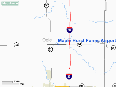
Maple Hurst Farms Airport |
Location
& QuickFacts
|
FAA
Information Effective: |
2007-12-20 |
|
Airport
Identifier: |
LL74 |
|
Airport
Status: |
Operational |
|
Longitude/Latitude: |
089-02-55.3520W/42-00-30.1000N
-89.048709/42.008361 (Estimated) |
|
Elevation: |
823 ft / 250.85 m (Surveyed) |
|
Land: |
0 acres |
|
From nearest
city: |
5 nautical miles N of Rochelle, IL |
|
Location: |
Ogle County, IL |
|
Magnetic
Variation: |
00E (1985) |
Owner & Manager
|
Ownership: |
Privately
owned |
|
Owner: |
Leonard D. Carmichael |
|
Address: |
Rr 1
Rochelle, IL 61068 |
|
Phone
number: |
815-562-8723 |
|
Manager: |
Leonard D. Carmichael |
|
Address: |
Rr 1
Rochelle, IL 61068 |
|
Phone
number: |
815-562-6415 |
Airport Operations
and Facilities
|
Airport Use: |
Private |
|
Wind
indicator: |
Yes |
|
Segmented
Circle: |
No |
|
Control
Tower: |
No |
|
Landing
fee charge: |
No |
|
Sectional
chart: |
Chicago |
|
Region: |
AGL - Great Lakes |
|
Boundary
ARTCC: |
ZAU - Chicago |
|
Tie-in
FSS: |
IKK - Kankakee |
|
FSS on
Airport: |
No |
|
FSS Toll
Free: |
1-800-WX-BRIEF |
Airport Services
|
Airframe
Repair: |
NONE |
|
Power
Plant Repair: |
NONE |
|
Runway Information
Runway 09/27
|
Dimension: |
2500 x 120 ft
/ 762.0 x 36.6 m |
|
Surface: |
TURF, |
|
|
Runway 09 |
Runway 27 |
|
Traffic
Pattern: |
Left |
Left |
|
Radio Navigation
Aids
|
ID |
Type |
Name |
Ch |
Freq |
Var |
Dist |
|
DKB |
NDB |
Dekalb |
|
209.00 |
02W |
15.9 nm |
|
FEP |
NDB |
Freeport |
|
335.00 |
00E |
27.9 nm |
|
JVL |
NDB |
Janesville |
|
375.00 |
03E |
36.5 nm |
|
BOZ |
NDB |
Whiteside |
|
254.00 |
01E |
37.5 nm |
|
VYS |
NDB |
Valley |
|
230.00 |
00W |
39.5 nm |
|
OIX |
NDB |
Ottawa |
|
266.00 |
01E |
39.8 nm |
|
ME |
NDB |
Deana |
|
350.00 |
00E |
45.7 nm |
|
LVV |
NDB |
Lake Lawn |
|
404.00 |
00W |
46.2 nm |
|
RFD |
VOR/DME |
Rockford |
045X |
110.80 |
01E |
14.7 nm |
|
PLL |
VOR/DME |
Polo |
049X |
111.20 |
03E |
21.4 nm |
|
DPA |
VOR/DME |
Dupage |
021X |
108.40 |
02E |
32.0 nm |
|
JVL |
VOR/DME |
Janesville |
090X |
114.30 |
03E |
33.1 nm |
|
JOT |
VORTAC |
Joliet |
070X |
112.30 |
02E |
42.9 nm |
Maple Hurst Farms Airport
Address:
Ogle County, IL
Tel:
815-562-8723,
815-562-6415
Images
and information placed above are from
http://www.airport-data.com/airport/LL74/
We
thank them for the data!
| General
Info |
| Country |
United
States |
| State |
ILLINOIS
|
| FAA ID |
LL74 |
| Latitude |
42-00-30.100N
|
| Longitude |
089-02-55.352W
|
| Elevation |
823 feet
|
| Near City |
ROCHELLE
|
We don't guarantee the information is fresh and accurate. The data may
be wrong or outdated.
For more up-to-date information please refer to other sources.
|
|


