 |
|
|
|
|
|
Location
& QuickFacts
|
FAA
Information Effective: |
2007-12-20 |
|
Airport
Identifier: |
C45 |
|
Airport
Status: |
Operational |
|
Longitude/Latitude: |
089-46-41.0910W/40-29-21.6410N
-89.778081/40.489345 (Estimated) |
|
Elevation: |
501 ft / 152.70 m (Surveyed) |
|
Land: |
80 acres |
|
From nearest
city: |
3 nautical miles N of Manito, IL |
|
Location: |
Tazewell County, IL |
|
Magnetic
Variation: |
04E (1965) |
Owner & Manager
|
Ownership: |
Privately
owned |
|
Owner: |
Mitchell Aerial Application |
|
Address: |
7757 Arpt Rd
Manito, IL 61546 |
|
Phone
number: |
309-545-2281 |
|
Manager: |
Dave Mitchell |
|
Address: |
7757 Arpt Rd
Manito, IL 61546 |
|
Phone
number: |
309-545-2281 |
Airport
Operations and Facilities
|
Airport
Use: |
Open
to public |
|
Wind indicator: |
Yes |
|
Segmented
Circle: |
No |
|
Control
Tower: |
No |
|
Lighting
Schedule: |
PHONE REQ
FOR NSTD LIRL RY 04/22 CALL 309-545-2281 - AFTER DARK OR
EMERGENCY. |
|
Landing
fee charge: |
No |
|
Sectional
chart: |
Chicago |
|
Region: |
AGL - Great Lakes |
|
Traffic
Pattern Alt: |
800 ft |
|
Boundary
ARTCC: |
ZAU - Chicago |
|
Tie-in
FSS: |
IKK - Kankakee |
|
FSS on
Airport: |
No |
|
FSS Toll
Free: |
1-800-WX-BRIEF |
|
NOTAMs
Facility: |
IKK (NOTAM-d service avaliable) |
Airport Communications
|
CTAF: |
122.800 |
|
Unicom: |
122.800
|
Airport Services
|
Bottled
Oxygen: |
NONE |
|
Bulk Oxygen: |
NONE |
|
Runway Information
Runway 04/22
|
Dimension: |
2784 x 40 ft
/ 848.6 x 12.2 m |
|
Surface: |
ASPH, Fair Condition
HAS 895 FT BY 40 FT ASPH STRIP SUPERIMPOSED ON N END. |
|
Edge Lights: |
Non-standard lighting system
NSTD LIRL BTN DSPLCD THLDS; FIXTURE SPACING & LGT INTST VARIES. |
|
|
Runway 04 |
Runway 22 |
|
Longitude: |
089-46-46.3330W |
089-46-30.8150W |
|
Latitude: |
40-29-10.0410N |
40-29-34.8740N |
|
Elevation: |
495.00 ft |
501.00 ft |
|
Alignment: |
25 |
127 |
|
Traffic
Pattern: |
Left |
Left |
|
Markings: |
None, |
None, |
|
Displaced
threshold: |
175.00 ft |
448.00 ft |
|
Runway End
Identifier: |
No |
No |
|
Centerline
Lights: |
No |
No |
|
Touchdown
Lights: |
No |
No |
|
Obstruction: |
58 ft tree, 1134.0 ft from runway, 250 ft right
of centerline, 16:1 slope to clear
APCH RATIO TO DSPLCD THR IS 22:1. |
31 ft pole, 213.0 ft from runway, 150 ft left
of centerline
APCH RATIO TO DSPLCD THR IS 21:1; APCH RATIO TO DSPLCD THR
OVER 47' TREE 30' FM RY END IS 2:1.
NUMEROUS TREES; POLES & BLDG WITH MAX TOPS 75' 182' L
OF CNTRLN 466' FM DSPLCD THR. |
|
Runway 18/36
|
Dimension: |
2188 x 40 ft
/ 666.9 x 12.2 m |
|
Surface: |
ASPH-TURF, Fair Condition
HAS 895 FT BY 40 FT ASPH STRIP SUPERIMPOSED ON N END. |
|
|
Runway 18 |
Runway 36 |
|
Longitude: |
089-46-44.2180W |
089-46-44.3710W |
|
Latitude: |
40-29-31.3600N |
40-29-09.7390N |
|
Elevation: |
496.00 ft |
495.00 ft |
|
Alignment: |
127 |
127 |
|
Traffic
Pattern: |
Left |
Left |
|
Markings: |
None, |
None, |
|
Displaced
threshold: |
700.00 ft |
80.00 ft |
|
Runway End
Identifier: |
No |
No |
|
Centerline
Lights: |
No |
No |
|
Touchdown
Lights: |
No |
No |
|
Obstruction: |
57 ft tree, 631.0 ft from runway, 149 ft right
of centerline, 11:1 slope to clear
RY 18 APCH RATIO IS CALCULATED TO THE DSPLCD THLD NOT THE
RY END AS PER PHOTO SLOPE DATED 10/23/97. |
82 ft tree, 1335.0 ft from runway, 258 ft left
of centerline, 16:1 slope to clear
RY 36 APCH RATIO TO DSPLCD THR IS 17:1. |
|
Radio Navigation
Aids
|
ID |
Type |
Name |
Ch |
Freq |
Var |
Dist |
|
PI |
NDB |
Tungg |
|
356.00 |
01E |
11.0 nm |
|
CTK |
NDB |
Canton |
|
236.00 |
02E |
14.4 nm |
|
AAA |
NDB |
Abraham |
|
329.00 |
00E |
28.3 nm |
|
LQ |
NDB |
Licol |
|
375.00 |
01W |
35.6 nm |
|
JZY |
NDB |
Macomb |
|
251.00 |
01E |
35.8 nm |
|
SP |
NDB |
Huskk |
|
382.00 |
01W |
43.1 nm |
|
EZI |
NDB |
Kewanee |
|
245.00 |
01E |
43.6 nm |
|
BMI |
VOR/DME |
Bloomington |
019X |
108.20 |
03E |
38.7 nm |
|
GBG |
VOR/DME |
Galesburg |
035X |
109.80 |
03E |
40.2 nm |
|
IJX |
VOR/DME |
Jacksonville |
023X |
108.60 |
02E |
47.8 nm |
|
PIA |
VORTAC |
Peoria |
099X |
115.20 |
04E |
11.5 nm |
|
CAP |
VORTAC |
Capital |
074X |
112.70 |
04E |
36.6 nm |
|
SPI |
VORTAC |
Spinner |
74X |
112.70 |
01W |
39.3 nm |
|
BDF |
VORTAC |
Bradford |
094X |
114.70 |
00E |
41.2 nm |
Remarks
- ACFT
TAKING OFF ON RY 36 CANNOT SEE AER 22 WHEN CROPS GROW HIGH.
Based
Aircraft
|
Aircraft
based on field: |
14 |
|
Single Engine
Airplanes: |
13 |
|
Helicopters: |
1 |
Operational Statistics
Time
Period: 2004-01-02 - 2004-12-31
|
Aircraft
Operations: |
116/Week |
|
General Aviation
Local: |
88.3% |
|
General Aviation
Itinerant: |
8.3% |
|
Military: |
3.3% |
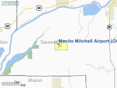
Manito Mitchell Airport
Address:
Tazewell County, IL
Tel:
309-545-2281
Images
and information placed above are from
http://www.airport-data.com/airport/C45/
We
thank them for the data!
| General
Info |
| Country |
United
States |
| State |
ILLINOIS
|
| FAA ID |
C45 |
| Latitude |
40-29-21.641N
|
| Longitude |
089-46-41.091W
|
| Elevation |
501 feet
|
| Near City |
MANITO
|
We don't guarantee the information is fresh and accurate. The data may
be wrong or outdated.
For more up-to-date information please refer to other sources.
|
|


