 |
|
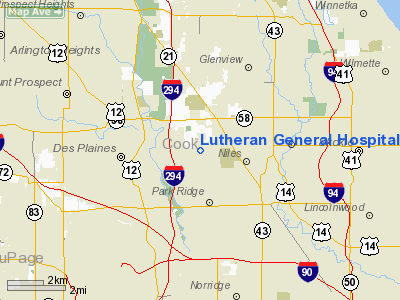
Lutheran General Hospital Heliport |
|
|
Location
& QuickFacts
|
FAA
Information Effective: |
2007-12-20 |
|
Airport
Identifier: |
71IL |
|
Airport
Status: |
Operational |
|
Longitude/Latitude: |
087-50-53.7500W/42-02-18.3400N
-87.848264/42.038428 (Estimated) |
|
Elevation: |
805 ft / 245.36 m (Estimated) |
|
Land: |
0 acres |
|
From nearest
city: |
1 nautical miles N of Park Ridge, IL |
|
Location: |
Cook County, IL |
|
Magnetic
Variation: |
02W (1995) |
Owner & Manager
|
Ownership: |
Privately
owned |
|
Owner: |
Lutheran General Hospital |
|
Address: |
1775 Dempster
Park Ridge, IL 60068-1174 |
|
Phone
number: |
847-696-2210 |
|
Manager: |
Alex Nisavic |
|
Address: |
1775 Dempstser
Park Ridge, IL 60068-1174 |
|
Phone
number: |
847-723-5123 |
Airport
Operations and Facilities
|
Airport
Use: |
Private
MEDICAL USE. |
|
Wind indicator: |
Yes |
|
Segmented
Circle: |
No |
|
Control
Tower: |
No |
|
Lighting
Schedule: |
PHONE REQ
FOR PERIMETER & FLOOD LGTS CALL 847-696-7446. |
|
Beacon
Color: |
Clear-Green-Yellow (heliport) |
|
Sectional
chart: |
Chicago |
|
Region: |
AGL - Great Lakes |
|
Boundary
ARTCC: |
ZAU - Chicago |
|
Tie-in
FSS: |
IKK - Kankakee |
|
FSS on
Airport: |
No |
|
FSS Toll
Free: |
1-800-WX-BRIEF |
|
Runway Information
Helipad H1
|
Dimension: |
44 x 48 ft /
13.4 x 14.6 m |
|
Surface: |
CONC,
ROOFTOP PAD. |
|
|
Runway H1 |
Runway |
|
Traffic
Pattern: |
Left |
Left |
|
Radio Navigation
Aids
|
ID |
Type |
Name |
Ch |
Freq |
Var |
Dist |
|
ME |
NDB |
Deana |
|
350.00 |
00E |
9.0 nm |
|
MX |
NDB |
Kedzi |
|
248.00 |
01W |
19.2 nm |
|
HK |
NDB |
Ermin |
|
332.00 |
01W |
19.2 nm |
|
RA |
NDB |
Paser |
|
206.00 |
00E |
38.8 nm |
|
DKB |
NDB |
Dekalb |
|
209.00 |
02W |
38.9 nm |
|
ORD |
VOR/DME |
Chicago O'hare |
086X |
113.90 |
02E |
4.0 nm |
|
OBK |
VOR/DME |
Northbrook |
077X |
113.00 |
02W |
11.9 nm |
|
DPA |
VOR/DME |
Dupage |
021X |
108.40 |
02E |
24.1 nm |
|
ENW |
VOR/DME |
Kenosha |
029X |
109.20 |
02W |
33.9 nm |
|
HRK |
VOR/DME |
Horlick |
124X |
117.70 |
02W |
43.5 nm |
|
BUU |
VOR/DME |
Burbun |
092X |
114.50 |
01W |
44.0 nm |
|
CGT |
VORTAC |
Chicago Heights |
089X |
114.20 |
02E |
34.1 nm |
|
JOT |
VORTAC |
Joliet |
070X |
112.30 |
02E |
36.3 nm |
|
EON |
VORTAC |
Peotone |
079X |
113.20 |
02E |
46.3 nm |
|
ORD |
VOT |
Chicago O'hare Intl |
|
112.00 |
|
4.3 nm |
|
MDW |
VOT |
Chicago Midway |
|
111.00 |
|
15.8 nm |
Remarks
- APCH/DEP
ROUTE 60 DEG CLKWISE TO 80 DEG & 200 DEG CLKWISE TO 220 DEG FM PAD
CENTER; APPROP MKD; MAINTAIN WIND INDICATOR; COMPLIANCE WITH 14 CFR
PART 91.126(B)(2).
Lutheran
General Hospital Heliport
Address:
Cook County, IL
Tel:
847-696-2210,
847-723-5123
Images
and information placed above are from
http://www.airport-data.com/airport/71IL/
We
thank them for the data!
| General
Info |
| Country |
United
States |
| State |
ILLINOIS
|
| FAA ID |
71IL |
| Latitude |
42-02-18.340N
|
| Longitude |
087-50-53.750W
|
| Elevation |
805 feet
|
| Near City |
PARK RIDGE
|
We don't guarantee the information is fresh and accurate. The data may
be wrong or outdated.
For more up-to-date information please refer to other sources.
|
|


