 |
|
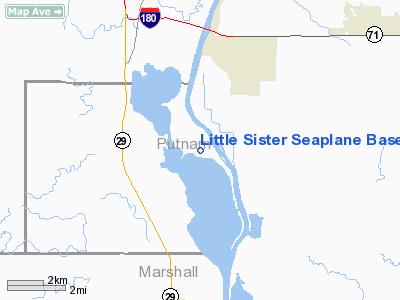
Little Sister Seaplane Base |
Location
& QuickFacts
|
FAA
Information Effective: |
2007-12-20 |
|
Airport
Identifier: |
8IL9 |
|
Airport
Status: |
Operational |
|
Longitude/Latitude: |
089-21-00.3200W/41-12-00.1310N
-89.350089/41.200036 (Estimated) |
|
Elevation: |
450 ft / 137.16 m (Estimated) |
|
Land: |
0 acres |
|
From
nearest city: |
3 nautical miles S of Hennepin, IL |
|
Location: |
Putnam County, IL |
|
Magnetic Variation: |
01E (1985) |
Owner
& Manager
|
Ownership: |
Privately
owned |
|
Owner: |
R. F. Whalen |
|
Address: |
1900 Chartres St
La Salle, IL 61301 |
|
Phone
number: |
815-223-8980 |
|
Manager: |
R. F. Whalen |
|
Address: |
1900 Chartres St
La Salle, IL 61301 |
|
Phone number: |
815-223-8980 |
Airport Operations and Facilities
|
Airport Use: |
Private |
|
Wind indicator: |
No |
|
Segmented Circle: |
No |
|
Control Tower: |
No |
|
Landing fee charge: |
No |
|
Sectional chart: |
Chicago |
|
Region: |
AGL - Great Lakes |
|
Boundary ARTCC: |
ZAU - Chicago |
|
Tie-in FSS: |
IKK - Kankakee |
|
FSS on Airport: |
No |
|
FSS Toll Free: |
1-800-WX-BRIEF |
Airport Services
|
Airframe
Repair: |
NONE |
|
Power
Plant Repair: |
NONE |
|
Runway
Information
Runway N/S
|
Dimension: |
5280 x 0 ft / 1609.3 x 0.0 m
LCTD IN ILLINOIS RIVER-WIDTH VARIES FROM 150 TO 350FT. |
|
Surface: |
WATER, |
|
|
Runway N |
Runway S |
|
Traffic
Pattern: |
Left |
Left |
|
Radio Navigation
Aids
|
ID |
Type |
Name |
Ch |
Freq |
Var |
Dist |
|
VYS |
NDB |
Valley |
|
230.00 |
00W |
13.0 nm |
|
OIX |
NDB |
Ottawa |
|
266.00 |
01E |
24.4 nm |
|
EZI |
NDB |
Kewanee |
|
245.00 |
01E |
27.6 nm |
|
BOZ |
NDB |
Whiteside |
|
254.00 |
01E |
36.4 nm |
|
PI |
NDB |
Tungg |
|
356.00 |
01E |
37.4 nm |
|
PNT |
VOR/DME |
Pontiac |
033X |
109.60 |
03E |
36.1 nm |
|
PLL |
VOR/DME |
Polo |
049X |
111.20 |
03E |
46.7 nm |
|
BMI |
VOR/DME |
Bloomington |
019X |
108.20 |
03E |
47.2 nm |
|
BDF |
VORTAC |
Bradford |
094X |
114.70 |
00E |
11.0 nm |
|
PIA |
VORTAC |
Peoria |
099X |
115.20 |
04E |
37.2 nm |
Remarks
- TREES
ALONG SHORELINE; BARGE TRAFFIC; GRAIN DOCKS IN AREA.
Little Sister Seaplane Base
Address:
Putnam County, IL
Tel:
815-223-8980
Images
and information placed above are from
http://www.airport-data.com/airport/8IL9/
We
thank them for the data!
| General
Info |
| Country |
United
States |
| State |
ILLINOIS
|
| FAA ID |
8IL9 |
| Latitude |
41-12-00.131N
|
| Longitude |
089-21-00.320W
|
| Elevation |
450 feet
|
| Near City |
HENNEPIN
|
We don't guarantee the information is fresh and accurate. The data may
be wrong or outdated.
For more up-to-date information please refer to other sources.
|
|


