 |
|
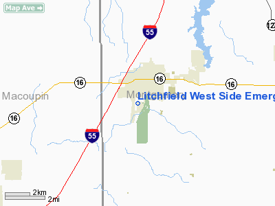
Litchfield West Side Emergency Services Heliport |
Location
& QuickFacts
|
FAA
Information Effective: |
2007-12-20 |
|
Airport
Identifier: |
4IL0 |
|
Airport
Status: |
Operational |
|
Longitude/Latitude: |
089-39-57.0000W/39-09-38.0000N
-89.665833/39.160556 (Estimated) |
|
Elevation: |
677 ft / 206.35 m () |
|
Land: |
0 acres |
|
From
nearest city: |
0 nautical miles of Litchfield, IL |
|
Location: |
Montgomery County, IL |
|
Magnetic Variation: |
00W (2000) |
Owner
& Manager
|
Ownership: |
Privately
owned |
|
Owner: |
City Of Litchfield |
|
Address: |
120 E Ryder St
Litchfield, IL 62056 |
|
Phone
number: |
217-324-5253 |
|
Manager: |
Bill Bergen - Fire Chief |
|
Address: |
City Of Litchfield Firehouse, 201 E. Edwards
Litchfield, IL 62056 |
|
Phone number: |
217-324-4042 |
Airport Operations and Facilities
|
Airport
Use: |
Private |
|
Wind
indicator: |
Yes |
|
Segmented Circle: |
No |
|
Control
Tower: |
No |
|
Sectional chart: |
Kansas City |
|
Region: |
AGL - Great Lakes |
|
Boundary
ARTCC: |
ZKC - Kansas City |
|
Tie-in
FSS: |
STL - Saint Louis |
|
FSS
Toll Free: |
1-800-WX-BRIEF |
|
Runway Information
Helipad H1
|
Dimension: |
30
x 30 ft / 9.1 x 9.1 m |
|
Surface: |
CONC, |
|
|
Runway H1 |
Runway |
|
Traffic
Pattern: |
Left |
Left |
|
Radio Navigation
Aids
|
ID |
Type |
Name |
Ch |
Freq |
Var |
Dist |
|
LTD |
NDB |
Litchfield |
|
371.00 |
01E |
0.5 nm |
|
CVM |
NDB |
Civic Memorial |
|
263.00 |
02E |
24.3 nm |
|
TAZ |
NDB |
Taylorville |
|
395.00 |
00E |
27.6 nm |
|
SP |
NDB |
Huskk |
|
382.00 |
01W |
37.1 nm |
|
SYZ |
NDB |
Shelbyville |
|
365.00 |
01E |
41.0 nm |
|
BL |
NDB |
Belleville |
|
362.00 |
02E |
42.0 nm |
|
LM |
NDB |
Oblio |
|
338.00 |
00E |
43.6 nm |
|
SLO |
NDB |
Salem |
|
400.00 |
01W |
45.1 nm |
|
LQ |
NDB |
Licol |
|
375.00 |
01W |
45.3 nm |
|
SKE |
TACAN |
Scott |
059X |
|
02E |
38.0 nm |
|
CSX |
VOR/DME |
Cardinal |
111Y |
116.45 |
00E |
40.7 nm |
|
IJX |
VOR/DME |
Jacksonville |
023X |
108.60 |
02E |
45.6 nm |
|
VLA |
VORTAC |
Vandalia |
090X |
114.30 |
04E |
23.8 nm |
|
TOY |
VORTAC |
Troy |
107X |
116.00 |
04E |
28.0 nm |
|
SPI |
VORTAC |
Spinner |
74X |
112.70 |
01W |
40.8 nm |
|
STL |
VORTAC |
St Louis |
121X |
117.40 |
01E |
42.2 nm |
|
CAP |
VORTAC |
Capital |
074X |
112.70 |
04E |
44.0 nm |
|
STL |
VOT |
St Louis Lambert |
|
111.00 |
|
40.9 nm |
Remarks
- PRVDD
APCH/DEP FM 245-255 & FM 345-355, AREA IS MKD, WIND INDICATOR MAINTAINED,&
COMPLY WITH FAR PART 91.126(B)(2).
Litchfield West Side Emergency Services
Heliport
Address:
Montgomery County, IL
Tel:
217-324-5253,
217-324-4042
Images
and information placed above are from
http://www.airport-data.com/airport/4IL0/
We
thank them for the data!
| General
Info |
| Country |
United
States |
| State |
ILLINOIS
|
| FAA ID |
4IL0 |
| Latitude |
39-09-38.000N
|
| Longitude |
089-39-57.000W
|
| Elevation |
677 feet
|
| Near City |
LITCHFIELD
|
We don't guarantee the information is fresh and accurate. The data may
be wrong or outdated.
For more up-to-date information please refer to other sources.
|
|


