 |
|
Lawrenceville - Vincennes International Airport |
| Lawrenceville-Vincennes International Airport |
 |
| 1998 USGS image |
| IATA: LWV – ICAO: KLWV – FAA LID: LWV |
| Summary |
| Airport type |
Public |
| Owner |
Bi-State Authority |
| Serves |
Lawrenceville, Illinois / Vincennes, Indiana |
| Location |
Allison Township, Lawrence County, near Lawrenceville, Illinois |
| Elevation AMSL |
430 ft / 131 m |
| Coordinates |
38°45′51″N 087°36′20″W / 38.76417°N 87.60556°W / 38.76417; -87.60556 |
| Runways |
| Direction |
Length |
Surface |
| ft |
m |
| 9/27 |
5,198 |
1,584 |
Asphalt |
| 18/36 |
5,199 |
1,585 |
Asphalt |
| 4U/22U |
1,000 |
305 |
Turf |
| Statistics (2007) |
| Aircraft operations |
35,000 |
| Based aircraft |
85 |
| Source: Federal Aviation Administration |
- For the Cold War United States Air Force Base, see George Air Force Base
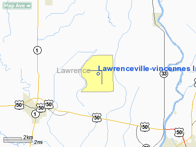
Lawrenceville-Vincennes International Airport (IATA: LWV, ICAO: KLWV, FAA LID: LWV) is a public-use airport located three nautical miles (6 km) northeast of the central business district of Lawrenceville, a city in Lawrence County, Illinois, United States. It is owned by the Bi-State Authority. Facilities and aircraft
Lawrenceville-Vincennes International Airport covers an area of 3,067 acres (1,241 ha) at an elevation of 430 feet (131 m) above mean sea level. It has two asphalt paved runways: 9/27 is 5,198 by 150 feet (1,584 x 46 m) and 18/36 is 5,199 by 150 feet (1,585 x 46 m). It also has one turf runway designated 4U/22U which measures 1,000 by 200 feet (305 x 61 m).
For the 12-month period ending July 31, 2007, the airport had 35,000 aircraft operations, an average of 95 per day: 88% general aviation, 11% air taxi and 1% military. At that time there were 85 aircraft based at this airport: 54% single-engine, 8% multi-engine, 1% helicopter, 26% glider and 11% ultralight.
History
Established in 1942 by the United States Army Air Forces. Known as George Army Airfield. Assigned to the Eastern Flying Training Command on 10 August. Conducted Advanced two-engine flying training until transferred to I Troop Carrier Command on 15 August 1944. Placed in standby status 1 September 1944 with the drawdown of AAFTC's pilot training program. Declared surplus and turned over to the Army Corps of Engineers on 30 September 1945. Eventually discharged to the War Assets Administration (WAA) and became civil airport.
The above content comes from Wikipedia and is published under free licenses – click here to read more.
Location
& QuickFacts
|
FAA
Information Effective: |
2007-12-20 |
|
Airport
Identifier: |
LWV |
|
Airport
Status: |
Operational |
|
Longitude/Latitude: |
087-36-19.7840W/38-45-51.4670N
-87.605496/38.764296 (Estimated) |
|
Elevation: |
430 ft / 131.06 m (Surveyed) |
|
Land: |
3067 acres |
|
From
nearest city: |
3 nautical miles NE of Lawrenceville, IL |
|
Location: |
Lawrence County, IL |
|
Magnetic Variation: |
01W (1990) |
Owner
& Manager
|
Ownership: |
Publicly
owned |
|
Owner: |
Bi-state Authority
CITIES OF VINCENNES, IN & LAWRENCEVILLE, IL JOINTLY
OWN ARPT. |
|
Address: |
Rr 4 Box 195
Lawrenceville, IL 62439 |
|
Phone number: |
618-943-5733 |
|
Manager: |
Kurtis Schwartz |
|
Address: |
Rr 4 Box 195
Lawrenceville, IL 62439 |
|
Phone number: |
618-943-5733
IF
NO ANSWER CALL
812-726-4889. |
Airport
Operations and Facilities
|
Airport
Use: |
Open
to public |
|
Wind
indicator: |
Yes |
|
Segmented Circle: |
Yes |
|
Control
Tower: |
No |
|
Lighting
Schedule: |
DUSK-DAWN
MIRL RY 18/36 PRESET ON LOW INTST; TO INCR INTST & ACTVT
MIRL RY 09/27 & REIL RYS 9, 27, 18 & 36 & ODALS
RY 27 - CTAF. |
|
Beacon
Color: |
Clear-Green (lighted land airport) |
|
Landing
fee charge: |
No |
|
Sectional chart: |
St Louis |
|
Region: |
AGL - Great Lakes |
|
Boundary
ARTCC: |
ZID - Indianapolis |
|
Tie-in
FSS: |
STL - Saint Louis |
|
FSS
on Airport: |
No |
|
FSS
Toll Free: |
1-800-WX-BRIEF |
|
NOTAMs
Facility: |
LWV (NOTAM-d service avaliable) |
|
Federal Agreements: |
NGPY |
Airport Communications
|
CTAF: |
122.800 |
|
Unicom: |
122.800
|
Airport
Services
|
Fuel
available: |
100LLA |
|
Airframe
Repair: |
MAJOR |
|
Power
Plant Repair: |
MAJOR |
|
Bottled
Oxygen: |
NONE |
|
Bulk
Oxygen: |
NONE |
|
Runway Information
Runway 04U/22U
|
Dimension: |
1000
x 200 ft / 304.8 x 61.0 m |
|
Surface: |
TURF, Fair Condition |
|
|
Runway 04U |
Runway 22U |
|
Traffic
Pattern: |
Left |
Right |
|
Obstruction: |
15 ft road, 600.0 ft from runway, 40:1 slope
to clear |
24 ft pole, 650.0 ft from runway, 50 ft left
of centerline, 27:1 slope to clear |
|
Runway 09/27
|
Dimension: |
5198
x 150 ft / 1584.4 x 45.7 m |
|
Surface: |
ASPH, Good Condition |
|
Weight
Limit: |
Single wheel: 40000 lbs.
Dual wheel: 50000 lbs.
Dual tandem wheel: 70000 lbs. |
|
Edge
Lights: |
Medium |
|
|
Runway 09 |
Runway 27 |
|
Longitude: |
087-37-08.7150W |
087-36-03.0940W |
|
Latitude: |
38-46-03.5300N |
38-46-04.0450N |
|
Elevation: |
426.00 ft |
430.00 ft |
|
Alignment: |
89 |
127 |
|
Traffic
Pattern: |
Left |
Left |
|
Markings: |
Non-precision instrument, Good Condition |
Non-precision instrument, Good Condition |
|
VASI: |
pulsating/steady burning on left side |
4-light PAPI on left side |
|
Approach
lights: |
|
ODALS |
|
Runway
End Identifier: |
Yes |
Yes |
|
Centerline
Lights: |
No |
No |
|
Touchdown
Lights: |
No |
No |
|
Obstruction: |
, 50:1 slope to clear |
74 ft tree, 3185.0 ft from runway, 549 ft right
of centerline, 40:1 slope to clear |
|
Runway 18/36
|
Dimension: |
5199
x 150 ft / 1584.7 x 45.7 m |
|
Surface: |
ASPH, Good Condition |
|
Weight
Limit: |
Single wheel: 19000 lbs.
Dual wheel: 28000 lbs. |
|
Edge
Lights: |
Medium |
|
|
Runway 18 |
Runway 36 |
|
Longitude: |
087-36-04.0360W |
087-36-03.4420W |
|
Latitude: |
38-46-04.7700N |
38-45-13.3840N |
|
Elevation: |
430.00 ft |
425.00 ft |
|
Alignment: |
127 |
127 |
|
Traffic
Pattern: |
Left |
Left |
|
Markings: |
Non-precision instrument, Good Condition |
Non-precision instrument, Good Condition |
|
VASI: |
pulsating/steady burning on left side |
4-light PAPI on left side |
|
Runway
End Identifier: |
Yes |
Yes |
|
Centerline
Lights: |
No |
No |
|
Touchdown
Lights: |
No |
No |
|
Obstruction: |
, 50:1 slope to clear |
62 ft tree, 3023.0 ft from runway, 640 ft left
of centerline, 45:1 slope to clear |
|
Radio Navigation
Aids
|
ID |
Type |
Name |
Ch |
Freq |
Var |
Dist |
|
OEA |
NDB |
Vincennes |
|
251.00 |
00E |
5.0
nm |
|
AJG |
NDB |
Mount
Carmel |
|
524.00 |
02W |
10.8
nm |
|
PLX |
NDB |
Palestine |
|
391.00 |
00W |
15.1
nm |
|
SIV |
NDB |
Sullivan |
|
326.00 |
02W |
22.3
nm |
|
DCY |
NDB |
Washington |
|
212.00 |
03W |
22.6
nm |
|
OLY |
NDB |
Olney |
|
272.00 |
00W |
26.7
nm |
|
CZB |
NDB |
Casey |
|
359.00 |
00E |
37.4
nm |
|
HU |
NDB |
Yinno |
|
245.00 |
02W |
38.7
nm |
|
FOA |
NDB |
Elm
River |
|
353.00 |
00E |
40.2
nm |
|
PDW |
NDB |
Evansville |
|
284.00 |
00E |
43.7
nm |
|
FWC |
NDB |
Wayne
County |
|
257.00 |
01E |
44.3
nm |
|
CUL |
NDB |
Carmi |
|
332.00 |
01W |
47.0
nm |
|
FNZ |
NDB |
Ferdinand |
|
239.00 |
00E |
47.6
nm |
|
MT |
NDB |
Zebre |
|
347.00 |
00E |
48.6
nm |
|
LWV |
VOR/DME |
Lawrenceville |
025X |
108.80 |
01W |
0.3
nm |
|
RSV |
VOR/DME |
Robinson |
021X |
108.40 |
02E |
15.4
nm |
|
SAM |
VOR/DME |
Samsville |
113X |
116.60 |
03E |
28.1
nm |
|
HNB |
VOR/DME |
Huntingburg |
029X |
109.20 |
00E |
43.4
nm |
|
BIB |
VORTAC |
Bible
Grove |
027X |
109.00 |
03E |
42.1
nm |
|
TTH |
VORTAC |
Terre
Haute |
100X |
115.30 |
02E |
46.6
nm |
Remarks
- GLIDER
ACTVTY SR-SS. RYS 09/27 & 18/36 HAVE LEFT HAND TFC PATTERN FOR GLIDER
ACFT.
- TPA
FOR POWERED ACFT USING RY 09/27 & 18/36 IS 900 FT AGL.
- TPA
FOR ULTRALIGHT TFC USING 04U/22U IS 500 FT MAX.
- BE
ALERT; ODALS FOR RY 27 ARE IN OPERATION SIMULTANEOUSLY WITH REILS ON
RY 18.
- EXISTED
PRIOR TO 1959.
Based
Aircraft
|
Aircraft
based on field: |
76 |
|
Single
Engine Airplanes: |
40 |
|
Multi
Engine Airplanes: |
5 |
|
Gliders: |
22 |
|
Ultralights: |
9 |
Operational Statistics
Time Period: 2006-08-01 - 2007-07-31
|
Aircraft
Operations: |
96/Day |
|
Air
Taxi: |
11.4% |
|
General
Aviation Local: |
51.4% |
|
General
Aviation Itinerant: |
36.3% |
|
Military: |
0.9% |
Lawrenceville-vincennes International
Airport
Address:
Lawrence County, IL
Tel:
618-943-5733
Images
and information placed above are from
http://www.airport-data.com/airport/LWV/
We
thank them for the data!
| General
Info |
| Country |
United
States |
| State |
ILLINOIS
|
| FAA ID |
LWV |
| Latitude |
38-45-51.467N
|
| Longitude |
087-36-19.784W
|
| Elevation |
430 feet
|
| Near City |
LAWRENCEVILLE
|
We don't guarantee the information is fresh and accurate. The data may
be wrong or outdated.
For more up-to-date information please refer to other sources.
|
|


