 |
|
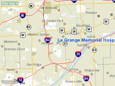
La Grange Memorial Hospital Heliport |
|
|
Location
& QuickFacts
|
FAA Information Effective: |
2007-12-20 |
|
Airport
Identifier: |
18IL |
|
Airport
Status: |
Operational |
|
Longitude/Latitude: |
087-53-12.2120W/41-47-48.1120N
-87.886726/41.796698 (Estimated) |
|
Elevation: |
700 ft / 213.36 m (Estimated) |
|
Land: |
0 acres |
|
From
nearest city: |
1 nautical miles SW of La Grange, IL |
|
Location: |
Cook County, IL |
|
Magnetic Variation: |
01W (1985) |
Owner
& Manager
|
Ownership: |
Privately owned |
|
Owner: |
La Grange Meml Hospital
OWNER IS; ADVENTIST HEALTHCARE SYSTEMS DBA LA GRANGE MEMORIAL
HOSPITAL. |
|
Address: |
5101 Willow Springs Road
La Grange, IL 60525 |
|
Phone
number: |
708-352-1200 |
|
Manager: |
Mike Cole |
|
Address: |
5101 Willow Springs Rd
La Grange, IL 60525 |
|
Phone number: |
708-352-1200 |
Airport
Operations and Facilities
|
Airport Use: |
Private
MEDICAL USE. |
|
Wind
indicator: |
Yes |
|
Segmented
Circle: |
No |
|
Control
Tower: |
No |
|
Lighting
Schedule: |
24 HRS
FOR PERIMETER & FLOOD LGTS PHONE
708-352-1200. |
|
Beacon Color: |
Clear-Green-Yellow (heliport) |
|
Landing fee charge: |
No |
|
Sectional chart: |
Chicago |
|
Region: |
AGL - Great Lakes |
|
Boundary ARTCC: |
ZAU - Chicago |
|
Tie-in FSS: |
IKK - Kankakee |
|
FSS on Airport: |
No |
|
FSS Toll Free: |
1-800-WX-BRIEF |
Airport
Services
|
Airframe Repair: |
NONE |
|
Power Plant Repair: |
NONE |
|
Runway Information
Helipad H1
|
Dimension: |
44 x 44 ft / 13.4 x 13.4 m |
|
Surface: |
CONC,
ROOFTOP. |
|
|
Runway H1 |
Runway |
|
Traffic
Pattern: |
Left |
Left |
|
Radio Navigation
Aids
|
ID |
Type |
Name |
Ch |
Freq |
Var |
Dist |
|
HK |
NDB |
Ermin |
|
332.00 |
01W |
5.2 nm |
|
MX |
NDB |
Kedzi |
|
248.00 |
01W |
9.4 nm |
|
ME |
NDB |
Deana |
|
350.00 |
00E |
12.0 nm |
|
DKB |
NDB |
Dekalb |
|
209.00 |
02W |
37.6 nm |
|
MGC |
NDB |
Michigan City |
|
203.00 |
01W |
48.3 nm |
|
VP |
NDB |
Sedly |
|
212.00 |
02W |
49.9 nm |
|
ORD |
VOR/DME |
Chicago O'hare |
086X |
113.90 |
02E |
11.5 nm |
|
DPA |
VOR/DME |
Dupage |
021X |
108.40 |
02E |
21.5 nm |
|
OBK |
VOR/DME |
Northbrook |
077X |
113.00 |
02W |
25.7 nm |
|
IKK |
VOR/DME |
Kankakee |
053X |
111.60 |
00E |
43.4 nm |
|
ENW |
VOR/DME |
Kenosha |
029X |
109.20 |
02W |
48.3 nm |
|
CGT |
VORTAC |
Chicago Heights |
089X |
114.20 |
02E |
22.3 nm |
|
JOT |
VORTAC |
Joliet |
070X |
112.30 |
02E |
24.5 nm |
|
EON |
VORTAC |
Peotone |
079X |
113.20 |
02E |
32.0 nm |
|
MDW |
VOT |
Chicago Midway |
|
111.00 |
|
6.1 nm |
|
ORD |
VOT |
Chicago O'hare Intl |
|
112.00 |
|
11.2 nm |
Remarks
- PROVIDED
APCH/DEP 010-030 DEGSS & 180-200 DEGS; NON-OBSTN WIND INDICATOR
MAINTAINED; TREES AT N PERIMETER OF BLDG (HELIPORT CONSTRUCTION SITE)
REMOVED; FLAG POLE TO S LGTD.
La Grange Memorial Hospital Heliport
Address:
Cook County, IL
Tel:
708-352-1200
Images
and information placed above are from
http://www.airport-data.com/airport/18IL/
We
thank them for the data!
| General
Info |
| Country |
United
States |
| State |
ILLINOIS
|
| FAA ID |
18IL |
| Latitude |
41-47-48.112N
|
| Longitude |
087-53-12.212W
|
| Elevation |
700 feet
|
| Near City |
LA GRANGE
|
We don't guarantee the information is fresh and accurate. The data may
be wrong or outdated.
For more up-to-date information please refer to other sources.
|
|


