 |
|
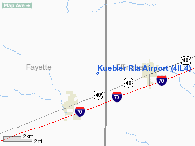
Location
& QuickFacts
|
FAA
Information Effective: |
2007-12-20 |
|
Airport
Identifier: |
4IL4 |
|
Airport
Status: |
Operational |
|
Longitude/Latitude: |
088-48-58.0000W/39-03-23.0000N
-88.816111/39.056389 (Estimated) |
|
Elevation: |
620 ft / 188.98 m (Estimated) |
|
Land: |
0 acres |
|
From
nearest city: |
3 nautical miles NE of St Elmo, IL |
|
Location: |
Fayette County, IL |
|
Magnetic Variation: |
00W (1995) |
Owner & Manager
|
Ownership: |
Privately owned |
|
Owner: |
John Kuebler |
|
Address: |
Rr 3 Box 115
Altamont, IL 62411 |
|
Phone number: |
618-483-5985 |
|
Manager: |
John Kuebler |
|
Address: |
Rr 3 Box 115
Altamont, IL 62411 |
|
Phone number: |
618-483-5985 |
Airport
Operations and Facilities
|
Airport
Use: |
Private |
|
Segmented Circle: |
No |
|
Control
Tower: |
No |
|
Sectional chart: |
Chicago |
|
Region: |
AGL - Great Lakes |
|
Boundary
ARTCC: |
ZKC - Kansas City |
|
Tie-in
FSS: |
COU - Columbia |
|
FSS
Toll Free: |
1-800-WX-BRIEF |
|
Runway Information
Runway 09/27
|
Dimension: |
2800
x 100 ft / 853.4 x 30.5 m |
|
Surface: |
TURF, |
|
|
Runway 09 |
Runway 27 |
|
Traffic
Pattern: |
Left |
Left |
|
Displaced
threshold: |
0.00 ft |
1000.00 ft |
|
Obstruction: |
28 ft pole, 1000.0 ft from runway |
65 ft silo, 50.0 ft from runway, 16:1 slope
to clear
APCH SLOPE 16:1 TO DSPLCD THLD OVR 65 FT SILO. |
|
Radio Navigation
Aids
|
ID |
Type |
Name |
Ch |
Freq |
Var |
Dist |
|
SYZ |
NDB |
Shelbyville |
|
365.00 |
01E |
21.1
nm |
|
SLO |
NDB |
Salem |
|
400.00 |
01W |
25.8
nm |
|
FOA |
NDB |
Elm
River |
|
353.00 |
00E |
28.8
nm |
|
OLY |
NDB |
Olney |
|
272.00 |
00W |
36.3
nm |
|
TAZ |
NDB |
Taylorville |
|
395.00 |
00E |
37.3
nm |
|
MT |
NDB |
Zebre |
|
347.00 |
00E |
37.9
nm |
|
LTD |
NDB |
Litchfield |
|
371.00 |
01E |
40.6
nm |
|
CZB |
NDB |
Casey |
|
359.00 |
00E |
40.8
nm |
|
FWC |
NDB |
Wayne
County |
|
257.00 |
01E |
44.9
nm |
|
MTO |
VOR/DME |
Mattoon |
031X |
109.40 |
03E |
35.4
nm |
|
VNN |
VOR/DME |
Mount
Vernon |
085X |
113.80 |
02E |
41.7
nm |
|
SAM |
VOR/DME |
Samsville |
113X |
116.60 |
03E |
48.5
nm |
|
VLA |
VORTAC |
Vandalia |
090X |
114.30 |
04E |
16.3
nm |
|
BIB |
VORTAC |
Bible
Grove |
027X |
109.00 |
03E |
17.6
nm |
|
DEC |
VORTAC |
Decatur |
119X |
117.20 |
03E |
41.0
nm |
|
ENL |
VORTAC |
Centralia |
097X |
115.00 |
04E |
41.5
nm |
Based
Aircraft
|
Aircraft
based on field: |
1 |
|
Single
Engine Airplanes: |
1 |
Kuebler Rla Airport
Address:
Fayette County, IL
Tel:
618-483-5985
Images
and information placed above are from
http://www.airport-data.com/airport/4IL4/
We
thank them for the data!
| General
Info |
| Country |
United
States |
| State |
ILLINOIS
|
| FAA ID |
4IL4 |
| Latitude |
39-03-23.000N
|
| Longitude |
088-48-58.000W
|
| Elevation |
620 feet
|
| Near City |
ST ELMO
|
We don't guarantee the information is fresh and accurate. The data may
be wrong or outdated.
For more up-to-date information please refer to other sources.
|
|


