 |
|
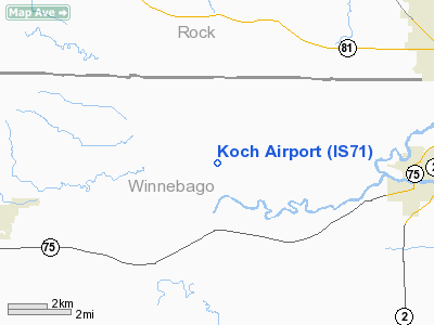
Location
& QuickFacts
|
FAA
Information Effective: |
2007-12-20 |
|
Airport
Identifier: |
IS71 |
|
Airport
Status: |
Operational |
|
Longitude/Latitude: |
089-11-42.0000W/42-27-30.0000N
-89.195000/42.458333 (Estimated) |
|
Elevation: |
800 ft / 243.84 m (Estimated) |
|
Land: |
0 acres |
|
From
nearest city: |
1 nautical miles N of Shirland, IL |
|
Location: |
Winnebago County, IL |
|
Magnetic Variation: |
01W (1995) |
Owner & Manager
|
Ownership: |
Privately owned |
|
Owner: |
Tom & Karen Koch |
|
Address: |
14096 Boswell Rd
Durand, IL 61024 |
|
Phone number: |
815-629-2582 |
|
Manager: |
Tom Koch |
|
Address: |
14096 Boswell Rd
Durand, IL 61024 |
|
Phone number: |
815-962-5594 |
Airport
Operations and Facilities
|
Airport
Use: |
Private |
|
Segmented Circle: |
No |
|
Control
Tower: |
No |
|
Sectional chart: |
Chicago |
|
Region: |
AGL - Great Lakes |
|
Boundary
ARTCC: |
ZAU - Chicago |
|
Tie-in
FSS: |
IKK - Kankakee |
|
FSS
Toll Free: |
1-800-WX-BRIEF |
|
Runway Information
Runway 08/26
|
Dimension: |
2450
x 70 ft / 746.8 x 21.3 m |
|
Surface: |
TURF, |
|
|
Runway 08 |
Runway 26 |
|
Traffic
Pattern: |
Left |
Left |
|
Obstruction: |
|
30 ft pline |
|
Radio Navigation
Aids
|
ID |
Type |
Name |
Ch |
Freq |
Var |
Dist |
|
JVL |
NDB |
Janesville |
|
375.00 |
03E |
11.6
nm |
|
FEP |
NDB |
Freeport |
|
335.00 |
00E |
21.6
nm |
|
LVV |
NDB |
Lake
Lawn |
|
404.00 |
00W |
30.3
nm |
|
MS |
NDB |
Monah |
|
400.00 |
00E |
36.9
nm |
|
DKB |
NDB |
Dekalb |
|
209.00 |
02W |
38.3
nm |
|
RYV |
NDB |
Rock
River |
|
371.00 |
01W |
47.7
nm |
|
JVL |
VOR/DME |
Janesville |
090X |
114.30 |
03E |
7.2
nm |
|
RFD |
VOR/DME |
Rockford |
045X |
110.80 |
01E |
14.0
nm |
|
PLL |
VOR/DME |
Polo |
049X |
111.20 |
03E |
33.0
nm |
|
BUU |
VOR/DME |
Burbun |
092X |
114.50 |
01W |
41.9
nm |
|
MSN |
VORTAC |
Madison |
023X |
108.60 |
03E |
41.8
nm |
Koch Airport
Address:
Winnebago County, IL
Tel:
815-629-2582,
815-962-5594
Images
and information placed above are from
http://www.airport-data.com/airport/IS71/
We
thank them for the data!
| General
Info |
| Country |
United
States |
| State |
ILLINOIS
|
| FAA ID |
IS71 |
| Latitude |
42-27-30.000N
|
| Longitude |
089-11-42.000W
|
| Elevation |
800 feet
|
| Near City |
SHIRLAND
|
We don't guarantee the information is fresh and accurate. The data may
be wrong or outdated.
For more up-to-date information please refer to other sources.
|
|


