 |
|
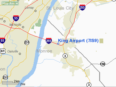
Location
& QuickFacts
|
FAA
Information Effective: |
2007-12-20 |
|
Airport
Identifier: |
7IS9 |
|
Airport
Status: |
Operational |
|
Longitude/Latitude: |
090-14-10.4090W/38-28-35.1900N
-90.236225/38.476442 (Estimated) |
|
Elevation: |
407 ft / 124.05 m (Estimated) |
|
Land: |
0 acres |
|
From
nearest city: |
3 nautical miles NW of Columbia, IL |
|
Location: |
Monroe County, IL |
|
Magnetic Variation: |
02E (1985) |
Owner & Manager
|
Ownership: |
Privately owned |
|
Owner: |
William H Quint |
|
Address: |
9545 Montbrook Dr
Affton, MO 63123 |
|
Phone number: |
314-631-4794 |
|
Address: |
|
Airport Operations and Facilities
|
Airport Use: |
Private |
|
Wind indicator: |
Yes |
|
Segmented Circle: |
No |
|
Control Tower: |
No |
|
Landing fee charge: |
No |
|
Sectional chart: |
St Louis |
|
Region: |
AGL - Great Lakes |
|
Boundary ARTCC: |
ZKC - Kansas City |
|
Tie-in FSS: |
STL - Saint Louis |
|
FSS on Airport: |
No |
|
FSS Toll Free: |
1-800-WX-BRIEF |
Airport Services
|
Airframe
Repair: |
MINOR |
|
Power
Plant Repair: |
MINOR |
|
Runway Information
Runway 15/33
|
Dimension: |
2000
x 100 ft / 609.6 x 30.5 m |
|
Surface: |
TURF, |
|
|
Runway 15 |
Runway 33 |
|
Traffic
Pattern: |
Left |
Left |
|
Radio Navigation
Aids
|
ID |
Type |
Name |
Ch |
Freq |
Var |
Dist |
|
FES |
NDB |
Festus |
|
269.00 |
01E |
18.3
nm |
|
LM |
NDB |
Oblio |
|
338.00 |
00E |
22.5
nm |
|
BL |
NDB |
Belleville |
|
362.00 |
02E |
22.6
nm |
|
CVM |
NDB |
Civic
Memorial |
|
263.00 |
02E |
26.4
nm |
|
SAR |
NDB |
Sparta |
|
239.00 |
01E |
32.1
nm |
|
PRI |
NDB |
Perrine |
|
367.00 |
02E |
43.7
nm |
|
UUV |
NDB |
Sullivan |
|
356.00 |
02E |
46.1
nm |
|
LTD |
NDB |
Litchfield |
|
371.00 |
01E |
49.0
nm |
|
SKE |
TACAN |
Scott |
059X |
|
02E |
18.6
nm |
|
CSX |
VOR/DME |
Cardinal |
111Y |
116.45 |
00E |
17.6
nm |
|
TOY |
VORTAC |
Troy |
107X |
116.00 |
04E |
21.7
nm |
|
STL |
VORTAC |
St
Louis |
121X |
117.40 |
01E |
25.8
nm |
|
FTZ |
VORTAC |
Foristell |
045X |
110.80 |
05E |
36.9
nm |
|
FAM |
VORTAC |
Farmington |
104X |
115.70 |
01E |
48.3
nm |
|
STL |
VOT |
St
Louis Lambert |
|
111.00 |
|
17.4
nm |
|
SUS |
VOT |
Spirit
Of St Louis |
|
112.20 |
|
22.5
nm |
Remarks
- ARPT
OWNER DESIRES ARPT NOT BE CHARTED.
- AIRPORT
CLOSED UNTIL FURTHER NOTICE.
Based
Aircraft
|
Aircraft
based on field: |
3 |
|
Single
Engine Airplanes: |
3 |
King Airport
Address:
Monroe County, IL
Tel:
314-631-4794
Images
and information placed above are from
http://www.airport-data.com/airport/7IS9/
We
thank them for the data!
| General
Info |
| Country |
United
States |
| State |
ILLINOIS
|
| FAA ID |
7IS9 |
| Latitude |
38-28-35.190N
|
| Longitude |
090-14-10.409W
|
| Elevation |
407 feet
|
| Near City |
COLUMBIA
|
We don't guarantee the information is fresh and accurate. The data may
be wrong or outdated.
For more up-to-date information please refer to other sources.
|
|


