 |
|
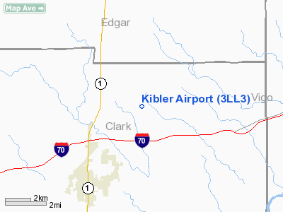
Location
& QuickFacts
|
FAA
Information Effective: |
2007-12-20 |
|
Airport
Identifier: |
3LL3 |
|
Airport
Status: |
Operational |
|
Longitude/Latitude: |
087-38-40.0930W/39-26-46.1280N
-87.644470/39.446147 (Estimated) |
|
Elevation: |
588 ft / 179.22 m (Estimated) |
|
Land: |
0 acres |
|
From
nearest city: |
3 nautical miles NE of Marshall, IL |
|
Location: |
Clark County, IL |
|
Magnetic Variation: |
01W (1985) |
Owner & Manager
|
Ownership: |
Privately owned |
|
Owner: |
Daniel Joseph Kibler |
|
Address: |
20623 N 2000 St
Marshall, IL 62441 |
|
Phone number: |
217-826-2990 |
|
Address: |
|
Airport Operations and Facilities
|
Airport Use: |
Private |
|
Wind indicator: |
Yes |
|
Segmented Circle: |
No |
|
Control Tower: |
No |
|
Landing fee charge: |
No |
|
Sectional chart: |
St Louis |
|
Region: |
AGL - Great Lakes |
|
Boundary ARTCC: |
ZID - Indianapolis |
|
Tie-in FSS: |
STL - Saint Louis |
|
FSS on Airport: |
No |
|
FSS Toll Free: |
1-800-WX-BRIEF |
Airport Services
|
Airframe
Repair: |
NONE |
|
Power
Plant Repair: |
NONE |
|
Runway Information
Runway N/S
|
Dimension: |
1423
x 70 ft / 433.7 x 21.3 m |
|
Surface: |
TURF, |
|
|
Runway N |
Runway S |
|
Traffic
Pattern: |
Left |
Left |
|
Displaced
threshold: |
0.00 ft |
300.00 ft |
|
Radio Navigation
Aids
|
ID |
Type |
Name |
Ch |
Freq |
Var |
Dist |
|
HU |
NDB |
Yinno |
|
245.00 |
02W |
12.0
nm |
|
PRG |
NDB |
Paris |
|
341.00 |
01E |
15.2
nm |
|
CZB |
NDB |
Casey |
|
359.00 |
00E |
18.6
nm |
|
SIV |
NDB |
Sullivan |
|
326.00 |
02W |
22.0
nm |
|
MT |
NDB |
Zebre |
|
347.00 |
00E |
24.6
nm |
|
PLX |
NDB |
Palestine |
|
391.00 |
00W |
26.0
nm |
|
HMJ |
NDB |
Homer |
|
281.00 |
01E |
37.7
nm |
|
TVX |
NDB |
Greencastle |
|
521.00 |
03W |
42.0
nm |
|
OEA |
NDB |
Vincennes |
|
251.00 |
00E |
45.6
nm |
|
CFJ |
NDB |
Crawfordsville |
|
388.00 |
02W |
46.6
nm |
|
RSV |
VOR/DME |
Robinson |
021X |
108.40 |
02E |
25.7
nm |
|
MTO |
VOR/DME |
Mattoon |
031X |
109.40 |
03E |
29.8
nm |
|
LWV |
VOR/DME |
Lawrenceville |
025X |
108.80 |
01W |
40.7
nm |
|
TTH |
VORTAC |
Terre
Haute |
100X |
115.30 |
02E |
18.5
nm |
|
CMI |
VORTAC |
Champaign |
037X |
110.00 |
03E |
45.9
nm |
Based
Aircraft
|
Aircraft
based on field: |
1 |
|
Single
Engine Airplanes: |
1 |
Kibler Airport
Address:
Clark County, IL
Tel:
217-826-2990
Images
and information placed above are from
http://www.airport-data.com/airport/3LL3/
We
thank them for the data!
| General
Info |
| Country |
United
States |
| State |
ILLINOIS
|
| FAA ID |
3LL3 |
| Latitude |
39-26-46.128N
|
| Longitude |
087-38-40.093W
|
| Elevation |
588 feet
|
| Near City |
MARSHALL
|
We don't guarantee the information is fresh and accurate. The data may
be wrong or outdated.
For more up-to-date information please refer to other sources.
|
|


