 |
|
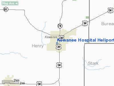
Kewanee Hospital Heliport |
|
|
Location
& QuickFacts
|
FAA
Information Effective: |
2007-12-20 |
|
Airport
Identifier: |
14IL |
|
Airport
Status: |
Operational |
|
Longitude/Latitude: |
089-55-51.3900W/41-14-07.1330N
-89.930942/41.235315 (Estimated) |
|
Elevation: |
838 ft / 255.42 m (Estimated) |
|
Land: |
0 acres |
|
From
nearest city: |
0 nautical miles E of Kewanee, IL |
|
Location: |
Henry County, IL |
|
Magnetic Variation: |
01E (1985) |
Owner & Manager
|
Ownership: |
Privately owned |
|
Owner: |
Kewanee Hospital |
|
Address: |
719 Elliott
Kewanee, IL 61443 |
|
Phone number: |
309-853-3361 |
|
Manager: |
Charles Duffy, Pres. |
|
Address: |
719 Elliott St
Kewanee, IL 61433 |
|
Phone number: |
309-853-3361 |
Airport
Operations and Facilities
|
Airport
Use: |
Private
MEDICAL USE. |
|
Wind
indicator: |
Yes |
|
Segmented Circle: |
No |
|
Control
Tower: |
No |
|
Lighting
Schedule: |
PHONE REQ
FOR ROTG BCN CALL
309-853-3361. |
|
Beacon Color: |
Clear-Green-Yellow (heliport) |
|
Landing fee charge: |
No |
|
Sectional chart: |
Chicago |
|
Region: |
AGL - Great Lakes |
|
Boundary ARTCC: |
ZAU - Chicago |
|
Tie-in FSS: |
IKK - Kankakee |
|
FSS on Airport: |
No |
|
FSS Toll Free: |
1-800-WX-BRIEF |
Airport Services
|
Airframe
Repair: |
NONE |
|
Power
Plant Repair: |
NONE |
|
Runway Information
Helipad H1
|
Dimension: |
40
x 40 ft / 12.2 x 12.2 m |
|
Surface: |
CONC, |
|
|
Runway H1 |
Runway |
|
Traffic
Pattern: |
Left |
Left |
|
Radio Navigation
Aids
|
ID |
Type |
Name |
Ch |
Freq |
Var |
Dist |
|
EZI |
NDB |
Kewanee |
|
245.00 |
01E |
2.4
nm |
|
BOZ |
NDB |
Whiteside |
|
254.00 |
01E |
29.3
nm |
|
VYS |
NDB |
Valley |
|
230.00 |
00W |
36.1
nm |
|
CWI |
NDB |
Clinton |
|
377.00 |
01E |
39.9
nm |
|
CTK |
NDB |
Canton |
|
236.00 |
02E |
40.8
nm |
|
PI |
NDB |
Tungg |
|
356.00 |
01E |
40.8
nm |
|
OIX |
NDB |
Ottawa |
|
266.00 |
01E |
49.2
nm |
|
GBG |
VOR/DME |
Galesburg |
035X |
109.80 |
03E |
29.0
nm |
|
PLL |
VOR/DME |
Polo |
049X |
111.20 |
03E |
47.6
nm |
|
BDF |
VORTAC |
Bradford |
094X |
114.70 |
00E |
16.2
nm |
|
MZV |
VORTAC |
Moline |
091X |
114.40 |
05E |
32.4
nm |
|
PIA |
VORTAC |
Peoria |
099X |
115.20 |
04E |
34.0
nm |
|
CVA |
VORTAC |
Davenport |
085X |
113.80 |
04E |
37.8
nm |
|
DVN |
VOT |
Davenport
Municipal |
|
111.80 |
|
37.2
nm |
Remarks
- HOSPITAL
EMERGENCY LANDING-RESIDENTIAL AREA SURROUNDING.
Kewanee Hospital Heliport
Address:
Henry County, IL
Tel:
309-853-3361
Images
and information placed above are from
http://www.airport-data.com/airport/14IL/
We
thank them for the data!
| General
Info |
| Country |
United
States |
| State |
ILLINOIS
|
| FAA ID |
14IL |
| Latitude |
41-14-07.133N
|
| Longitude |
089-55-51.390W
|
| Elevation |
838 feet
|
| Near City |
KEWANEE
|
We don't guarantee the information is fresh and accurate. The data may
be wrong or outdated.
For more up-to-date information please refer to other sources.
|
|


