 |
|
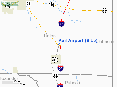
Location
& QuickFacts
|
FAA
Information Effective: |
2007-12-20 |
|
Airport
Identifier: |
6IL5 |
|
Airport
Status: |
Operational |
|
Longitude/Latitude: |
089-09-37.2820W/37-23-11.1810N
-89.160356/37.386439 (Estimated) |
|
Elevation: |
525 ft / 160.02 m (Estimated) |
|
Land: |
65 acres |
|
From
nearest city: |
1 nautical miles N of Dongola, IL |
|
Location: |
Union County, IL |
|
Magnetic Variation: |
01W (1985) |
Owner & Manager
|
Ownership: |
Privately owned |
|
Owner: |
Jack B. Keil |
|
Address: |
Rr 2, Box 309
Dongola, IL 62926 |
|
Phone number: |
618-827-4310 |
|
Manager: |
Jack B. Keil |
|
Address: |
Rr 2, Box 309
Dongola, IL 62926 |
|
Phone number: |
618-827-4310 |
Airport
Operations and Facilities
|
Airport
Use: |
Private |
|
Wind
indicator: |
Yes |
|
Segmented Circle: |
No |
|
Control
Tower: |
No |
|
Sectional chart: |
St Louis |
|
Region: |
AGL - Great Lakes |
|
Boundary
ARTCC: |
ZME - Memphis |
|
Tie-in
FSS: |
COU - Columbia |
|
FSS
Toll Free: |
1-800-WX-BRIEF |
|
Runway Information
Runway 01/19
|
Dimension: |
1850
x 100 ft / 563.9 x 30.5 m |
|
Surface: |
TURF, |
|
|
Runway 01 |
Runway 19 |
|
Traffic
Pattern: |
Left |
Left |
|
Obstruction: |
20 ft pline, 100.0 ft from runway |
|
|
Radio Navigation
Aids
|
ID |
Type |
Name |
Ch |
Freq |
Var |
Dist |
|
CIR |
NDB |
Cairo |
|
397.00 |
00E |
19.8
nm |
|
BDD |
NDB |
Bellgrade |
|
254.00 |
00E |
27.5
nm |
|
CHQ |
NDB |
Charleston |
|
208.00 |
01E |
33.9
nm |
|
PJY |
NDB |
Pinckneyville |
|
215.00 |
00E |
36.7
nm |
|
HSB |
NDB |
Harrisburg-raleigh |
|
230.00 |
00E |
38.9
nm |
|
GGK |
NDB |
Mayfield |
|
401.00 |
00E |
49.9
nm |
|
CGI |
VOR/DME |
Cape
Girardeau |
076X |
112.90 |
01E |
21.9
nm |
|
MWA |
VOR/DME |
Marion |
041X |
110.40 |
04E |
23.2
nm |
|
CNG |
VORTAC |
Cunningham |
078X |
113.10 |
03E |
27.5
nm |
Remarks
- PRVDD
OBS IN RY APCH SLOPE REMOVED/LOWERED OR THR DSPLCD & MKD TO PRVDMIN
20:1 APCH CLNC OVER OBS; AREA 125 FT EITHER SIDE RY CL CLEAR OF OBS;
SEND OF RY RELOCATED NORTH AT LEAST 200 FT FM ROADS.
Based
Aircraft
|
Aircraft
based on field: |
1 |
|
Single
Engine Airplanes: |
1 |
Keil Airport
Address:
Union County, IL
Tel:
618-827-4310
Images
and information placed above are from
http://www.airport-data.com/airport/6IL5/
We
thank them for the data!
| General
Info |
| Country |
United
States |
| State |
ILLINOIS
|
| FAA ID |
6IL5 |
| Latitude |
37-23-11.181N
|
| Longitude |
089-09-37.282W
|
| Elevation |
525 feet
|
| Near City |
DONGOLA
|
We don't guarantee the information is fresh and accurate. The data may
be wrong or outdated.
For more up-to-date information please refer to other sources.
|
|


