 |
|
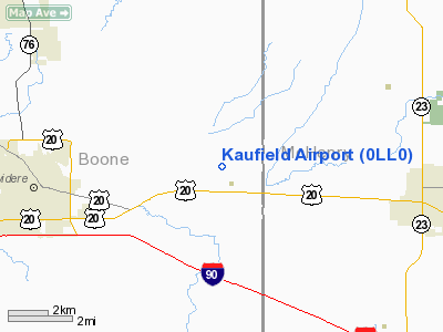
Location
& QuickFacts
|
FAA
Information Effective: |
2007-12-20 |
|
Airport
Identifier: |
0LL0 |
|
Airport
Status: |
Operational |
|
Longitude/Latitude: |
088-43-48.0000W/42-15-53.0000N
-88.730000/42.264722 (Estimated) |
|
Elevation: |
783 ft / 238.66 m (Estimated) |
|
Land: |
0 acres |
|
From
nearest city: |
5 nautical miles E of Belvidere, IL |
|
Location: |
Adams County, IL |
|
Magnetic Variation: |
01W (1995) |
Owner
& Manager
|
Ownership: |
Privately
owned |
|
Owner: |
John Kaufield |
|
Address: |
7698 Garden Prairie Road
Garden Prairie, IL 61038 |
|
Phone
number: |
815-597-3981 |
|
Manager: |
John Kaufield |
|
Address: |
7698 Garden Prairie Road
Garden Prairie, IL 61038 |
|
Phone number: |
815-597-3981 |
Airport Operations and Facilities
|
Airport
Use: |
Private |
|
Wind
indicator: |
Yes |
|
Segmented Circle: |
No |
|
Control
Tower: |
No |
|
Lighting
Schedule: |
PHONE REQ
FOR LIRL CALL
815-597-3981. |
|
Sectional chart: |
Chicago |
|
Region: |
AGL - Great Lakes |
|
Boundary
ARTCC: |
ZAU - Chicago |
|
Tie-in
FSS: |
IKK - Kankakee |
|
FSS
Toll Free: |
1-800-WX-BRIEF |
|
Runway Information
Runway 09/27
|
Dimension: |
2030
x 70 ft / 618.7 x 21.3 m |
|
Surface: |
TURF, |
|
Edge
Lights: |
Non-standard lighting system |
|
|
Runway 09 |
Runway 27 |
|
Traffic
Pattern: |
Left |
Left |
|
Obstruction: |
|
25 ft pline, 600.0 ft from runway |
|
Radio Navigation
Aids
|
ID |
Type |
Name |
Ch |
Freq |
Var |
Dist |
|
DKB |
NDB |
Dekalb |
|
209.00 |
02W |
19.9
nm |
|
JVL |
NDB |
Janesville |
|
375.00 |
03E |
25.2
nm |
|
LVV |
NDB |
Lake
Lawn |
|
404.00 |
00W |
26.8
nm |
|
ME |
NDB |
Deana |
|
350.00 |
00E |
36.1
nm |
|
FEP |
NDB |
Freeport |
|
335.00 |
00E |
38.1
nm |
|
RA |
NDB |
Paser |
|
206.00 |
00E |
44.6
nm |
|
GM |
NDB |
Teels |
|
242.00 |
02W |
49.3
nm |
|
RFD |
VOR/DME |
Rockford |
045X |
110.80 |
01E |
21.0
nm |
|
JVL |
VOR/DME |
Janesville |
090X |
114.30 |
03E |
24.3
nm |
|
DPA |
VOR/DME |
Dupage |
021X |
108.40 |
02E |
28.2
nm |
|
BUU |
VOR/DME |
Burbun |
092X |
114.50 |
01W |
31.8
nm |
|
OBK |
VOR/DME |
Northbrook |
077X |
113.00 |
02W |
34.7
nm |
|
PLL |
VOR/DME |
Polo |
049X |
111.20 |
03E |
39.7
nm |
|
ORD |
VOR/DME |
Chicago
O'hare |
086X |
113.90 |
02E |
40.4
nm |
|
ENW |
VOR/DME |
Kenosha |
029X |
109.20 |
02W |
40.7
nm |
|
JOT |
VORTAC |
Joliet |
070X |
112.30 |
02E |
46.9
nm |
|
ORD |
VOT |
Chicago
O'hare Intl |
|
112.00 |
|
40.4
nm |
Remarks
- RY
09/27 HAS 50 FT POWERLINES 200 FT S OF RY & 60 FT POWERLINES 1800
FT N OF RY. RY
09/27 HAS +25 FT BLDG 500 FT SE OF RY.
- PRVDD
CLEAR 20:1 APCH; CLEAR AREA 125 FT EITHER SIDE OF RY AND 200 FT OFF
RY ENDS; AREA 60 FT EITHER SIDE OF RY AND 240 FT OFF RY ENDS IS GRADED
WITH NO HAZARDS.
Based
Aircraft
|
Aircraft
based on field: |
1 |
|
Single
Engine Airplanes: |
1 |
Kaufield Airport
Address:
Adams County, IL
Tel:
815-597-3981
Images
and information placed above are from
http://www.airport-data.com/airport/0LL0/
We
thank them for the data!
| General
Info |
| Country |
United
States |
| State |
ILLINOIS
|
| FAA ID |
0LL0 |
| Latitude |
42-15-53.000N
|
| Longitude |
088-43-48.000W
|
| Elevation |
783 feet
|
| Near City |
BELVIDERE
|
We don't guarantee the information is fresh and accurate. The data may
be wrong or outdated.
For more up-to-date information please refer to other sources.
|
|


