 |
|
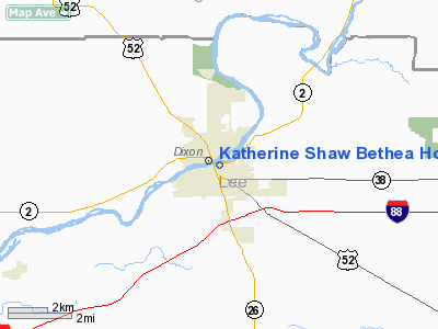
Katherine Shaw Bethea Hospital Heliport |
|
|
Location
& QuickFacts
|
FAA
Information Effective: |
2007-12-20 |
|
Airport
Identifier: |
49IS |
|
Airport
Status: |
Operational |
|
Longitude/Latitude: |
089-28-45.4730W/41-50-40.1160N
-89.479298/41.844477 (Estimated) |
|
Elevation: |
582 ft / 177.39 m (Estimated) |
|
Land: |
0 acres |
|
From
nearest city: |
0 nautical miles E of Dixon, IL |
|
Location: |
Lee County, IL |
|
Magnetic Variation: |
01E (1985) |
Owner
& Manager
|
Ownership: |
Privately
owned |
|
Owner: |
Katherine Shaw Bethea Hosp |
|
Address: |
403 East First St.
Dixon, IL 61021 |
|
Phone
number: |
815-288-5531 |
|
Manager: |
Darryl Vandervort |
|
Address: |
403 East First St.
Dixon, IL 61021 |
|
Phone number: |
815-288-5531 |
Airport Operations and Facilities
|
Airport
Use: |
Private
MEDICAL USE. |
|
Wind
indicator: |
Yes |
|
Segmented Circle: |
No |
|
Control
Tower: |
No |
|
Lighting
Schedule: |
24 HRS
FOR PERIMETER LGTS PHONE
815-288-5531. |
|
Beacon
Color: |
Clear-Green-Yellow (heliport) |
|
Sectional chart: |
Chicago |
|
Region: |
AGL - Great Lakes |
|
Boundary
ARTCC: |
ZAU - Chicago |
|
Tie-in
FSS: |
IKK - Kankakee |
|
FSS
Toll Free: |
1-800-WX-BRIEF
OR LOCAL CALL 965-6758. |
|
Runway Information
Helipad H1
|
Dimension: |
42
x 40 ft / 12.8 x 12.2 m |
|
Surface: |
CONC, |
|
|
Runway H1 |
Runway |
|
Traffic
Pattern: |
Left |
Left |
|
Radio Navigation
Aids
|
ID |
Type |
Name |
Ch |
Freq |
Var |
Dist |
|
BOZ |
NDB |
Whiteside |
|
254.00 |
01E |
15.9
nm |
|
FEP |
NDB |
Freeport |
|
335.00 |
00E |
24.6
nm |
|
VYS |
NDB |
Valley |
|
230.00 |
00W |
33.0
nm |
|
DKB |
NDB |
Dekalb |
|
209.00 |
02W |
35.0
nm |
|
CWI |
NDB |
Clinton |
|
377.00 |
01E |
38.0
nm |
|
OIX |
NDB |
Ottawa |
|
266.00 |
01E |
40.4
nm |
|
EZI |
NDB |
Kewanee |
|
245.00 |
01E |
44.3
nm |
|
PLL |
VOR/DME |
Polo |
049X |
111.20 |
03E |
7.6
nm |
|
RFD |
VOR/DME |
Rockford |
045X |
110.80 |
01E |
26.1
nm |
|
JVL |
VOR/DME |
Janesville |
090X |
114.30 |
03E |
46.0
nm |
|
BDF |
VORTAC |
Bradford |
094X |
114.70 |
00E |
41.4
nm |
|
CVA |
VORTAC |
Davenport |
085X |
113.80 |
04E |
45.7
nm |
Remarks
- PROVIDING
ALL APCH/DEP ROUTES 260-280 DEGS & 190-210 DEGS; TAKEOFF/LDG AREA
APPROPRIATELY MKD; NON-OBSTRUCTING WIND INDICATOR MAINTAINED.
Katherine Shaw Bethea Hospital Heliport
Address:
Lee County, IL
Tel:
815-288-5531
Images
and information placed above are from
http://www.airport-data.com/airport/49IS/
We
thank them for the data!
| General
Info |
| Country |
United
States |
| State |
ILLINOIS
|
| FAA ID |
49IS |
| Latitude |
41-50-40.116N
|
| Longitude |
089-28-45.473W
|
| Elevation |
582 feet
|
| Near City |
DIXON
|
We don't guarantee the information is fresh and accurate. The data may
be wrong or outdated.
For more up-to-date information please refer to other sources.
|
|


