 |
|
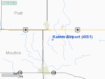
Location
& QuickFacts
|
FAA
Information Effective: |
2007-12-20 |
|
Airport
Identifier: |
4IS1 |
|
Airport
Status: |
Operational |
|
Longitude/Latitude: |
088-26-55.2000W/39-46-23.1180N
-88.448667/39.773088 (Estimated) |
|
Elevation: |
672 ft / 204.83 m (Estimated) |
|
Land: |
3 acres |
|
From
nearest city: |
2 nautical miles S of Atwood, IL |
|
Location: |
Douglas County, IL |
|
Magnetic Variation: |
00E (1984) |
Owner
& Manager
|
Ownership: |
Privately
owned |
|
Owner: |
Mary Kamm
KAMM LIMITED FAMILY PARTNERSHIP. |
|
Address: |
806 N. 125 East
Atwood, IL 61913 |
|
Phone number: |
217-578-3208 |
|
Manager: |
Howard Kamm |
|
Address: |
806 N. 125 East
Atwood, IL 61913 |
|
Phone number: |
217-578-3086 |
Airport
Operations and Facilities
|
Airport
Use: |
Private |
|
Wind
indicator: |
Yes |
|
Segmented Circle: |
No |
|
Control
Tower: |
No |
|
Sectional chart: |
St Louis |
|
Region: |
AGL - Great Lakes |
|
Boundary
ARTCC: |
ZKC - Kansas City |
|
Tie-in
FSS: |
STL - Saint Louis |
|
FSS
on Airport: |
No |
|
FSS
Toll Free: |
1-800-WX-BRIEF |
|
Runway Information
Runway 09/27
|
Dimension: |
1840
x 70 ft / 560.8 x 21.3 m |
|
Surface: |
TURF, |
|
|
Runway 09 |
Runway 27 |
|
Traffic
Pattern: |
Left |
Left |
|
Displaced
threshold: |
0.00 ft |
225.00 ft |
|
Obstruction: |
40 ft trees, 800.0 ft from runway, 20:1 slope
to clear |
, 225.0 ft from runway, 15:1 slope to clear |
|
Radio Navigation
Aids
|
ID |
Type |
Name |
Ch |
Freq |
Var |
Dist |
|
MT |
NDB |
Zebre |
|
347.00 |
00E |
23.6
nm |
|
HMJ |
NDB |
Homer |
|
281.00 |
01E |
27.5
nm |
|
SYZ |
NDB |
Shelbyville |
|
365.00 |
01E |
28.6
nm |
|
CZB |
NDB |
Casey |
|
359.00 |
00E |
34.9
nm |
|
PRG |
NDB |
Paris |
|
341.00 |
01E |
36.1
nm |
|
TAZ |
NDB |
Taylorville |
|
395.00 |
00E |
42.9
nm |
|
AAA |
NDB |
Abraham |
|
329.00 |
00E |
47.1
nm |
|
MTO |
VOR/DME |
Mattoon |
031X |
109.40 |
03E |
19.3
nm |
|
BMI |
VOR/DME |
Bloomington |
019X |
108.20 |
03E |
48.0
nm |
|
CMI |
VORTAC |
Champaign |
037X |
110.00 |
03E |
17.6
nm |
|
DEC |
VORTAC |
Decatur |
119X |
117.20 |
03E |
19.0
nm |
Remarks
- PRVDD
RWY THRS ARE LCTD/DSPLCD TO PRVD 20:1 APCH CLRNC OVR ANY/ALL OBSTACLES.
Based
Aircraft
|
Aircraft
based on field: |
1 |
|
Single
Engine Airplanes: |
1 |
Kamm Airport
Address:
Douglas County, IL
Tel:
217-578-3208,
217-578-3086
Images
and information placed above are from
http://www.airport-data.com/airport/4IS1/
We
thank them for the data!
| General
Info |
| Country |
United
States |
| State |
ILLINOIS
|
| FAA ID |
4IS1 |
| Latitude |
39-46-23.118N
|
| Longitude |
088-26-55.200W
|
| Elevation |
672 feet
|
| Near City |
ATWOOD
|
We don't guarantee the information is fresh and accurate. The data may
be wrong or outdated.
For more up-to-date information please refer to other sources.
|
|


