 |
|
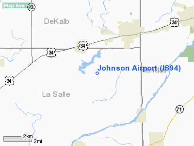
Location
& QuickFacts
|
FAA Information Effective: |
2007-12-20 |
|
Airport
Identifier: |
IS94 |
|
Airport
Status: |
Operational |
|
Longitude/Latitude: |
088-39-40.2740W/41-36-20.1090N
-88.661187/41.605586 (Estimated) |
|
Elevation: |
667 ft / 203.30 m (Estimated) |
|
Land: |
0 acres |
|
From
nearest city: |
4 nautical miles SW of Sandwich, IL |
|
Location: |
La Salle County, IL |
|
Magnetic Variation: |
00W (1985) |
Owner
& Manager
|
Ownership: |
Privately owned |
|
Owner: |
Dean Johnson |
|
Address: |
Route 1
Sandwich, IL 60548 |
|
Phone number: |
815-786-2895 |
|
Manager: |
Dean Johnson |
|
Address: |
Route 1
Sandwich, IL 60548 |
|
Phone number: |
815-786-2895 |
Airport
Operations and Facilities
|
Airport Use: |
Private |
|
Wind
indicator: |
Yes |
|
Segmented
Circle: |
No |
|
Control
Tower: |
No |
|
Landing
fee charge: |
No |
|
Sectional
chart: |
Chicago |
|
Region: |
AGL - Great Lakes |
|
Boundary
ARTCC: |
ZAU - Chicago |
|
Tie-in
FSS: |
IKK - Kankakee |
|
FSS
on Airport: |
No |
|
FSS
Toll Free: |
1-800-WX-BRIEF |
|
Runway Information
Runway 09/27
|
Dimension: |
1800 x 50 ft / 548.6 x 15.2 m |
|
Surface: |
TURF, |
|
|
Runway 09 |
Runway 27 |
|
Traffic
Pattern: |
Right |
Left |
|
Radio Navigation
Aids
|
ID |
Type |
Name |
Ch |
Freq |
Var |
Dist |
|
OIX |
NDB |
Ottawa |
|
266.00 |
01E |
17.0 nm |
|
DKB |
NDB |
Dekalb |
|
209.00 |
02W |
19.9 nm |
|
VYS |
NDB |
Valley |
|
230.00 |
00W |
26.6 nm |
|
ME |
NDB |
Deana |
|
350.00 |
00E |
35.8 nm |
|
HK |
NDB |
Ermin |
|
332.00 |
01W |
37.7 nm |
|
MX |
NDB |
Kedzi |
|
248.00 |
01W |
44.4 nm |
|
DPA |
VOR/DME |
Dupage |
021X |
108.40 |
02E |
22.1 nm |
|
ORD |
VOR/DME |
Chicago O'hare |
086X |
113.90 |
02E |
40.9 nm |
|
PLL |
VOR/DME |
Polo |
049X |
111.20 |
03E |
44.3 nm |
|
RFD |
VOR/DME |
Rockford |
045X |
110.80 |
01E |
44.4 nm |
|
PNT |
VOR/DME |
Pontiac |
033X |
109.60 |
03E |
47.3 nm |
|
IKK |
VOR/DME |
Kankakee |
053X |
111.60 |
00E |
48.6 nm |
|
OBK |
VOR/DME |
Northbrook |
077X |
113.00 |
02W |
48.8 nm |
|
JOT |
VORTAC |
Joliet |
070X |
112.30 |
02E |
15.8 nm |
|
EON |
VORTAC |
Peotone |
079X |
113.20 |
02E |
44.1 nm |
|
CGT |
VORTAC |
Chicago Heights |
089X |
114.20 |
02E |
49.3 nm |
|
BDF |
VORTAC |
Bradford |
094X |
114.70 |
00E |
49.6 nm |
|
ORD |
VOT |
Chicago O'hare Intl |
|
112.00 |
|
40.7 nm |
|
MDW |
VOT |
Chicago Midway |
|
111.00 |
|
42.2 nm |
Remarks
- PROVIDED
ALL ACFT OPNS ARE CONDUCTED ON THE SOUTH SIDE OF THE E/W RWY.
Based
Aircraft
|
Aircraft
based on field: |
1 |
|
Single
Engine Airplanes: |
1 |
Johnson La Salle Airport
Address:
La Salle County, IL
Tel:
815-786-2895
Images
and information placed above are from
http://www.airport-data.com/airport/IS94/
We
thank them for the data!
| General
Info |
| Country |
United
States |
| State |
ILLINOIS
|
| FAA ID |
IS94
|
| Latitude |
41-36-20.109N
|
| Longitude |
088-39-40.274W
|
| Elevation |
667 feet
|
| Near City |
SANDWICH
|
We don't guarantee the information is fresh and accurate. The data may
be wrong or outdated.
For more up-to-date information please refer to other sources.
|
|


