 |
|
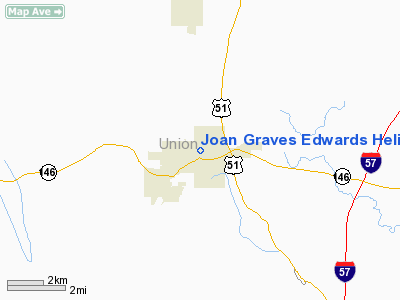
Joan Graves Edwards Heliport |
Location
& QuickFacts
|
FAA
Information Effective: |
2007-12-20 |
|
Airport
Identifier: |
4IS0 |
|
Airport
Status: |
Operational |
|
Longitude/Latitude: |
089-14-45.3010W/37-27-50.1780N
-89.245917/37.463938 (Estimated) |
|
Elevation: |
624 ft / 190.20 m (Estimated) |
|
Land: |
0 acres |
|
From
nearest city: |
0 nautical miles NE of Anna, IL |
|
Location: |
Union County, IL |
|
Magnetic Variation: |
01E (1984) |
Owner & Manager
|
Ownership: |
Privately owned |
|
Owner: |
Union County Hospital Dist |
|
Address: |
517 North Main
Anna, IL 62906 |
|
Phone number: |
618-833-4511 |
|
Manager: |
C. L. Goodman, Admin. |
|
Address: |
517 North Main
Anna, IL 62906 |
|
Phone number: |
618-833-4511 |
Airport
Operations and Facilities
|
Airport
Use: |
Private
MEDICAL USE. |
|
Wind
indicator: |
Yes |
|
Segmented Circle: |
No |
|
Control
Tower: |
No |
|
Landing
fee charge: |
No |
|
Sectional chart: |
St Louis |
|
Region: |
AGL - Great Lakes |
|
Boundary
ARTCC: |
ZKC - Kansas City |
|
Tie-in
FSS: |
COU - Columbia |
|
FSS
on Airport: |
No |
|
FSS
Toll Free: |
1-800-WX-BRIEF |
|
Runway Information
Helipad H1
|
Dimension: |
40
x 40 ft / 12.2 x 12.2 m |
|
Surface: |
CONC, |
|
|
Runway H1 |
Runway |
|
Traffic
Pattern: |
Left |
Left |
|
Radio Navigation
Aids
|
ID |
Type |
Name |
Ch |
Freq |
Var |
Dist |
|
CIR |
NDB |
Cairo |
|
397.00 |
00E |
24.2
nm |
|
PJY |
NDB |
Pinckneyville |
|
215.00 |
00E |
31.2
nm |
|
BDD |
NDB |
Bellgrade |
|
254.00 |
00E |
33.5
nm |
|
CHQ |
NDB |
Charleston |
|
208.00 |
01E |
37.6
nm |
|
HSB |
NDB |
Harrisburg-raleigh |
|
230.00 |
00E |
39.4
nm |
|
SAR |
NDB |
Sparta |
|
239.00 |
01E |
46.3
nm |
|
MWA |
VOR/DME |
Marion |
041X |
110.40 |
04E |
20.7
nm |
|
CGI |
VOR/DME |
Cape
Girardeau |
076X |
112.90 |
01E |
21.1
nm |
|
CNG |
VORTAC |
Cunningham |
078X |
113.10 |
03E |
33.6
nm |
|
FAM |
VORTAC |
Farmington |
104X |
115.70 |
01E |
48.7
nm |
Remarks
- PRVDD
ALL OPNS ARE CONDD IN AREA FM 150-180 & 300-350 DEG, AREA APROPLY
MKD, WIND INDCR MAINTD.
Joan Graves Edwards Heliport
Address:
Union County, IL
Tel:
618-833-4511
Images
and information placed above are from
http://www.airport-data.com/airport/4IS0/
We
thank them for the data!
| General
Info |
| Country |
United
States |
| State |
ILLINOIS
|
| FAA ID |
4IS0 |
| Latitude |
37-27-50.178N
|
| Longitude |
089-14-45.301W
|
| Elevation |
624 feet
|
| Near City |
ANNA |
We don't guarantee the information is fresh and accurate. The data may
be wrong or outdated.
For more up-to-date information please refer to other sources.
|
|


