 |
|
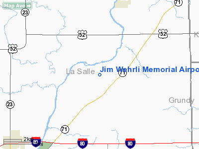
Jim Wehrli Memorial Airport |
Location
& QuickFacts
|
FAA
Information Effective: |
2007-12-20 |
|
Airport
Identifier: |
34IS |
|
Airport
Status: |
Operational |
|
Longitude/Latitude: |
088-43-00.2670W/41-26-41.1140N
-88.716741/41.444754 (Estimated) |
|
Elevation: |
630 ft / 192.02 m (Estimated) |
|
Land: |
7 acres |
|
From
nearest city: |
7 nautical miles NW of Marseilles, IL |
|
Location: |
La Salle County, IL |
|
Magnetic Variation: |
00E (1985) |
Owner
& Manager
|
Ownership: |
Privately
owned |
|
Owner: |
Richard Wehrli |
|
Address: |
1805 High Grove Lane
Naperville, IL 60540 |
|
Phone
number: |
630-335-9740 |
|
Manager: |
Richard Wehrli |
|
Address: |
1805 High Grove Lane
Naperville, IL 60540 |
|
Phone number: |
630-355-9740 |
Airport Operations and Facilities
|
Airport Use: |
Private |
|
Wind indicator: |
Yes |
|
Segmented Circle: |
No |
|
Control Tower: |
No |
|
Sectional chart: |
Chicago |
|
Region: |
AGL - Great Lakes |
|
Boundary ARTCC: |
ZAU - Chicago |
|
Tie-in FSS: |
IKK - Kankakee |
|
FSS Toll Free: |
1-800-WX-BRIEF |
Airport Services
|
Runway
Information
Runway N/S
|
Dimension: |
2600
x 70 ft / 792.5 x 21.3 m |
|
Surface: |
TURF, |
|
|
Runway N |
Runway S |
|
Traffic
Pattern: |
Left |
Left |
|
Displaced
threshold: |
450.00 ft |
225.00 ft |
|
Obstruction: |
30 ft trees, 225.0 ft from runway |
15 ft road, 10.0 ft from runway |
|
Radio Navigation
Aids
|
ID |
Type |
Name |
Ch |
Freq |
Var |
Dist |
|
OIX |
NDB |
Ottawa |
|
266.00 |
01E |
7.9
nm |
|
VYS |
NDB |
Valley |
|
230.00 |
00W |
20.2
nm |
|
DKB |
NDB |
Dekalb |
|
209.00 |
02W |
29.4
nm |
|
HK |
NDB |
Ermin |
|
332.00 |
01W |
42.9
nm |
|
ME |
NDB |
Deana |
|
350.00 |
00E |
44.1
nm |
|
MX |
NDB |
Kedzi |
|
248.00 |
01W |
49.5
nm |
|
DPA |
VOR/DME |
Dupage |
021X |
108.40 |
02E |
31.4
nm |
|
PNT |
VOR/DME |
Pontiac |
033X |
109.60 |
03E |
37.5
nm |
|
IKK |
VOR/DME |
Kankakee |
053X |
111.60 |
00E |
45.1
nm |
|
PLL |
VOR/DME |
Polo |
049X |
111.20 |
03E |
47.9
nm |
|
ORD |
VOR/DME |
Chicago
O'hare |
086X |
113.90 |
02E |
48.9
nm |
|
JOT |
VORTAC |
Joliet |
070X |
112.30 |
02E |
18.9
nm |
|
BDF |
VORTAC |
Bradford |
094X |
114.70 |
00E |
42.9
nm |
|
EON |
VORTAC |
Peotone |
079X |
113.20 |
02E |
43.1
nm |
|
MDW |
VOT |
Chicago
Midway |
|
111.00 |
|
48.0
nm |
|
ORD |
VOT |
Chicago
O'hare Intl |
|
112.00 |
|
48.6
nm |
Based
Aircraft
|
Aircraft
based on field: |
2 |
|
Single
Engine Airplanes: |
2 |
Jim Wehrli Memorial Airport
Address:
La Salle County, IL
Tel:
630-335-9740,
630-355-9740
Images
and information placed above are from
http://www.airport-data.com/airport/34IS/
We
thank them for the data!
| General
Info |
| Country |
United
States |
| State |
ILLINOIS
|
| FAA ID |
34IS |
| Latitude |
41-26-41.114N
|
| Longitude |
088-43-00.267W
|
| Elevation |
630 feet
|
| Near City |
MARSEILLES
|
We don't guarantee the information is fresh and accurate. The data may
be wrong or outdated.
For more up-to-date information please refer to other sources.
|
|


