 |
|
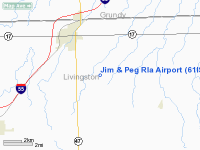
Location
& QuickFacts
|
FAA
Information Effective: |
2007-12-20 |
|
Airport
Identifier: |
61IS |
|
Airport
Status: |
Operational |
|
Longitude/Latitude: |
088-23-14.2050W/41-03-17.1150N
-88.387279/41.054754 (Estimated) |
|
Elevation: |
630 ft / 192.02 m (Estimated) |
|
Land: |
6 acres |
|
From
nearest city: |
2 nautical miles SE of Dwight, IL |
|
Location: |
Livingston County, IL |
|
Magnetic Variation: |
00W (1985) |
Owner
& Manager
|
Ownership: |
Privately
owned |
|
Owner: |
James Watters |
|
Address: |
111 S Clinton St
Dwight, IL 60420 |
|
Phone
number: |
815-584-2540 |
|
Manager: |
James Watters |
|
Address: |
111 S Clinton St
Dwight, IL 60420 |
|
Phone number: |
815-584-2540 |
Airport Operations and Facilities
|
Airport
Use: |
Private |
|
Wind
indicator: |
Yes |
|
Segmented Circle: |
No |
|
Control
Tower: |
No |
|
Sectional chart: |
Chicago |
|
Region: |
AGL - Great Lakes |
|
Boundary
ARTCC: |
ZAU - Chicago |
|
Tie-in
FSS: |
IKK - Kankakee |
|
FSS
Toll Free: |
1-800-WX-BRIEF |
|
Runway Information
Runway 18/36
|
Dimension: |
2400
x 100 ft / 731.5 x 30.5 m |
|
Surface: |
TURF, |
|
|
Runway 18 |
Runway 36 |
|
Traffic
Pattern: |
Left |
Left |
|
Displaced
threshold: |
0.00 ft |
200.00 ft |
|
Radio Navigation
Aids
|
ID |
Type |
Name |
Ch |
Freq |
Var |
Dist |
|
OIX |
NDB |
Ottawa |
|
266.00 |
01E |
28.1
nm |
|
VYS |
NDB |
Valley |
|
230.00 |
00W |
38.8
nm |
|
HK |
NDB |
Ermin |
|
332.00 |
01W |
47.0
nm |
|
PNT |
VOR/DME |
Pontiac |
033X |
109.60 |
03E |
21.1
nm |
|
IKK |
VOR/DME |
Kankakee |
053X |
111.60 |
00E |
24.4
nm |
|
RBS |
VOR/DME |
Roberts |
115X |
116.80 |
02E |
30.2
nm |
|
BMI |
VOR/DME |
Bloomington |
019X |
108.20 |
03E |
42.5
nm |
|
JOT |
VORTAC |
Joliet |
070X |
112.30 |
02E |
29.7
nm |
|
EON |
VORTAC |
Peotone |
079X |
113.20 |
02E |
29.9
nm |
|
CGT |
VORTAC |
Chicago
Heights |
089X |
114.20 |
02E |
45.9
nm |
Remarks
Based
Aircraft
|
Aircraft
based on field: |
2 |
|
Single
Engine Airplanes: |
2 |
Jim And Peg Rla Airport
Address:
Livingston County, IL
Tel:
815-584-2540
Images
and information placed above are from
http://www.airport-data.com/airport/61IS/
We
thank them for the data!
| General
Info |
| Country |
United
States |
| State |
ILLINOIS
|
| FAA ID |
61IS |
| Latitude |
41-03-17.115N
|
| Longitude |
088-23-14.205W
|
| Elevation |
630 feet
|
| Near City |
DWIGHT
|
We don't guarantee the information is fresh and accurate. The data may
be wrong or outdated.
For more up-to-date information please refer to other sources.
|
|


