 |
|
Jasper County Flying Club Airport |
Location
& QuickFacts
|
FAA
Information Effective: |
2007-12-20 |
|
Airport
Identifier: |
6LL7 |
|
Airport
Status: |
Operational |
|
Longitude/Latitude: |
088-10-35.1410W/38-59-22.1550N
-88.176428/38.989488 (Estimated) |
|
Elevation: |
540 ft / 164.59 m (Estimated) |
|
Land: |
0 acres |
|
From
nearest city: |
1 nautical miles W of Newton, IL |
|
Location: |
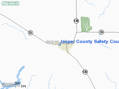
Jasper County, IL |
|
Magnetic Variation: |
00E (1985) |
Owner
& Manager
|
Ownership: |
Publicly
owned |
|
Owner: |
Jasper County
JASPER COUNTY SAFETY COUNCIL. |
|
Address: |
501 Iva Street
Newton, IL 62448 |
|
Phone number: |
618-783-8225 |
|
Manager: |
Darrel Holland |
|
Address: |
501 Iva Street
Newton, IL 62448 |
|
Phone number: |
618-783-8225 |
Airport
Operations and Facilities
|
Airport
Use: |
Private |
|
Wind
indicator: |
Yes
A WINDSOCK INSTALLED 300' SE PAD |
|
Segmented Circle: |
No |
|
Control
Tower: |
No |
|
Landing
fee charge: |
No |
|
Sectional chart: |
St Louis |
|
Region: |
AGL - Great Lakes |
|
Boundary
ARTCC: |
ZKC - Kansas City |
|
Tie-in
FSS: |
COU - Columbia |
|
FSS
on Airport: |
No |
|
FSS
Toll Free: |
1-800-WX-BRIEF |
|
Runway Information
Helipad H1
|
Dimension: |
100
x 100 ft / 30.5 x 30.5 m |
|
Surface: |
TURF, |
|
|
Runway H1 |
Runway |
|
Traffic
Pattern: |
Left |
Left |
|
Radio Navigation
Aids
|
ID |
Type |
Name |
Ch |
Freq |
Var |
Dist |
|
OLY |
NDB |
Olney |
|
272.00 |
00W |
16.3
nm |
|
CZB |
NDB |
Casey |
|
359.00 |
00E |
20.6
nm |
|
FOA |
NDB |
Elm
River |
|
353.00 |
00E |
23.2
nm |
|
PLX |
NDB |
Palestine |
|
391.00 |
00W |
25.1
nm |
|
MT |
NDB |
Zebre |
|
347.00 |
00E |
27.2
nm |
|
AJG |
NDB |
Mount
Carmel |
|
524.00 |
02W |
31.0
nm |
|
OEA |
NDB |
Vincennes |
|
251.00 |
00E |
34.2
nm |
|
SIV |
NDB |
Sullivan |
|
326.00 |
02W |
34.9
nm |
|
FWC |
NDB |
Wayne
County |
|
257.00 |
01E |
38.2
nm |
|
SYZ |
NDB |
Shelbyville |
|
365.00 |
01E |
39.9
nm |
|
SLO |
NDB |
Salem |
|
400.00 |
01W |
42.5
nm |
|
HU |
NDB |
Yinno |
|
245.00 |
02W |
43.5
nm |
|
PRG |
NDB |
Paris |
|
341.00 |
01E |
48.6
nm |
|
RSV |
VOR/DME |
Robinson |
021X |
108.40 |
02E |
24.7
nm |
|
MTO |
VOR/DME |
Mattoon |
031X |
109.40 |
03E |
29.8
nm |
|
LWV |
VOR/DME |
Lawrenceville |
025X |
108.80 |
01W |
29.9
nm |
|
SAM |
VOR/DME |
Samsville |
113X |
116.60 |
03E |
30.6
nm |
|
VNN |
VOR/DME |
Mount
Vernon |
085X |
113.80 |
02E |
47.9
nm |
|
BIB |
VORTAC |
Bible
Grove |
027X |
109.00 |
03E |
14.9
nm |
|
VLA |
VORTAC |
Vandalia |
090X |
114.30 |
04E |
46.5
nm |
Remarks
- PROVIDED
INGRESS/EGRESS RTES ARE LMTD TO 270 AND 090 DEG BEARINGS FM THE HELIPAD
(USING HELIPAD AS CENTER OF COMPASS ROSE).
Jasper County Safety Council Heliport
Address:
Jasper County, IL
Tel:
618-783-8225
Images
and information placed above are from
http://www.airport-data.com/airport/6LL7/
We
thank them for the data!
| General
Info |
| Country |
United
States |
| State |
ILLINOIS
|
| FAA ID |
6LL7 |
| Latitude |
38-59-22.155N
|
| Longitude |
088-10-35.141W
|
| Elevation |
540 feet
|
| Near City |
NEWTON
|
We don't guarantee the information is fresh and accurate. The data may
be wrong or outdated.
For more up-to-date information please refer to other sources.
|
|


