 |
|
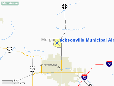
Jacksonville Municipal Airport |
|
|
Location
& QuickFacts
|
FAA
Information Effective: |
2007-12-20 |
|
Airport
Identifier: |
IJX |
|
Airport
Status: |
Operational |
|
Longitude/Latitude: |
090-14-17.7720W/39-46-28.5910N
-90.238270/39.774609 (Estimated) |
|
Elevation: |
624 ft / 190.20 m (Surveyed) |
|
Land: |
468 acres |
|
From
nearest city: |
3 nautical miles N of Jacksonville, IL |
|
Location: |
Morgan County, IL |
|
Magnetic Variation: |
03E (1980) |
Owner
& Manager
|
Ownership: |
Publicly
owned |
|
Owner: |
Jacksonville Airport Auth |
|
Address: |
1956 Baldwin Rd
Jacksonville, IL 62650 |
|
Phone
number: |
217-243-5824 |
|
Manager: |
Don Bangert |
|
Address: |
1956 Baldwin Rd, Jacksonville Airport
Jacksonville, IL 62650 |
|
Phone number: |
217-243-5824 |
Airport Operations and Facilities
|
Airport
Use: |
Open
to public |
|
Wind
indicator: |
Yes |
|
Segmented Circle: |
No |
|
Control
Tower: |
No |
|
Lighting
Schedule: |
DUSK-DAWN
ACTVT MIRL RY 13/31, 04/22, REIL RYS 13 & 31, &
TWY LGTS - CTAF. |
|
Beacon
Color: |
Clear-Green (lighted land airport) |
|
Landing
fee charge: |
No |
|
Sectional chart: |
St Louis |
|
Region: |
AGL - Great Lakes |
|
Traffic
Pattern Alt: |
800 ft |
|
Boundary
ARTCC: |
ZKC - Kansas City |
|
Tie-in
FSS: |
STL - Saint Louis |
|
FSS
on Airport: |
No |
|
FSS
Toll Free: |
1-800-WX-BRIEF |
|
NOTAMs
Facility: |
IJX (NOTAM-d service avaliable) |
|
Federal Agreements: |
NGY |
Airport Communications
|
CTAF: |
122.800 |
|
Unicom: |
122.800
|
Airport
Services
|
Fuel
available: |
100LLA |
|
Airframe
Repair: |
MAJOR |
|
Power
Plant Repair: |
MAJOR |
|
Bottled
Oxygen: |
NONE |
|
Bulk
Oxygen: |
NONE |
|
Runway Information
Runway 04/22
|
Dimension: |
4001
x 75 ft / 1219.5 x 22.9 m |
|
Surface: |
ASPH, Good Condition |
|
Edge
Lights: |
Medium |
|
|
Runway 04 |
Runway 22 |
|
Longitude: |
090-14-35.0910W |
090-13-58.8540W |
|
Latitude: |
39-46-15.2710N |
39-46-43.2320N |
|
Elevation: |
617.00 ft |
618.00 ft |
|
Alignment: |
45 |
127 |
|
Traffic
Pattern: |
Left |
Left |
|
Markings: |
Basic, Good Condition |
Basic, Good Condition |
|
Runway
End Identifier: |
No |
No |
|
Centerline
Lights: |
No |
No |
|
Touchdown
Lights: |
No |
No |
|
Obstruction: |
51 ft trees, 1618.0 ft from runway, 225 ft
right of centerline, 27:1 slope to clear |
25 ft trees, 615.0 ft from runway, 146 ft right
of centerline, 16:1 slope to clear |
|
Runway 13/31
|
Dimension: |
5000
x 75 ft / 1524.0 x 22.9 m |
|
Surface: |
ASPH, Good Condition |
|
Weight
Limit: |
Single wheel: 22000 lbs.
Dual wheel: 28000 lbs. |
|
Edge
Lights: |
Medium |
|
|
Runway 13 |
Runway 31 |
|
Longitude: |
090-14-40.9900W |
090-13-55.8330W |
|
Latitude: |
39-46-45.5810N |
39-46-10.5450N |
|
Elevation: |
617.00 ft |
621.00 ft |
|
Alignment: |
127 |
127 |
|
Traffic
Pattern: |
Left |
Left |
|
Markings: |
Non-precision instrument, Fair Condition |
Non-precision instrument, Fair Condition |
|
Crossing
Height: |
36.00 ft |
0.00 ft |
|
VASI: |
4-box on left side |
|
|
Visual
Glide Angle: |
3.00° |
0.00° |
|
Runway
End Identifier: |
Yes |
Yes |
|
Centerline
Lights: |
No |
No |
|
Touchdown
Lights: |
No |
No |
|
Obstruction: |
48 ft tree, 1469.0 ft from runway, 59 ft left
of centerline, 26:1 slope to clear |
46 ft trees, 1110.0 ft from runway, 331 ft
right of centerline, 19:1 slope to clear |
|
Radio Navigation
Aids
|
ID |
Type |
Name |
Ch |
Freq |
Var |
Dist |
|
SP |
NDB |
Huskk |
|
382.00 |
01W |
22.1
nm |
|
PPQ |
NDB |
Pittsfield |
|
344.00 |
02E |
26.4
nm |
|
LQ |
NDB |
Licol |
|
375.00 |
01W |
30.5
nm |
|
TAZ |
NDB |
Taylorville |
|
395.00 |
00E |
44.7
nm |
|
LTD |
NDB |
Litchfield |
|
371.00 |
01E |
45.0
nm |
|
JZY |
NDB |
Macomb |
|
251.00 |
01E |
47.1
nm |
|
UI |
NDB |
Quincy |
|
293.00 |
02E |
47.4
nm |
|
AAA |
NDB |
Abraham |
|
329.00 |
00E |
47.5
nm |
|
CTK |
NDB |
Canton |
|
236.00 |
02E |
48.1
nm |
|
IJX |
VOR/DME |
Jacksonville |
023X |
108.60 |
02E |
0.1
nm |
|
SPI |
VORTAC |
Spinner |
74X |
112.70 |
01W |
26.2
nm |
|
CAP |
VORTAC |
Capital |
074X |
112.70 |
04E |
29.2
nm |
|
UIN |
VORTAC |
Quincy |
083X |
113.60 |
05E |
48.2
nm |
Remarks
- CTN:
DEER ON & IN VCNTY OF ARPT.
Based
Aircraft
|
Aircraft
based on field: |
34 |
|
Single
Engine Airplanes: |
28 |
|
Multi
Engine Airplanes: |
5 |
|
Gliders: |
1 |
Operational Statistics
Time Period: 2004-01-02 - 2004-12-31
|
Aircraft
Operations: |
231/Week |
|
Air
Taxi: |
8.3% |
|
General
Aviation Local: |
50.0% |
|
General
Aviation Itinerant: |
41.7% |
Jacksonville Municipal Airport
Address:
Morgan County, IL
Tel:
217-243-5824
Images
and information placed above are from
http://www.airport-data.com/airport/IJX/
We
thank them for the data!
| General
Info |
| Country |
United
States |
| State |
ILLINOIS
|
| FAA ID |
IJX |
| Latitude |
39-46-28.591N
|
| Longitude |
090-14-17.772W
|
| Elevation |
624 feet
|
| Near City |
JACKSONVILLE
|
We don't guarantee the information is fresh and accurate. The data may
be wrong or outdated.
For more up-to-date information please refer to other sources.
|
|


