|
|
Illinois Valley Regional - Walter A Duncan Field Airport |
Illinois Valley Regional Airport
Walter A. Duncan Field |
| IATA: VYS – ICAO: KVYS – FAA LID: VYS |
| Summary |
| Airport type |
Public |
| Owner/Operator |
City of Peru |
| Serves |
Peru, Illinois |
| Elevation AMSL |
654 ft / 199 m |
| Coordinates |
41°21′07″N 089°09′11″W / 41.35194°N 89.15306°W / 41.35194; -89.15306 |
| Website |
www.peru.il.us/... |
| Runways |
| Direction |
Length |
Surface |
| ft |
m |
| 18/36 |
6,000 |
1,829 |
Asphalt |
| 7/25 |
4,000 |
1,219 |
Asphalt |
| Statistics (2007) |
| Aircraft operations |
21,000 |
| Based aircraft |
33 |
| Source: Federal Aviation Administration |
Illinois Valley Regional Airport (IATA: VYS, ICAO: KVYS, FAA LID: VYS), also known as Walter A. Duncan Field, is a city-owned, public-use airport located one nautical mile (1.85 km) northwest of the central business district of Peru, a city in La Salle County, Illinois, United States. The airport was opened in November 1985. Facilities and aircraft
Illinois Valley Regional Airport covers an area of 200 acres (81 ha) at an elevation of 654 feet (199 m) above mean sea level. It has two runways, one designated 18/36 with an asphalt surface measuring 6,000 by 100 feet (1,829 x 30 m) and a second designated 7/25 with an asphalt surface measuring 4,000 by 75 feet.
For the 12-month period ending December 31, 2007, the airport had 21,000 aircraft operations, an average of 57 per day: 98% general aviation, 1% air taxi and 1% military. At that time there were 33 aircraft based at this airport: 85% single-engine, 12% multi-engine and 3% helicopter.
The above content comes from Wikipedia and is published under free licenses – click here to read more.
|
 |
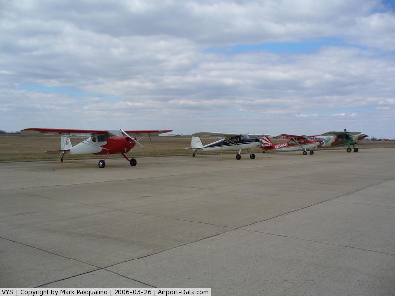
(Click on the photo to enlarge) |
|
 |
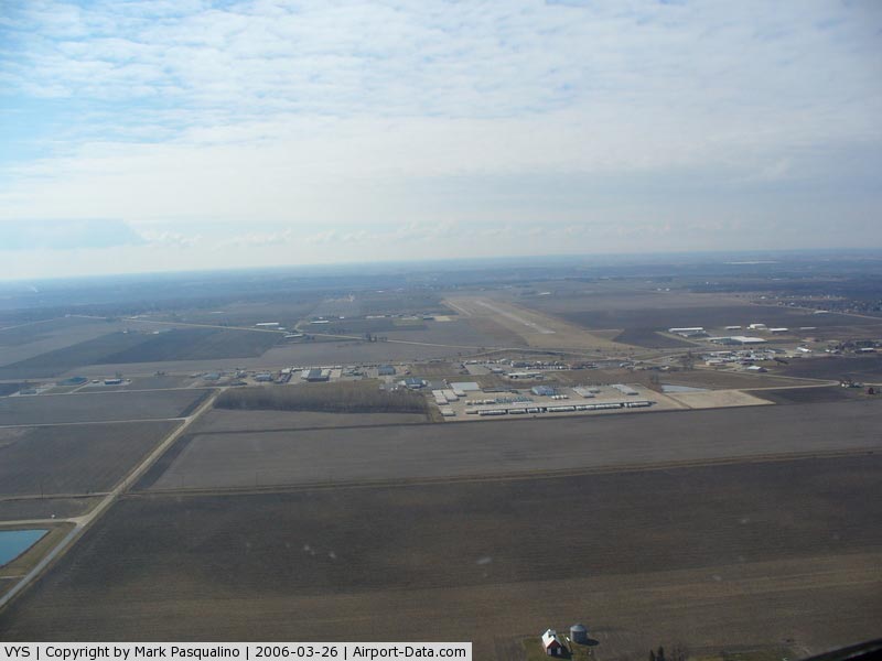
(Click on the photo to enlarge) |
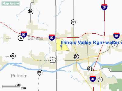
Location
& QuickFacts
|
FAA
Information Effective: |
2007-12-20 |
|
Airport
Identifier: |
VYS |
|
Airport
Status: |
Operational |
|
Longitude/Latitude: |
089-09-11.1030W/41-21-06.7250N
-89.153084/41.351868 (Estimated) |
|
Elevation: |
654 ft / 199.34 m (Surveyed) |
|
Land: |
200 acres |
|
From
nearest city: |
1 nautical miles E of Peru, IL |
|
Location: |
La Salle County, IL |
|
Magnetic Variation: |
00E (1990) |
Owner
& Manager
|
Ownership: |
Publicly
owned |
|
Owner: |
City Of Peru |
|
Address: |
1727 4th Street
Peru, IL 61354 |
|
Phone
number: |
815-223-1148 |
|
Manager: |
Don Kowalczyk |
|
Address: |
Illinois Valley Rgnl Arpt
Peru, IL 61354 |
|
Phone number: |
815-223-2962 |
Airport Operations and Facilities
|
Airport
Use: |
Open
to public |
|
Wind
indicator: |
Yes |
|
Segmented Circle: |
Yes |
|
Control
Tower: |
No |
|
Lighting
Schedule: |
DUSK-DAWN
MIRL RY 18/36 PRESET LOW INTST; TO INCR INTST & ACTVT
ODALS RY 36 - CTAF. |
|
Beacon
Color: |
Clear-Green (lighted land airport) |
|
Sectional chart: |
Chicago |
|
Region: |
AGL - Great Lakes |
|
Boundary
ARTCC: |
ZAU - Chicago |
|
Tie-in
FSS: |
IKK - Kankakee |
|
FSS
on Airport: |
No |
|
FSS
Toll Free: |
1-800-WX-BRIEF |
|
NOTAMs
Facility: |
VYS (NOTAM-d service avaliable) |
|
Federal Agreements: |
NGY |
Airport Communications
|
CTAF: |
123.000 |
|
Unicom: |
123.000
|
Airport
Services
|
Fuel
available: |
100LLA |
|
Airframe
Repair: |
MAJOR |
|
Power
Plant Repair: |
MAJOR |
|
Runway Information
Runway 18/36
|
Dimension: |
6000
x 100 ft / 1828.8 x 30.5 m |
|
Surface: |
ASPH, Good Condition |
|
Weight
Limit: |
Single wheel: 24000 lbs. |
|
Edge
Lights: |
Medium |
|
|
Runway 18 |
Runway 36 |
|
Longitude: |
089-09-11.4270W |
089-09-10.8410W |
|
Latitude: |
41-21-36.3270N |
41-20-37.0490N |
|
Elevation: |
654.00 ft |
640.00 ft |
|
Alignment: |
127 |
127 |
|
ILS
Type: |
|
LOC/DME |
|
Traffic
Pattern: |
Left |
Left |
|
Markings: |
Non-precision instrument, Good Condition |
Non-precision instrument, Good Condition |
|
Approach
lights: |
|
ODALS |
|
Obstruction: |
33 ft pole, 1229.0 ft from runway, 559 ft left
of centerline, 31:1 slope to clear |
57 ft tree, 1972.0 ft from runway, 706 ft right
of centerline, 31:1 slope to clear |
|
Radio Navigation
Aids
|
ID |
Type |
Name |
Ch |
Freq |
Var |
Dist |
|
VYS |
NDB |
Valley |
|
230.00 |
00W |
0.3
nm |
|
OIX |
NDB |
Ottawa |
|
266.00 |
01E |
13.5
nm |
|
BOZ |
NDB |
Whiteside |
|
254.00 |
01E |
35.7
nm |
|
EZI |
NDB |
Kewanee |
|
245.00 |
01E |
37.5
nm |
|
DKB |
NDB |
Dekalb |
|
209.00 |
02W |
40.3
nm |
|
PI |
NDB |
Tungg |
|
356.00 |
01E |
49.1
nm |
|
PNT |
VOR/DME |
Pontiac |
033X |
109.60 |
03E |
37.1
nm |
|
PLL |
VOR/DME |
Polo |
049X |
111.20 |
03E |
40.5
nm |
|
DPA |
VOR/DME |
Dupage |
021X |
108.40 |
02E |
48.5
nm |
|
BDF |
VORTAC |
Bradford |
094X |
114.70 |
00E |
22.8
nm |
|
JOT |
VORTAC |
Joliet |
070X |
112.30 |
02E |
39.4
nm |
|
PIA |
VORTAC |
Peoria |
099X |
115.20 |
04E |
49.7
nm |
Remarks
- SOUTHBOUND
JET DEPS CLIMB STRAIGHT SOUTH TO THE RIVER (APRXLY 3 MI) BEFORE TURNING
EASTBOUND.
- PRVDD
50:1 APCH CLNC IS MAINTAINED FOR RY 36.
Based
Aircraft
|
Aircraft
based on field: |
43 |
|
Single
Engine Airplanes: |
38 |
|
Multi
Engine Airplanes: |
4 |
|
Helicopters: |
1 |
Operational Statistics
Time Period: 2006-01-01 - 2006-12-31
|
Aircraft
Operations: |
58/Day |
|
Air
Taxi: |
1.4% |
|
General
Aviation Local: |
66.7% |
|
General
Aviation Itinerant: |
31.2% |
|
Military: |
0.7% |
Illinois Valley Regional-walter A Duncan
Field Airport
Address:
La Salle County, IL
Tel:
815-223-1148,
815-223-2962
Images
and information placed above are from
http://www.airport-data.com/airport/VYS/
We
thank them for the data!
| General
Info |
| Country |
United
States |
| State |
ILLINOIS
|
| FAA ID |
VYS |
| Latitude |
41-21-06.725N
|
| Longitude |
089-09-11.103W
|
| Elevation |
654 feet
|
| Near City |
PERU |
We don't guarantee the information is fresh and accurate. The data may
be wrong or outdated.
For more up-to-date information please refer to other sources.
|
|