 |
|
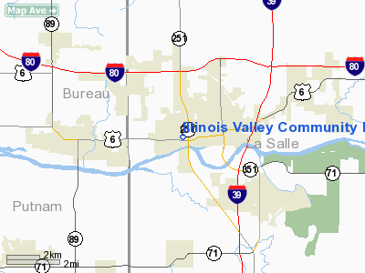
Illinois Valley Community Hospital Heliport |
Location
& QuickFacts
|
FAA
Information Effective: |
2007-12-20 |
|
Airport
Identifier: |
IS49 |
|
Airport
Status: |
Operational |
|
Longitude/Latitude: |
089-07-25.3010W/41-19-45.1250N
-89.123695/41.329201 (Estimated) |
|
Elevation: |
600 ft / 182.88 m (Estimated) |
|
Land: |
0 acres |
|
From
nearest city: |
0 nautical miles W of Peru, IL |
|
Location: |
La Salle County, IL |
|
Magnetic Variation: |
01E (1985) |
Owner & Manager
|
Ownership: |
Privately owned |
|
Owner: |
Illinois Valley Comm Hospital |
|
Address: |
925 West St
Peru, IL 61354 |
|
Phone number: |
815-223-3300 |
|
Manager: |
Steven A. Hayes |
|
Address: |
925 West St
Peru, IL 61354 |
|
Phone number: |
815-223-3300 |
Airport
Operations and Facilities
|
Airport
Use: |
Private
MEDICAL USE. |
|
Wind
indicator: |
Yes |
|
Segmented Circle: |
No |
|
Control
Tower: |
No |
|
Lighting
Schedule: |
24 HRS |
|
Beacon
Color: |
Clear-Green-Yellow (heliport) |
|
Sectional chart: |
Chicago |
|
Region: |
AGL - Great Lakes |
|
Boundary
ARTCC: |
ZAU - Chicago |
|
Tie-in
FSS: |
IKK - Kankakee |
|
FSS
Toll Free: |
1-800-WX-BRIEF |
|
Runway Information
Helipad H1
|
Dimension: |
40
x 30 ft / 12.2 x 9.1 m |
|
Surface: |
ASPH, |
|
|
Runway H1 |
Runway |
|
Traffic
Pattern: |
Left |
Left |
|
Radio Navigation
Aids
|
ID |
Type |
Name |
Ch |
Freq |
Var |
Dist |
|
VYS |
NDB |
Valley |
|
230.00 |
00W |
1.9
nm |
|
OIX |
NDB |
Ottawa |
|
266.00 |
01E |
12.3
nm |
|
BOZ |
NDB |
Whiteside |
|
254.00 |
01E |
37.6
nm |
|
EZI |
NDB |
Kewanee |
|
245.00 |
01E |
38.5
nm |
|
DKB |
NDB |
Dekalb |
|
209.00 |
02W |
40.9
nm |
|
PI |
NDB |
Tungg |
|
356.00 |
01E |
48.4
nm |
|
PNT |
VOR/DME |
Pontiac |
033X |
109.60 |
03E |
35.3
nm |
|
PLL |
VOR/DME |
Polo |
049X |
111.20 |
03E |
42.3
nm |
|
DPA |
VOR/DME |
Dupage |
021X |
108.40 |
02E |
48.4
nm |
|
BDF |
VORTAC |
Bradford |
094X |
114.70 |
00E |
23.3
nm |
|
JOT |
VORTAC |
Joliet |
070X |
112.30 |
02E |
38.6
nm |
|
PIA |
VORTAC |
Peoria |
099X |
115.20 |
04E |
49.4
nm |
Remarks
- PRVDD
APP/DEP FM 040 TO 250; AREA IS MARKED; WIND INDICATOR IS MAINTAINED;
NIGHT OPNS ONLY IF AREA & WINDSOCK ARE LIGHTED & BCN IS INSTALLED.
Illinois Valley Community Hospital Heliport
Address:
La Salle County, IL
Tel:
815-223-3300
Images
and information placed above are from
http://www.airport-data.com/airport/IS49/
We
thank them for the data!
| General
Info |
| Country |
United
States |
| State |
ILLINOIS
|
| FAA ID |
IS49 |
| Latitude |
41-19-45.125N
|
| Longitude |
089-07-25.301W
|
| Elevation |
600 feet
|
| Near City |
PERU |
We don't guarantee the information is fresh and accurate. The data may
be wrong or outdated.
For more up-to-date information please refer to other sources.
|
|


