 |
|
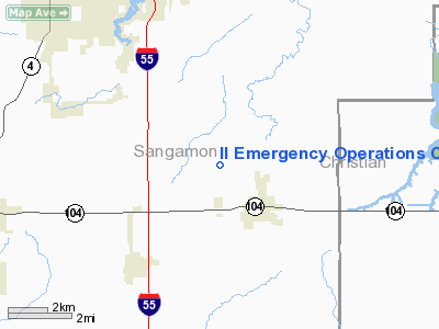
Il Emergency Operations Center Heliport |
Location
& QuickFacts
|
FAA
Information Effective: |
2007-12-20 |
|
Airport
Identifier: |
IL20 |
|
Airport
Status: |
Operational |
|
Longitude/Latitude: |
089-36-16.0000W/39-36-41.0000N
-89.604444/39.611389 (Estimated) |
|
Elevation: |
590 ft / 179.83 m (Estimated) |
|
Land: |
0 acres |
|
From
nearest city: |
3 nautical miles E of Springfield, IL |
|
Location: |
Sangamon County, IL |
|
Magnetic Variation: |
() |
Owner
& Manager
|
Ownership: |
Privately
owned |
|
Owner: |
Il Emergency Management Agency |
|
Address: |
2200 South Dirksen Pkwy
Springfield, IL 62703 |
|
Phone
number: |
217-782-7860 |
|
Manager: |
Jim Watts |
|
Address: |
2200 South Dirksen Pkwy
Springfield, IL 62703 |
|
Phone number: |
217-782-6598 |
Airport Operations and Facilities
|
Airport
Use: |
Private |
|
Wind
indicator: |
Yes |
|
Control
Tower: |
No |
|
Sectional chart: |
St Louis |
|
Region: |
AGL - Great Lakes |
|
Boundary
ARTCC: |
ZKC - Kansas City |
|
Tie-in
FSS: |
STL - Saint Louis |
|
FSS
Toll Free: |
1-800-WX-BRIEF |
|
Runway Information
Helipad H1
|
Dimension: |
40
x 40 ft / 12.2 x 12.2 m |
|
Surface: |
CONC, Good Condition |
|
|
Runway H1 |
Runway |
|
Traffic
Pattern: |
Left |
Left |
|
Radio Navigation
Aids
|
ID |
Type |
Name |
Ch |
Freq |
Var |
Dist |
|
SP |
NDB |
Huskk |
|
382.00 |
01W |
12.1
nm |
|
TAZ |
NDB |
Taylorville |
|
395.00 |
00E |
13.8
nm |
|
LQ |
NDB |
Licol |
|
375.00 |
01W |
18.1
nm |
|
LTD |
NDB |
Litchfield |
|
371.00 |
01E |
27.0
nm |
|
AAA |
NDB |
Abraham |
|
329.00 |
00E |
35.2
nm |
|
SYZ |
NDB |
Shelbyville |
|
365.00 |
01E |
37.4
nm |
|
CVM |
NDB |
Civic
Memorial |
|
263.00 |
02E |
48.1
nm |
|
IJX |
VOR/DME |
Jacksonville |
023X |
108.60 |
02E |
31.0
nm |
|
SPI |
VORTAC |
Spinner |
74X |
112.70 |
01W |
14.1
nm |
|
CAP |
VORTAC |
Capital |
074X |
112.70 |
04E |
16.9
nm |
|
DEC |
VORTAC |
Decatur |
119X |
117.20 |
03E |
35.4
nm |
|
VLA |
VORTAC |
Vandalia |
090X |
114.30 |
04E |
37.3
nm |
Remarks
- PRVDD
APCH/DEP FR 085 TO 095 DEG & FR 275 TO 285 DEG; AREA IS MARKED;
WIND INDICATOR IS MAINTAINED;& COMPLY WITH 14 CFR 91.126 (B)(2).
Il Emergency Operations Center Heliport
Address:
Sangamon County, IL
Tel:
217-782-7860,
217-782-6598
Images
and information placed above are from
http://www.airport-data.com/airport/IL20/
We
thank them for the data!
We don't guarantee the information is fresh and accurate. The data may
be wrong or outdated.
For more up-to-date information please refer to other sources.
|
|


