 |
|
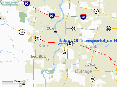
Il Dept Of Transportation Heliport |
Location
& QuickFacts
|
FAA
Information Effective: |
2007-12-20 |
|
Airport
Identifier: |
2IL8 |
|
Airport
Status: |
Operational |
|
Longitude/Latitude: |
088-16-58.2800W/42-01-14.0960N
-88.282856/42.020582 (Estimated) |
|
Elevation: |
730 ft / 222.50 m (Estimated) |
|
Land: |
0 acres |
|
From
nearest city: |
0 nautical miles S of Elgin, IL |
|
Location: |
Kane County, IL |
|
Magnetic Variation: |
01W (1985) |
Owner
& Manager
|
Ownership: |
Publicly
owned |
|
Owner: |
Illinois Dot |
|
Address: |
Capital Airport
Springfield, IL 62707 |
|
Phone
number: |
217-785-8380 |
|
Manager: |
C.d. Gamble |
|
Address: |
Div Of Aero,capitol Arpt
Springfield, IL 62707 |
|
Phone number: |
217-785-8380 |
Airport Operations and Facilities
|
Airport Use: |
Private |
|
Wind indicator: |
Yes |
|
Segmented Circle: |
No |
|
Control Tower: |
No |
|
Landing fee charge: |
No |
|
Sectional chart: |
Chicago |
|
Region: |
AGL - Great Lakes |
|
Boundary ARTCC: |
ZAU - Chicago |
|
Tie-in FSS: |
IKK - Kankakee |
|
FSS on Airport: |
No |
|
FSS Toll Free: |
1-800-WX-BRIEF |
Airport Services
|
Airframe
Repair: |
NONE |
|
Power
Plant Repair: |
NONE |
|
Runway Information
Helipad H1
|
Dimension: |
25 x 25 ft / 7.6 x 7.6 m
<25X25' HARD SFC PAD SUPERIMPOSED ON 60' CIRCULAR TURF PAD. |
|
Surface: |
CONC, |
|
|
Runway H1 |
Runway |
|
Traffic
Pattern: |
Left |
Left |
|
Radio Navigation
Aids
|
ID |
Type |
Name |
Ch |
Freq |
Var |
Dist |
|
ME |
NDB |
Deana |
|
350.00 |
00E |
11.9
nm |
|
DKB |
NDB |
Dekalb |
|
209.00 |
02W |
19.7
nm |
|
HK |
NDB |
Ermin |
|
332.00 |
01W |
27.0
nm |
|
MX |
NDB |
Kedzi |
|
248.00 |
01W |
31.4
nm |
|
LVV |
NDB |
Lake
Lawn |
|
404.00 |
00W |
43.0
nm |
|
RA |
NDB |
Paser |
|
206.00 |
00E |
43.3
nm |
|
OIX |
NDB |
Ottawa |
|
266.00 |
01E |
47.1
nm |
|
JVL |
NDB |
Janesville |
|
375.00 |
03E |
49.1
nm |
|
DPA |
VOR/DME |
Dupage |
021X |
108.40 |
02E |
8.4
nm |
|
ORD |
VOR/DME |
Chicago
O'hare |
086X |
113.90 |
02E |
17.0
nm |
|
OBK |
VOR/DME |
Northbrook |
077X |
113.00 |
02W |
19.1
nm |
|
ENW |
VOR/DME |
Kenosha |
029X |
109.20 |
02W |
38.1
nm |
|
BUU |
VOR/DME |
Burbun |
092X |
114.50 |
01W |
40.2
nm |
|
RFD |
VOR/DME |
Rockford |
045X |
110.80 |
01E |
42.7
nm |
|
JVL |
VOR/DME |
Janesville |
090X |
114.30 |
03E |
48.8
nm |
|
HRK |
VOR/DME |
Horlick |
124X |
117.70 |
02W |
49.2
nm |
|
JOT |
VORTAC |
Joliet |
070X |
112.30 |
02E |
28.5
nm |
|
CGT |
VORTAC |
Chicago
Heights |
089X |
114.20 |
02E |
44.3
nm |
|
ORD |
VOT |
Chicago
O'hare Intl |
|
112.00 |
|
16.9
nm |
|
MDW |
VOT |
Chicago
Midway |
|
111.00 |
|
27.6
nm |
Il dept Of Transportation Heliport
Address:
Kane County, IL
Tel:
217-785-8380
Images
and information placed above are from
http://www.airport-data.com/airport/2IL8/
We
thank them for the data!
| General
Info |
| Country |
United
States |
| State |
ILLINOIS
|
| FAA ID |
2IL8 |
| Latitude |
42-01-14.096N
|
| Longitude |
088-16-58.280W
|
| Elevation |
730 feet
|
| Near City |
ELGIN
|
We don't guarantee the information is fresh and accurate. The data may
be wrong or outdated.
For more up-to-date information please refer to other sources.
|
|


