 |
|
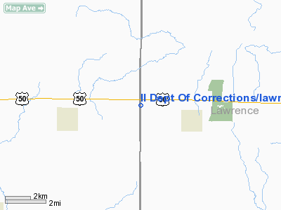
Il Dept Of Corrections lawrence County Heliport |
Location
& QuickFacts
|
FAA
Information Effective: |
2007-12-20 |
|
Airport
Identifier: |
34LL |
|
Airport
Status: |
Operational |
|
Longitude/Latitude: |
087-54-29.0000W/38-43-42.0000N
-87.908056/38.728333 (Estimated) |
|
Elevation: |
490 ft / 149.35 m (Estimated) |
|
Land: |
0 acres |
|
From
nearest city: |
3 nautical miles W of Sumner, IL |
|
Location: |
Lawrence County, IL |
|
Magnetic Variation: |
02W (2000) |
Owner
& Manager
|
Ownership: |
Privately
owned |
|
Owner: |
Il Dept Of Corrections |
|
Address: |
1301 Concordia Court
Springfield, IL 62794-9277 |
|
Phone
number: |
217-522-2666 |
|
Manager: |
Mike Neal, Warden |
|
Address: |
C/o Dept Of Corrections, Rte 50 Box 1000
Sumner, IL 62466 |
|
Phone number: |
618-943-7714 |
Airport Operations and Facilities
|
Airport
Use: |
Private |
|
Segmented Circle: |
No |
|
Control
Tower: |
No |
|
Sectional chart: |
St Louis |
|
Region: |
AGL - Great Lakes |
|
Boundary
ARTCC: |
ZID - Indianapolis |
|
Tie-in
FSS: |
COU - Columbia |
|
FSS
Toll Free: |
1-800-WX-BRIEF |
|
Runway Information
Helipad H1
|
Dimension: |
40
x 40 ft / 12.2 x 12.2 m |
|
Surface: |
CONC, |
|
|
Runway H1 |
Runway |
|
Traffic
Pattern: |
Left |
Left |
|
Radio Navigation
Aids
|
ID |
Type |
Name |
Ch |
Freq |
Var |
Dist |
|
AJG |
NDB |
Mount
Carmel |
|
524.00 |
02W |
11.0
nm |
|
OLY |
NDB |
Olney |
|
272.00 |
00W |
12.4
nm |
|
OEA |
NDB |
Vincennes |
|
251.00 |
00E |
16.7
nm |
|
PLX |
NDB |
Palestine |
|
391.00 |
00W |
21.2
nm |
|
FOA |
NDB |
Elm
River |
|
353.00 |
00E |
25.8
nm |
|
FWC |
NDB |
Wayne
County |
|
257.00 |
01E |
31.5
nm |
|
SIV |
NDB |
Sullivan |
|
326.00 |
02W |
31.6
nm |
|
CZB |
NDB |
Casey |
|
359.00 |
00E |
35.0
nm |
|
DCY |
NDB |
Washington |
|
212.00 |
03W |
36.4
nm |
|
CUL |
NDB |
Carmi |
|
332.00 |
01W |
39.4
nm |
|
MT |
NDB |
Zebre |
|
347.00 |
00E |
44.7
nm |
|
PDW |
NDB |
Evansville |
|
284.00 |
00E |
45.0
nm |
|
HU |
NDB |
Yinno |
|
245.00 |
02W |
46.2
nm |
|
SLO |
NDB |
Salem |
|
400.00 |
01W |
50.0
nm |
|
LWV |
VOR/DME |
Lawrenceville |
025X |
108.80 |
01W |
14.5
nm |
|
SAM |
VOR/DME |
Samsville |
113X |
116.60 |
03E |
16.8
nm |
|
RSV |
VOR/DME |
Robinson |
021X |
108.40 |
02E |
21.2
nm |
|
VNN |
VOR/DME |
Mount
Vernon |
085X |
113.80 |
02E |
47.7
nm |
|
MTO |
VOR/DME |
Mattoon |
031X |
109.40 |
03E |
48.4
nm |
|
BIB |
VORTAC |
Bible
Grove |
027X |
109.00 |
03E |
29.2
nm |
|
PXV |
VORTAC |
Pocket
City |
080X |
113.30 |
03E |
48.6
nm |
Remarks
- PRVDD
ALL APCH/DEP FM 165-175 & 005-015, AREA IS MARKED, WIND INDICATOR
IS MAINTAINED & COMPLY WITH FAR PART 91.126 (B)(2).
Il Dept Of Corrections lawrence County
Heliport
Address:
Lawrence County, IL
Tel:
217-522-2666,
618-943-7714
Images
and information placed above are from
http://www.airport-data.com/airport/34LL/
We
thank them for the data!
| General
Info |
| Country |
United
States |
| State |
ILLINOIS
|
| FAA ID |
34LL |
| Latitude |
38-43-42.000N
|
| Longitude |
087-54-29.000W
|
| Elevation |
490 feet
|
| Near City |
SUMNER
|
We don't guarantee the information is fresh and accurate. The data may
be wrong or outdated.
For more up-to-date information please refer to other sources.
|
|


