 |
|
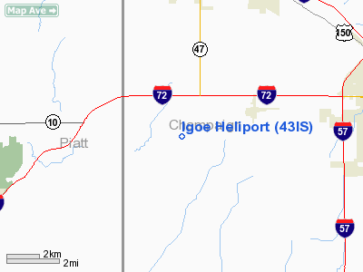
Location
& QuickFacts
|
FAA
Information Effective: |
2007-12-20 |
|
Airport
Identifier: |
43IS |
|
Airport
Status: |
Operational |
|
Longitude/Latitude: |
088-25-14.2070W/40-05-52.1160N
-88.420613/40.097810 (Estimated) |
|
Elevation: |
695 ft / 211.84 m (Estimated) |
|
Land: |
0 acres |
|
From
nearest city: |
1 nautical miles NW of Seymour, IL |
|
Location: |
Champaign County, IL |
|
Magnetic Variation: |
00E (1985) |
Owner
& Manager
|
Ownership: |
Privately
owned |
|
Owner: |
Martha Igoe |
|
Address: |
229 County Rd 1500n
Seymour, IL 61875 |
|
Manager: |
Martha Igoe |
|
Address: |
229 County Rd 1500n
Seymour, IL 61875 |
|
Phone number: |
217-687-5800 |
Airport Operations and Facilities
|
Airport
Use: |
Private |
|
Wind
indicator: |
Yes |
|
Segmented Circle: |
No |
|
Control
Tower: |
No |
|
Sectional chart: |
Chicago |
|
Region: |
AGL - Great Lakes |
|
Boundary
ARTCC: |
ZAU - Chicago |
|
Tie-in
FSS: |
STL - Saint Louis |
|
FSS
Toll Free: |
1-800-WX-BRIEF |
|
Runway Information
Helipad H1
|
Dimension: |
150
x 150 ft / 45.7 x 45.7 m |
|
Surface: |
TURF, |
|
|
Runway H1 |
Runway |
|
Traffic
Pattern: |
Left |
Left |
|
Radio Navigation
Aids
|
ID |
Type |
Name |
Ch |
Freq |
Var |
Dist |
|
HMJ |
NDB |
Homer |
|
281.00 |
01E |
21.9
nm |
|
MT |
NDB |
Zebre |
|
347.00 |
00E |
41.0
nm |
|
PRG |
NDB |
Paris |
|
341.00 |
01E |
42.0
nm |
|
AAA |
NDB |
Abraham |
|
329.00 |
00E |
42.3
nm |
|
SYZ |
NDB |
Shelbyville |
|
365.00 |
01E |
45.9
nm |
|
RBS |
VOR/DME |
Roberts |
115X |
116.80 |
02E |
31.4
nm |
|
BMI |
VOR/DME |
Bloomington |
019X |
108.20 |
03E |
32.8
nm |
|
MTO |
VOR/DME |
Mattoon |
031X |
109.40 |
03E |
37.8
nm |
|
PNT |
VOR/DME |
Pontiac |
033X |
109.60 |
03E |
45.8
nm |
|
CMI |
VORTAC |
Champaign |
037X |
110.00 |
03E |
7.7
nm |
|
DEC |
VORTAC |
Decatur |
119X |
117.20 |
03E |
29.5
nm |
|
DNV |
VORTAC |
Danville |
047X |
111.00 |
02E |
41.4
nm |
Remarks
- PRVDD
OPERS ARE COND FM 100 DEG TO 270 DEG; WND IND IS MAINTAINED.
Based
Aircraft
|
Aircraft
based on field: |
1 |
|
Helicopters: |
1 |
Igoe Heliport
Address:
Champaign County, IL
Tel:
217-687-5800
Images
and information placed above are from
http://www.airport-data.com/airport/43IS/
We
thank them for the data!
| General
Info |
| Country |
United
States |
| State |
ILLINOIS
|
| FAA ID |
43IS |
| Latitude |
40-05-52.116N
|
| Longitude |
088-25-14.207W
|
| Elevation |
695 feet
|
| Near City |
SEYMOUR
|
We don't guarantee the information is fresh and accurate. The data may
be wrong or outdated.
For more up-to-date information please refer to other sources.
|
|


