 |
|
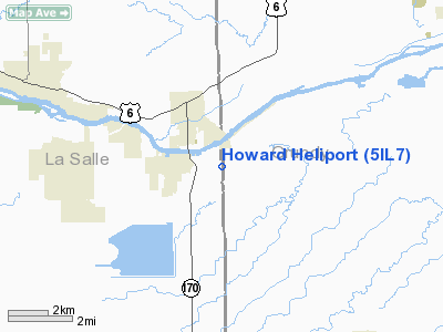
Location
& QuickFacts
|
FAA
Information Effective: |
2007-12-20 |
|
Airport
Identifier: |
5IL7 |
|
Airport
Status: |
Operational |
|
Longitude/Latitude: |
088-35-21.0000W/41-17-31.0000N
-88.589167/41.291944 (Estimated) |
|
Elevation: |
570 ft / 173.74 m (Estimated) |
|
Land: |
0 acres |
|
From
nearest city: |
5 nautical miles SE of Seneca, IL |
|
Location: |
Grundy County, IL |
|
Magnetic Variation: |
01W (1995) |
Owner
& Manager
|
Ownership: |
Privately
owned |
|
Owner: |
Robert Howard |
|
Address: |
640 N Lasalle Rd
Seneca, IL 61360 |
|
Phone
number: |
815-357-6565 |
|
Manager: |
Robert Howard |
|
Address: |
640 N Lasalle Rd
Seneca, IL 61360 |
|
Phone number: |
815-357-6565 |
Airport Operations and Facilities
|
Airport
Use: |
Private |
|
Wind
indicator: |
Yes |
|
Segmented Circle: |
No |
|
Control
Tower: |
No |
|
Sectional chart: |
Chicago |
|
Region: |
AGL - Great Lakes |
|
Boundary
ARTCC: |
ZAU - Chicago |
|
Tie-in
FSS: |
IKK - Kankakee |
|
FSS
Toll Free: |
1-800-WX-BRIEF |
|
Runway Information
Helipad H1
|
Dimension: |
50
x 50 ft / 15.2 x 15.2 m |
|
Surface: |
TURF, |
|
|
Runway H1 |
Runway |
|
Traffic
Pattern: |
Left |
Left |
|
Radio Navigation
Aids
|
ID |
Type |
Name |
Ch |
Freq |
Var |
Dist |
|
OIX |
NDB |
Ottawa |
|
266.00 |
01E |
12.7
nm |
|
VYS |
NDB |
Valley |
|
230.00 |
00W |
25.5
nm |
|
DKB |
NDB |
Dekalb |
|
209.00 |
02W |
39.0
nm |
|
HK |
NDB |
Ermin |
|
332.00 |
01W |
42.5
nm |
|
ME |
NDB |
Deana |
|
350.00 |
00E |
47.8
nm |
|
MX |
NDB |
Kedzi |
|
248.00 |
01W |
48.7
nm |
|
PNT |
VOR/DME |
Pontiac |
033X |
109.60 |
03E |
29.0
nm |
|
IKK |
VOR/DME |
Kankakee |
053X |
111.60 |
00E |
35.9
nm |
|
DPA |
VOR/DME |
Dupage |
021X |
108.40 |
02E |
37.5
nm |
|
RBS |
VOR/DME |
Roberts |
115X |
116.80 |
02E |
46.8
nm |
|
JOT |
VORTAC |
Joliet |
070X |
112.30 |
02E |
19.6
nm |
|
EON |
VORTAC |
Peotone |
079X |
113.20 |
02E |
36.1
nm |
|
BDF |
VORTAC |
Bradford |
094X |
114.70 |
00E |
45.8
nm |
|
CGT |
VORTAC |
Chicago
Heights |
089X |
114.20 |
02E |
47.7
nm |
|
MDW |
VOT |
Chicago
Midway |
|
111.00 |
|
48.0
nm |
Remarks
- SEE
AIRSPACE CASE 98-AGL-251-NRA.
Based
Aircraft
|
Aircraft
based on field: |
1 |
|
Helicopters: |
1 |
Howard Heliport
Address:
Grundy County, IL
Tel:
815-357-6565
Images
and information placed above are from
http://www.airport-data.com/airport/5IL7/
We
thank them for the data!
| General
Info |
| Country |
United
States |
| State |
ILLINOIS
|
| FAA ID |
5IL7 |
| Latitude |
41-17-31.000N
|
| Longitude |
088-35-21.000W
|
| Elevation |
570 feet
|
| Near City |
SENECA
|
We don't guarantee the information is fresh and accurate. The data may
be wrong or outdated.
For more up-to-date information please refer to other sources.
|
|


