 |
|
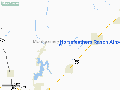
Horsefeathers Ranch Airport |
Location
& QuickFacts
|
FAA
Information Effective: |
2007-12-20 |
|
Airport
Identifier: |
1IL1 |
|
Airport
Status: |
Operational |
|
Longitude/Latitude: |
089-25-33.3150W/39-14-40.1700N
-89.425921/39.244492 (Estimated) |
|
Elevation: |
653 ft / 199.03 m (Estimated) |
|
Land: |
6 acres |
|
From
nearest city: |
3 nautical miles N of Irving, IL |
|
Location: |
Montgomery County, IL |
|
Magnetic Variation: |
01E (1985) |
Owner & Manager
|
Ownership: |
Privately owned |
|
Owner: |
Douglas G. Schulte |
|
Address: |
16302 Dons Road
Irving, IL 62051 |
|
Phone number: |
618-550-9580 |
|
Manager: |
Douglas G. Schulte |
|
Address: |
16302 Dons Road
Irving, IL 62051 |
|
Phone number: |
618-550-9580 |
Airport
Operations and Facilities
|
Airport
Use: |
Private
PERSONAL USE. |
|
Wind
indicator: |
Yes |
|
Segmented Circle: |
No |
|
Control
Tower: |
No |
|
Sectional chart: |
St Louis |
|
Region: |
AGL - Great Lakes |
|
Boundary
ARTCC: |
ZKC - Kansas City |
|
Tie-in
FSS: |
STL - Saint Louis |
|
FSS
Toll Free: |
1-800-WX-BRIEF |
|
Runway Information
Runway 01/19
|
Dimension: |
2100
x 102 ft / 640.1 x 31.1 m |
|
Surface: |
TURF, |
|
|
Runway 01 |
Runway 19 |
|
Traffic
Pattern: |
Left |
Left |
|
Displaced
threshold: |
0.00 ft |
400.00 ft |
|
Obstruction: |
|
20 ft trees, 400.0 ft from runway |
|
Radio Navigation
Aids
|
ID |
Type |
Name |
Ch |
Freq |
Var |
Dist |
|
LTD |
NDB |
Litchfield |
|
371.00 |
01E |
12.6
nm |
|
TAZ |
NDB |
Taylorville |
|
395.00 |
00E |
18.2
nm |
|
SYZ |
NDB |
Shelbyville |
|
365.00 |
01E |
28.8
nm |
|
SP |
NDB |
Huskk |
|
382.00 |
01W |
35.3
nm |
|
CVM |
NDB |
Civic
Memorial |
|
263.00 |
02E |
36.2
nm |
|
LQ |
NDB |
Licol |
|
375.00 |
01W |
41.0
nm |
|
SLO |
NDB |
Salem |
|
400.00 |
01W |
42.0
nm |
|
BL |
NDB |
Belleville |
|
362.00 |
02E |
49.3
nm |
|
SKE |
TACAN |
Scott |
059X |
|
02E |
46.5
nm |
|
IJX |
VOR/DME |
Jacksonville |
023X |
108.60 |
02E |
49.4
nm |
|
VLA |
VORTAC |
Vandalia |
090X |
114.30 |
04E |
15.3
nm |
|
SPI |
VORTAC |
Spinner |
74X |
112.70 |
01W |
37.6
nm |
|
TOY |
VORTAC |
Troy |
107X |
116.00 |
04E |
38.1
nm |
|
DEC |
VORTAC |
Decatur |
119X |
117.20 |
03E |
39.7
nm |
|
CAP |
VORTAC |
Capital |
074X |
112.70 |
04E |
40.0
nm |
|
BIB |
VORTAC |
Bible
Grove |
027X |
109.00 |
03E |
48.2
nm |
Remarks
- PRVDD
OBSTRUCTIONS IN RY APCH SLOPE REMOVED/LOWERED OR THLD DSPLCD & MKD
TO PRVDD MINIMUM 20:1 APCH CLNC; 125' EITHER SIDE OF RY CLEAR OF OBSTRUCTIONS.
Based
Aircraft
|
Aircraft
based on field: |
3 |
|
Single
Engine Airplanes: |
2 |
|
Ultralights: |
1 |
Horsefeathers Ranch Airport
Address:
Montgomery County, IL
Tel:
618-550-9580
Images
and information placed above are from
http://www.airport-data.com/airport/1IL1/
We
thank them for the data!
| General
Info |
| Country |
United
States |
| State |
ILLINOIS
|
| FAA ID |
1IL1 |
| Latitude |
39-14-40.170N
|
| Longitude |
089-25-33.315W
|
| Elevation |
653 feet
|
| Near City |
IRVING
|
We don't guarantee the information is fresh and accurate. The data may
be wrong or outdated.
For more up-to-date information please refer to other sources.
|
|


