 |
|
|
|
|
|
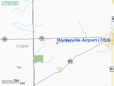
Location
& QuickFacts
|
FAA
Information Effective: |
2007-12-20 |
|
Airport
Identifier: |
7IS3 |
|
Airport
Status: |
Operational |
|
Longitude/Latitude: |
089-05-30.3070W/40-08-36.1380N
-89.091752/40.143372 (Estimated) |
|
Elevation: |
730 ft / 222.50 m (Estimated) |
|
Land: |
8 acres |
|
From
nearest city: |
6 nautical miles W of Clinton, IL |
|
Location: |
De Witt County, IL |
|
Magnetic Variation: |
01E (1985) |
Owner & Manager
|
Ownership: |
Privately owned |
|
Owner: |
John Warner, Iv |
|
Address: |
Rt 1, Box 114
Kenney, IL 06174 |
|
Phone number: |
217-935-3641 |
|
Manager: |
John Warner, Iv |
|
Address: |
Rt 1, Box 114
Kenney, IL 61749 |
|
Phone number: |
217-935-6173 |
Airport
Operations and Facilities
|
Airport
Use: |
Private |
|
Wind
indicator: |
Yes |
|
Segmented Circle: |
Yes |
|
Control
Tower: |
No |
|
Lighting
Schedule: |
PHONE REQ
ACTVT LIRL RY 18/36 - 122.8. |
|
Beacon
Color: |
Clear-Green (lighted
land airport)
PPR FOR ROTG BCN; CALL AMGR
217-935-6173. |
|
Sectional chart: |
St Louis |
|
Region: |
AGL - Great Lakes |
|
Boundary
ARTCC: |
ZAU - Chicago |
|
Tie-in
FSS: |
STL - Saint Louis |
|
FSS
on Airport: |
No |
|
FSS
Toll Free: |
1-800-WX-BRIEF |
Airport
Communications
|
Runway Information
Runway 18/36
|
Dimension: |
2300
x 102 ft / 701.0 x 31.1 m |
|
Surface: |
TURF, |
|
Edge
Lights: |
Low |
|
|
Runway 18 |
Runway 36 |
|
Traffic
Pattern: |
Left |
Left |
|
Obstruction: |
100 ft silo, 1600.0 ft from runway |
30 ft trees, 1000.0 ft from runway |
|
Radio Navigation
Aids
|
ID |
Type |
Name |
Ch |
Freq |
Var |
Dist |
|
AAA |
NDB |
Abraham |
|
329.00 |
00E |
11.3
nm |
|
LQ |
NDB |
Licol |
|
375.00 |
01W |
27.3
nm |
|
PI |
NDB |
Tungg |
|
356.00 |
01E |
36.0
nm |
|
SP |
NDB |
Huskk |
|
382.00 |
01W |
38.0
nm |
|
TAZ |
NDB |
Taylorville |
|
395.00 |
00E |
38.0
nm |
|
SYZ |
NDB |
Shelbyville |
|
365.00 |
01E |
45.7
nm |
|
BMI |
VOR/DME |
Bloomington |
019X |
108.20 |
03E |
21.6
nm |
|
PNT |
VOR/DME |
Pontiac |
033X |
109.60 |
03E |
43.9
nm |
|
RBS |
VOR/DME |
Roberts |
115X |
116.80 |
02E |
50.0
nm |
|
DEC |
VORTAC |
Decatur |
119X |
117.20 |
03E |
26.7
nm |
|
CAP |
VORTAC |
Capital |
074X |
112.70 |
04E |
28.8
nm |
|
SPI |
VORTAC |
Spinner |
74X |
112.70 |
01W |
32.6
nm |
|
CMI |
VORTAC |
Champaign |
037X |
110.00 |
03E |
38.1
nm |
|
PIA |
VORTAC |
Peoria |
099X |
115.20 |
04E |
45.5
nm |
Remarks
- TIE-DOWN
FACS FOR 3 ACFT. A LCL A&P MECHANIC AVBL FOR ACFT RPRS.
Based
Aircraft
|
Aircraft
based on field: |
2 |
|
Single
Engine Airplanes: |
2 |
Hooterville Airport
Address:
De Witt County, IL
Tel:
217-935-3641,
217-935-6173
Images
and information placed above are from
http://www.airport-data.com/airport/7IS3/
We
thank them for the data!
| General
Info |
| Country |
United
States |
| State |
ILLINOIS
|
| FAA ID |
7IS3 |
| Latitude |
40-08-36.138N
|
| Longitude |
089-05-30.307W
|
| Elevation |
730 feet
|
| Near City |
CLINTON
|
We don't guarantee the information is fresh and accurate. The data may
be wrong or outdated.
For more up-to-date information please refer to other sources.
|
|


