 |
|
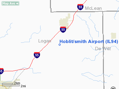
Location
& QuickFacts
|
FAA
Information Effective: |
2007-12-20 |
|
Airport
Identifier: |
IL94 |
|
Airport
Status: |
Operational |
|
Longitude/Latitude: |
089-14-34.4500W/40-13-34.7400N
-89.242903/40.226317 (Estimated) |
|
Elevation: |
623 ft / 189.89 m (Estimated) |
|
Land: |
0 acres |
|
From
nearest city: |
2 nautical miles S of Atlanta, IL |
|
Location: |
Logan County, IL |
|
Magnetic Variation: |
01W (1990) |
Owner & Manager
|
Ownership: |
Privately owned |
|
Owner: |
Frank Hoblit |
|
Address: |
Rr 2 - Box 140
Atlanta, IL 61723 |
|
Phone number: |
217-648-2161 |
|
Manager: |
Frank Hoblit |
|
Address: |
Rr 2 - Box 140
Atlanta, IL 61723 |
|
Phone number: |
217-648-2161 |
Airport
Operations and Facilities
|
Airport
Use: |
Private |
|
Segmented Circle: |
No |
|
Control
Tower: |
No |
|
Sectional chart: |
Green Bay |
|
Region: |
AGL - Great Lakes |
|
Boundary
ARTCC: |
ZAU - Chicago |
|
Tie-in
FSS: |
STL - Saint Louis |
|
FSS
Toll Free: |
1-800-WX-BRIEF |
|
Runway Information
Runway 18/36
|
Dimension: |
2060
x 102 ft / 627.9 x 31.1 m |
|
Surface: |
TURF, |
|
|
Runway 18 |
Runway 36 |
|
Traffic
Pattern: |
Left |
Left |
|
Radio Navigation
Aids
|
ID |
Type |
Name |
Ch |
Freq |
Var |
Dist |
|
AAA |
NDB |
Abraham |
|
329.00 |
00E |
5.9
nm |
|
LQ |
NDB |
Licol |
|
375.00 |
01W |
25.1
nm |
|
PI |
NDB |
Tungg |
|
356.00 |
01E |
27.9
nm |
|
SP |
NDB |
Huskk |
|
382.00 |
01W |
36.2
nm |
|
TAZ |
NDB |
Taylorville |
|
395.00 |
00E |
41.7
nm |
|
CTK |
NDB |
Canton |
|
236.00 |
02E |
43.3
nm |
|
BMI |
VOR/DME |
Bloomington |
019X |
108.20 |
03E |
20.9
nm |
|
PNT |
VOR/DME |
Pontiac |
033X |
109.60 |
03E |
42.7
nm |
|
CAP |
VORTAC |
Capital |
074X |
112.70 |
04E |
26.7
nm |
|
SPI |
VORTAC |
Spinner |
74X |
112.70 |
01W |
30.7
nm |
|
DEC |
VORTAC |
Decatur |
119X |
117.20 |
03E |
34.4
nm |
|
PIA |
VORTAC |
Peoria |
099X |
115.20 |
04E |
37.1
nm |
|
CMI |
VORTAC |
Champaign |
037X |
110.00 |
03E |
45.9
nm |
Remarks
- (E111-1)
OR THE RY THR IS DSPLCD & MARKED TO PRVD A MIN OF 20:1 CLNC OVER
THE 30 FT BLDG N OF RY & A SEPARATE FAA FORM 7480-1 IS SUBMITTED
WHICH REQUESTS THE DEACTIVATION OR ABANDONMENT OF SMITH FARMS APT.
- PRVDD
THE AREA 125 FT EITHER SIDE OF RY CNTRLN & 200 FT OFF THE RY END
BE CLEAR OF ANY OBSTNS; ANY OBSTNS IN THE RY APCH SLOPE BE REMOVED/LOWERED;
Hoblit/smith Airport
Address:
Logan County, IL
Tel:
217-648-2161
Images
and information placed above are from
http://www.airport-data.com/airport/IL94/
We
thank them for the data!
| General
Info |
| Country |
United
States |
| State |
ILLINOIS
|
| FAA ID |
IL94 |
| Latitude |
40-13-34.740N
|
| Longitude |
089-14-34.450W
|
| Elevation |
623 feet
|
| Near City |
ATLANTA
|
We don't guarantee the information is fresh and accurate. The data may
be wrong or outdated.
For more up-to-date information please refer to other sources.
|
|


