|
|
| Hinckley Airport |
| IATA: none – ICAO: none – FAA LID: 0C2 |
| Summary |
| Airport type |
Public |
| Owner |
Partners Investment Cap Inc. |
| Serves |
Hinckley, Illinois |
| Elevation AMSL |
760 ft / 232 m |
| Coordinates |
41°46′15″N 088°42′12″W / 41.77083°N 88.70333°W / 41.77083; -88.70333 |
| Runways |
| Direction |
Length |
Surface |
| ft |
m |
| 9/27 |
2,640 |
805 |
Turf |
| Statistics (2006) |
| Aircraft operations |
48,000 |
| Based aircraft |
35 |
| Source: Federal Aviation Administration |
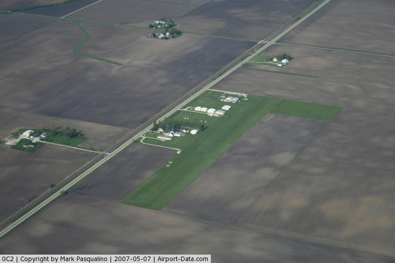
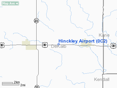
Hinckley Airport (FAA LID: 0C2) is a privately-owned, public-use airport located three nautical miles (6 km) west of the central business district of Hinckley, a village in DeKalb County, Illinois, United States.
Facilities and aircraft
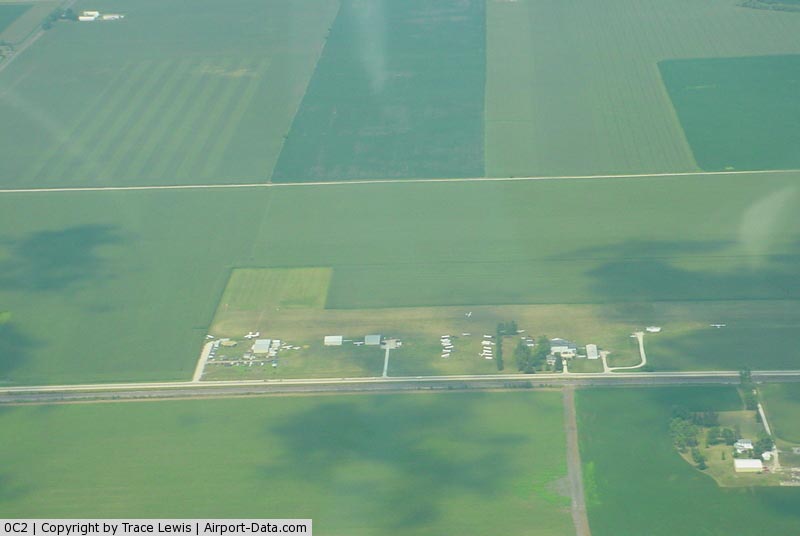
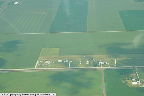
Hinckley Airport covers an area of 22 acres (9 ha) at an elevation of 760 feet (232 m) above mean sea level. It has one runway designated 9/27 with a 2,640 by 100 ft (805 x 30 m) turf surface.
For the 12-month period ending December 31, 2006, the airport had 48,000 aircraft operations, an average of 131 per day, all of which were general aviation. At that time there were 35 aircraft based at this airport: 71% glider, 26% single-engine and 3% multi-engine.
The above content comes from Wikipedia and is published under free licenses – click here to read more.
|
 |
(Click on the photo to enlarge) |
|
 |
(Click on the photo to enlarge) |
Location
& QuickFacts
|
FAA
Information Effective: |
2007-12-20 |
|
Airport
Identifier: |
0C2 |
|
Airport
Status: |
Operational |
|
Longitude/Latitude: |
088-42-12.2920W/41-46-15.1060N
-88.703414/41.770863 (Estimated) |
|
Elevation: |
760 ft / 231.65 m (Estimated) |
|
Land: |
22 acres |
|
From
nearest city: |
3 nautical miles W of Hinckley, IL |
|
Location: |
De Kalb County, IL |
|
Magnetic Variation: |
00W (1985) |
Owner
& Manager
|
Ownership: |
Privately
owned |
|
Owner: |
Partners Investment Cap Inc. |
|
Address: |
170 N May St.
Hinckley, IL 60520 |
|
Phone number: |
847-888-2919 |
|
Manager: |
Alan Abell |
|
Address: |
1610 Highland Ave.
Elgin, IL 60123 |
|
Phone number: |
847-888-2919 |
Airport
Operations and Facilities
|
Airport
Use: |
Open
to public |
|
Wind
indicator: |
Yes |
|
Segmented Circle: |
No |
|
Control
Tower: |
No |
|
Landing
fee charge: |
No |
|
Sectional chart: |
Chicago |
|
Region: |
AGL - Great Lakes |
|
Traffic
Pattern Alt: |
800 ft |
|
Boundary
ARTCC: |
ZAU - Chicago |
|
Tie-in
FSS: |
IKK - Kankakee |
|
FSS
on Airport: |
No |
|
FSS
Toll Free: |
1-800-WX-BRIEF |
|
NOTAMs
Facility: |
IKK (NOTAM-d service avaliable) |
Airport Communications
Airport Services
|
Bottled
Oxygen: |
NONE |
|
Bulk
Oxygen: |
NONE |
|
Runway Information
Runway 09/27
|
Dimension: |
2640
x 100 ft / 804.7 x 30.5 m |
|
Surface: |
TURF, Good Condition |
|
|
Runway 09 |
Runway 27 |
|
Longitude: |
088-42-30.1100W |
088-41-55.2900W |
|
Latitude: |
41-46-15.0800N |
41-46-15.1000N |
|
Elevation: |
760.00 ft |
755.00 ft |
|
Traffic
Pattern: |
Left |
Left |
|
Markings: |
None, |
None, |
|
Runway
End Identifier: |
No |
No |
|
Centerline
Lights: |
No |
No |
|
Touchdown
Lights: |
No |
No |
|
Radio Navigation
Aids
|
ID |
Type |
Name |
Ch |
Freq |
Var |
Dist |
|
DKB |
NDB |
Dekalb |
|
209.00 |
02W |
9.8
nm |
|
OIX |
NDB |
Ottawa |
|
266.00 |
01E |
25.5
nm |
|
VYS |
NDB |
Valley |
|
230.00 |
00W |
32.0
nm |
|
ME |
NDB |
Deana |
|
350.00 |
00E |
32.5
nm |
|
HK |
NDB |
Ermin |
|
332.00 |
01W |
39.0
nm |
|
MX |
NDB |
Kedzi |
|
248.00 |
01W |
45.5
nm |
|
FEP |
NDB |
Freeport |
|
335.00 |
00E |
48.7
nm |
|
BOZ |
NDB |
Whiteside |
|
254.00 |
01E |
48.7
nm |
|
DPA |
VOR/DME |
Dupage |
021X |
108.40 |
02E |
17.4
nm |
|
RFD |
VOR/DME |
Rockford |
045X |
110.80 |
01E |
35.2
nm |
|
ORD |
VOR/DME |
Chicago
O'hare |
086X |
113.90 |
02E |
38.0
nm |
|
PLL |
VOR/DME |
Polo |
049X |
111.20 |
03E |
38.6
nm |
|
OBK |
VOR/DME |
Northbrook |
077X |
113.00 |
02W |
43.1
nm |
|
JOT |
VORTAC |
Joliet |
070X |
112.30 |
02E |
21.9
nm |
|
ORD |
VOT |
Chicago
O'hare Intl |
|
112.00 |
|
37.8
nm |
|
MDW |
VOT |
Chicago
Midway |
|
111.00 |
|
42.6
nm |
Remarks
- SOARING
CONDUCTED AT ARPT.
- EXTSV
PAJA & GLIDER OPNS CONDD SFC-14,500 FT
- FREQUENCY
123.3 IS AVBL FOR ADVISORY.
- ARPT
MAY BE UNUSBL UNDER VERY WET CONDS.
- RY
09/27 NOT PLOWED; USE AT OWN RISK.
Based
Aircraft
|
Aircraft
based on field: |
35 |
|
Single
Engine Airplanes: |
9 |
|
Multi
Engine Airplanes: |
1 |
|
Gliders: |
25 |
Operational Statistics
Time Period: 2006-01-01 - 2006-12-31
|
Aircraft
Operations: |
132/Day |
|
General
Aviation Local: |
77.1% |
|
General
Aviation Itinerant: |
22.9% |
Hinckley Airport
Address:
De Kalb County, IL
Tel:
847-888-2919
Images
and information placed above are from
http://www.airport-data.com/airport/0C2/
We
thank them for the data!
| General
Info |
| Country |
United
States |
| State |
ILLINOIS
|
| FAA ID |
0C2 |
| Latitude |
41-46-15.106N
|
| Longitude |
088-42-12.292W
|
| Elevation |
760 feet
|
| Near City |
HINCKLEY
|
We don't guarantee the information is fresh and accurate. The data may
be wrong or outdated.
For more up-to-date information please refer to other sources.
|
|