 |
|
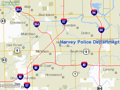
Harvey Police Department Heliport |
Location
& QuickFacts
|
FAA
Information Effective: |
2007-12-20 |
|
Airport
Identifier: |
IS17 |
|
Airport
Status: |
Operational |
|
Longitude/Latitude: |
087-40-12.0000W/41-36-44.0000N
-87.670000/41.612222 (Estimated) |
|
Elevation: |
605 ft / 184.40 m (Estimated) |
|
Land: |
0 acres |
|
From
nearest city: |
0 nautical miles N of Harvey, IL |
|
Location: |
Cook County, IL |
|
Magnetic Variation: |
02W (1995) |
Owner & Manager
|
Ownership: |
Privately owned |
|
Owner: |
Harvey Police Dept |
|
Address: |
15301 Dixie Hwy
Harvey, IL 60426 |
|
Phone number: |
708-331-3030 |
|
Manager: |
Mike Landini |
|
Address: |
15301 Dixie Hwy
Harvey, IL |
|
Phone number: |
708-331-3030 |
Airport
Operations and Facilities
|
Airport
Use: |
Private |
|
Segmented Circle: |
No |
|
Control
Tower: |
No |
|
Lighting
Schedule: |
PHONE REQ
FOR FLOOD LGTS CALL
708-331-3030
EXTN 7186. |
|
Sectional chart: |
Chicago |
|
Region: |
AGL - Great Lakes |
|
Boundary
ARTCC: |
ZAU - Chicago |
|
Tie-in
FSS: |
IKK - Kankakee |
|
FSS
Toll Free: |
1-800-WX-BRIEF |
|
Runway Information
Helipad H1
|
Dimension: |
100
x 100 ft / 30.5 x 30.5 m |
|
Surface: |
ASPH, |
|
|
Runway H1 |
Runway |
|
Traffic
Pattern: |
Left |
Left |
|
Radio Navigation
Aids
|
ID |
Type |
Name |
Ch |
Freq |
Var |
Dist |
|
MX |
NDB |
Kedzi |
|
248.00 |
01W |
7.8
nm |
|
HK |
NDB |
Ermin |
|
332.00 |
01W |
9.8
nm |
|
ME |
NDB |
Deana |
|
350.00 |
00E |
26.7
nm |
|
VP |
NDB |
Sedly |
|
212.00 |
02W |
36.9
nm |
|
MGC |
NDB |
Michigan
City |
|
203.00 |
01W |
38.7
nm |
|
IUL |
NDB |
La
Porte |
|
356.00 |
03W |
41.0
nm |
|
RZL |
NDB |
Rensselaer |
|
362.00 |
02W |
45.6
nm |
|
ORD |
VOR/DME |
Chicago
O'hare |
086X |
113.90 |
02E |
24.9
nm |
|
IKK |
VOR/DME |
Kankakee |
053X |
111.60 |
00E |
33.3
nm |
|
DPA |
VOR/DME |
Dupage |
021X |
108.40 |
02E |
34.8
nm |
|
OBK |
VOR/DME |
Northbrook |
077X |
113.00 |
02W |
38.7
nm |
|
OXI |
VOR/DME |
Knox |
103X |
115.60 |
00E |
49.2
nm |
|
CGT |
VORTAC |
Chicago
Heights |
089X |
114.20 |
02E |
7.6
nm |
|
EON |
VORTAC |
Peotone |
079X |
113.20 |
02E |
21.3
nm |
|
JOT |
VORTAC |
Joliet |
070X |
112.30 |
02E |
29.4
nm |
|
MDW |
VOT |
Chicago
Midway |
|
111.00 |
|
11.1
nm |
|
ORD |
VOT |
Chicago
O'hare Intl |
|
112.00 |
|
24.7
nm |
Remarks
- SEE
AIRSPACE CASE 97-AGL-229-NRA.
Harvey Police Department Heliport
Address:
Cook County, IL
Tel:
708-331-3030
Images
and information placed above are from
http://www.airport-data.com/airport/IS17/
We
thank them for the data!
| General
Info |
| Country |
United
States |
| State |
ILLINOIS
|
| FAA ID |
IS17 |
| Latitude |
41-36-44.000N
|
| Longitude |
087-40-12.000W
|
| Elevation |
605 feet
|
| Near City |
HARVEY
|
We don't guarantee the information is fresh and accurate. The data may
be wrong or outdated.
For more up-to-date information please refer to other sources.
|
|


