 |
|
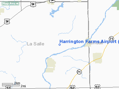
Location
& QuickFacts
|
FAA
Information Effective: |
2007-12-20 |
|
Airport
Identifier: |
IS95 |
|
Airport
Status: |
Operational |
|
Longitude/Latitude: |
088-39-52.2700W/41-33-31.1100N
-88.664519/41.558642 (Estimated) |
|
Elevation: |
640 ft / 195.07 m (Estimated) |
|
Land: |
0 acres |
|
From
nearest city: |
2 nautical miles NE of Sheridan, IL |
|
Location: |
La Salle County, IL |
|
Magnetic Variation: |
00W (1985) |
Owner & Manager
|
Ownership: |
Privately owned |
|
Owner: |
Albert Breuer |
|
Address: |
Rt 1
Sheridan, IL 60551 |
|
Manager: |
Max Harrington |
|
Address: |
Rt 1
Sheridan, IL 60551 |
|
Phone number: |
815-496-2627 |
Airport
Operations and Facilities
|
Airport
Use: |
Private |
|
Wind
indicator: |
Yes |
|
Segmented Circle: |
No |
|
Control
Tower: |
No |
|
Landing
fee charge: |
No |
|
Sectional chart: |
Chicago |
|
Region: |
AGL - Great Lakes |
|
Boundary
ARTCC: |
ZAU - Chicago |
|
Tie-in
FSS: |
IKK - Kankakee |
|
FSS
on Airport: |
No |
|
FSS
Toll Free: |
1-800-WX-BRIEF |
|
Runway Information
Runway 12/30
|
Dimension: |
1900
x 100 ft / 579.1 x 30.5 m |
|
Surface: |
TURF, |
|
|
Runway 12 |
Runway 30 |
|
Traffic
Pattern: |
Left |
Right |
|
Obstruction: |
30 ft trees, 1000.0 ft from runway |
50 ft trees, 1000.0 ft from runway |
|
Radio Navigation
Aids
|
ID |
Type |
Name |
Ch |
Freq |
Var |
Dist |
|
OIX |
NDB |
Ottawa |
|
266.00 |
01E |
14.6
nm |
|
DKB |
NDB |
Dekalb |
|
209.00 |
02W |
22.6
nm |
|
VYS |
NDB |
Valley |
|
230.00 |
00W |
25.0
nm |
|
ME |
NDB |
Deana |
|
350.00 |
00E |
37.7
nm |
|
HK |
NDB |
Ermin |
|
332.00 |
01W |
38.4
nm |
|
MX |
NDB |
Kedzi |
|
248.00 |
01W |
45.1
nm |
|
DPA |
VOR/DME |
Dupage |
021X |
108.40 |
02E |
24.4
nm |
|
ORD |
VOR/DME |
Chicago
O'hare |
086X |
113.90 |
02E |
42.7
nm |
|
PNT |
VOR/DME |
Pontiac |
033X |
109.60 |
03E |
44.4
nm |
|
PLL |
VOR/DME |
Polo |
049X |
111.20 |
03E |
45.7
nm |
|
RFD |
VOR/DME |
Rockford |
045X |
110.80 |
01E |
46.7
nm |
|
IKK |
VOR/DME |
Kankakee |
053X |
111.60 |
00E |
46.9
nm |
|
JOT |
VORTAC |
Joliet |
070X |
112.30 |
02E |
15.6
nm |
|
EON |
VORTAC |
Peotone |
079X |
113.20 |
02E |
43.0
nm |
|
BDF |
VORTAC |
Bradford |
094X |
114.70 |
00E |
48.1
nm |
|
CGT |
VORTAC |
Chicago
Heights |
089X |
114.20 |
02E |
49.3
nm |
|
ORD |
VOT |
Chicago
O'hare Intl |
|
112.00 |
|
42.5
nm |
|
MDW |
VOT |
Chicago
Midway |
|
111.00 |
|
43.2
nm |
Remarks
- PROVIDED
ALL OPERATIONS ARE CONDUCTED IN ACCORDANCE WITH LTR OF AGREEMENT BETWEEN
YOUR ARPT; CWAIN AND BURNS AIRPORTS.
Based
Aircraft
|
Aircraft
based on field: |
1 |
|
Single
Engine Airplanes: |
1 |
Harrington Farms Airport
Address:
La Salle County, IL
Tel:
815-496-2627
Images
and information placed above are from
http://www.airport-data.com/airport/IS95/
We
thank them for the data!
| General
Info |
| Country |
United
States |
| State |
ILLINOIS
|
| FAA ID |
IS95 |
| Latitude |
41-33-31.110N
|
| Longitude |
088-39-52.270W
|
| Elevation |
640 feet
|
| Near City |
SHERIDAN
|
We don't guarantee the information is fresh and accurate. The data may
be wrong or outdated.
For more up-to-date information please refer to other sources.
|
|


